Category:Old maps of Schmallenberg
Jump to navigation
Jump to search
Media in category "Old maps of Schmallenberg"
The following 9 files are in this category, out of 9 total.
-
 Dorff und Closter Graffschafft 1653.jpg 547 × 423; 210 KB
-
 Karte Umgebung Kloster Grafschaft 1697.JPG 716 × 407; 197 KB
-
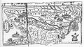
 Raum Schmallenberg, Auszug aus Blaeu 1645 - Westphalia Ducatus.jpg 889 × 640; 520 KB
-
 Schmallenberg 1697.JPG 422 × 618; 272 KB
-
 Schmallenberg 1724 (Ausschnitt).jpg 1,074 × 786; 786 KB
-
 Schmallenberg 1815.jpg 2,155 × 3,582; 5.15 MB
-
 Schmallenberg Gliederung vor1975.jpg 932 × 769; 209 KB
-
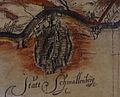 Statt Schmallenberg 1653.jpg 793 × 643; 384 KB
-
 Statt Schmallenberg sowie Dorff und Closter Graffschafft 1653.jpg 928 × 784; 598 KB


.jpg)


