Category:Old maps of Tours
Jump to navigation
Jump to search
Subcategories
This category has the following 2 subcategories, out of 2 total.
M
- Maps of Tours city walls (15 F)
Media in category "Old maps of Tours"
The following 12 files are in this category, out of 12 total.
-

-

-

-
-
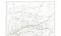
 Diocèse de Tours - Dressé et gravé par MM Charle ; et Darmet - btv1b8445590v.jpg 9,093 × 7,155; 7.47 MB
-
 Tours - bastion du XVIe siècle.png 960 × 597; 31 KB
-
 Tours - bastion XVIe siècle.svg 778 × 514; 8 KB
-
 Tours - clouaison Jean le Bon.svg 1,073 × 484; 367 KB
-
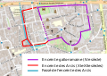 Tours - enceinte des Arcis.svg 654 × 461; 362 KB
-
 Tours rempart bastionné Trudaine.jpg 998 × 492; 174 KB
-
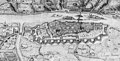 Tours- carte de René Siette.jpg 1,766 × 897; 467 KB
-
 Ville de Tours Giraudet Eugène.jpg 1,443 × 1,054; 311 KB

%27_(11224971843).jpg)
.jpg)
.jpg)


