Category:Old maps of Virginia in the American Civil War
Jump to navigation
Jump to search
States of the United States: Alabama · Arkansas · Florida · Georgia · Kentucky · Louisiana · Maryland · Mississippi · Missouri · North Carolina · Pennsylvania · South Carolina · Tennessee · Texas · Virginia – Washington, D.C.
Subcategories
This category has the following 3 subcategories, out of 3 total.
Media in category "Old maps of Virginia in the American Civil War"
The following 200 files are in this category, out of 200 total.
-
 (Map of part of the Union lines during the siege of Petersburg, Virginia) LOC 2006626040.jpg 4,952 × 5,894; 3.91 MB
-
 (Map of part of the Union lines during the siege of Petersburg, Virginia) LOC 2006626040.tif 4,952 × 5,894; 83.51 MB
-
 (Map of the vicinity of Mine Run.) - NARA - 305832.tif 3,076 × 4,800; 42.24 MB
-
-
 108 of 'History of the American Civil War, etc' (11095094006).jpg 2,384 × 1,452; 388 KB
-
 121 of 'History of the American War' (11069134774).jpg 1,395 × 1,632; 335 KB
-

-
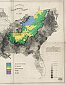 1860-61 Secession in Appalachia by County.jpg 1,887 × 2,393; 1.82 MB
-
 1865 Washington.jpg 5,539 × 7,691; 9.6 MB
-
 Map showing the location of battle fields of Virginia (10089635013).jpg 800 × 678; 173 KB
-

-
 1907 Taneytown Road.png 472 × 1,479; 1.47 MB
-
 25 miles around Richmond. Grant's campaign war map, supplement.jpg 2,000 × 1,725; 2.82 MB
-
 252 of 'History of the American Civil War, etc' (11246835973).jpg 1,393 × 991; 327 KB
-
 26 of 'History of the American War' (11069728356).jpg 2,437 × 2,478; 1.08 MB
-
 289 of 'History of the American War' (11070780995).jpg 1,574 × 2,519; 515 KB
-

-
 2ndbullrun.svg 744 × 1,052; 102 KB
-
 317 of 'Ohio in the War- her statesmen, her generals and soldiers' (11084464145).jpg 1,638 × 2,546; 927 KB
-
 370 of 'History of the American Civil War, etc' (11093980746).jpg 2,352 × 1,404; 631 KB
-
 384 of 'History of the American Civil War, etc' (11094206666).jpg 1,365 × 2,351; 764 KB
-
 388 of 'History of the American Civil War, etc' (11094666375).jpg 2,336 × 1,376; 720 KB
-
 393 of 'History of the American War' (11070626604).jpg 1,309 × 2,272; 392 KB
-
 396 of 'History of the American Civil War, etc' (11093580546).jpg 2,352 × 1,410; 679 KB
-
 402 of 'History of the American Civil War, etc' (11094869306).jpg 1,417 × 1,955; 645 KB
-
 403 of 'History of the American Civil War, etc' (11093685126).jpg 2,375 × 1,440; 687 KB
-
-
 465 of 'History of Morgan's Cavalry' (11075341353).jpg 1,323 × 2,270; 318 KB
-
 567 of 'History of the American Civil War, etc' (11095376483).jpg 2,385 × 1,440; 652 KB
-
 581 of 'History of the American Civil War, etc' (11093690536).jpg 2,380 × 1,440; 564 KB
-
 587 of 'History of the American Civil War, etc' (11095042414).jpg 2,378 × 1,440; 777 KB
-
 697 of 'Ohio in the War- her statesmen, her generals and soldiers' (11087129186).jpg 1,638 × 2,620; 1.24 MB
-

-
 Abraham Lincoln - a history (1914) (14578485840).jpg 2,080 × 1,052; 544 KB
-
 Abraham Lincoln - a history (1914) (14578510949).jpg 1,140 × 1,688; 654 KB
-
 Abraham Lincoln - a history (1914) (14583560429).jpg 1,372 × 2,068; 911 KB
-
 Abraham Lincoln - a history (1914) (14765150995).jpg 2,016 × 2,128; 1.06 MB
-
 Abraham Lincoln - a history (1914) (14765169995).jpg 1,912 × 1,964; 1.34 MB
-
 Abraham Lincoln - a history (1914) (14769856592).jpg 2,148 × 2,412; 1.57 MB
-
 Abraham Lincoln - a history (1914) (14790071593).jpg 1,516 × 2,048; 959 KB
-
 Abraham Lincoln and the battles of the Civil War (1886) (14576323548).jpg 2,114 × 2,930; 1.45 MB
-
 Alexandria Bird's Eye View 1863.jpg 7,624 × 5,112; 23.5 MB
-
 Approach to Wytheville 2 1863.JPG 683 × 306; 68 KB
-
 Battle of Beaver Dam Creek, map.jpg 2,172 × 1,935; 814 KB
-
 Battle of Hampton Roads Map.png 939 × 934; 397 KB
-
 Battle of Rich Mountain.png 1,052 × 810; 471 KB
-
 Battle of the Wilderness 1864 map.png 2,355 × 1,519; 2.43 MB
-
 BattleOfChantillyMap.jpg 4,016 × 3,118; 1.8 MB
-
 Battles on Fairfax and Prince William border.jpg 2,000 × 1,672; 3.53 MB
-
 Bermuda Hundred Campaign topography.jpg 1,681 × 2,145; 788 KB
-
 Boissonnas, Un Vaincu, 1875 (page 160 crop).jpg 3,279 × 4,529; 1.62 MB
-
 Boissonnas, Un Vaincu, 1875 (page 160-161 crop).jpg 4,504 × 6,452; 14.22 MB
-
 Boissonnas, Un Vaincu, 1875 (page 161 crop).jpg 3,245 × 4,512; 1.5 MB
-
 Britannica North Anna.jpg 768 × 937; 222 KB
-
 Britannica Spottsylvania May 12th.jpg 865 × 867; 279 KB
-
 Britannica Totopotomoy and Cold Harbor.jpg 866 × 860; 224 KB
-
 Britannica Wilderness.jpg 1,033 × 843; 278 KB
-
 Bull run 1.png 1,060 × 806; 43 KB
-

-
 Clover Hill Railroad.jpg 2,232 × 1,435; 899 KB
-

-

-
 Der Amerikanische Kriegsschauplatz zwischen Washington und Richmond.jpg 4,739 × 5,683; 7.86 MB
-

-
 First Manassas map.jpg 4,750 × 4,660; 13.24 MB
-
 Fort Craig VA Map (cropped).jpg 668 × 436; 350 KB
-
 Fort Craig VA Map.jpg 1,095 × 711; 799 KB
-
 Fort Lyon Diagram.jpg 4,203 × 2,656; 11.51 MB
-

-
 Fort Monroe Map.jpg 989 × 1,340; 1.03 MB
-
 Fort-lyon-alexandria-virginia-vhs00032-1-.jpg 1,609 × 2,158; 1.17 MB
-
 G3884 H2 2F6 186 D8 (16703426243).jpg 2,154 × 1,750; 673 KB
-
 Hampton Roads, Virginia (4231293839).jpg 2,000 × 1,845; 3.14 MB
-
 Harpers Ferry 1863.jpg 8,830 × 7,558; 17.06 MB
-
 Historical map of the Battle of the Wilderness.jpg 1,120 × 832; 127 KB
-
 History of the American Civil War (1867) (14576000620).jpg 2,528 × 1,536; 559 KB
-
 History of the American Civil War (1867) (14576001730).jpg 2,540 × 1,552; 505 KB
-
 History of the American Civil War (1867) (14576040789).jpg 2,512 × 1,516; 658 KB
-
 History of the American Civil War (1867) (14576215057).jpg 1,472 × 2,532; 608 KB
-
 History of the American Civil War (1867) (14739832526).jpg 1,940 × 3,250; 833 KB
-
 History of the American Civil War (1867) (14759512861).jpg 1,528 × 2,558; 466 KB
-
 History of the American Civil War (1867) (14762685845).jpg 1,464 × 2,516; 608 KB
-
 History of the American Civil War (1867) (14762688045).jpg 2,496 × 1,484; 727 KB
-
 History of the American Civil War (1867) (14782553523).jpg 1,500 × 2,528; 761 KB
-
 History of the Civil War in America (1875) (14576170609).jpg 3,536 × 2,512; 1.67 MB
-
 History of the Civil War in America (1875) (14576354577).jpg 3,186 × 2,302; 2.02 MB
-
 History of the Civil War in America (1875) (14760327374).jpg 2,336 × 2,806; 1.02 MB
-
 History of the Civil War in America (1875) (14762482972).jpg 2,400 × 2,848; 2.06 MB
-

-

-

-
-

-
 J.H. Coltons Topographical map of seat of war in Virginia, Maryland, &c. (5961391040).jpg 1,376 × 2,000; 2.99 MB
-
 Johnson's map of the vicinity of Richmond, and Peninsula Campaign. Johnson 1862.jpg 2,005 × 1,345; 243 KB
-
 Kelly's Ford March 1863.jpg 933 × 1,113; 780 KB
-

-

-
 Makers of the world's history and their grand achievements (1903) (14596098057).jpg 1,264 × 2,016; 344 KB
-
 Malvern Hill cw0560000.jpg 2,596 × 3,437; 1.78 MB
-

-
 Map of eastern Virginia (6094153798).jpg 1,592 × 2,000; 3.6 MB
-
 Map of Harper's Ferry.jpg 1,323 × 907; 591 KB
-
 Map of Mosby's route through Virginia and North Carolina. LOC gvhs01.vhs00176.jpg 3,204 × 2,278; 1.85 MB
-
 Map of Richmond 1864 small.jpg 3,219 × 2,938; 3.69 MB
-
 Map of Richmond 1864 with burnt districts small.jpg 3,219 × 2,938; 3.69 MB
-

-

-

-

-

-

-

-
 Map of the battlefield of Five-Forks (6012626090).jpg 1,285 × 2,000; 2.47 MB
-
 Map of the country within thirty miles of the rebel capital (5960819093).jpg 1,518 × 2,000; 3.28 MB
-
-
 Map of the Passages of the Rappahannock and the Battle of Fredericksburg - NARA - 305589.tif 6,000 × 5,105; 87.63 MB
-
 Map of the seat of war in VA.jpg 1,697 × 1,400; 600 KB
-
 Map of the seat of war in Virginia. Duncan 1862.jpg 1,133 × 1,721; 212 KB
-
 Map of the seat of war showing the battles of July 18th & 21st 1861 (5960823143).jpg 2,000 × 1,721; 2.78 MB
-

-

-
 Map of the State of Virginia (5960840069).jpg 2,000 × 1,284; 2.89 MB
-
 Map of the State of Virginia (6093615035).jpg 2,000 × 1,320; 3.16 MB
-
 Map showing from Richmond to Fredericksburg, Va. LOC gvhs01.vhs00249.tif 4,376 × 5,320; 66.61 MB
-

-
 Map to illustrate the battle of Bull Run, Stone Bridge or Manassas Plains (5121142208).jpg 2,000 × 1,512; 2.99 MB
-
-
 Military map of Maryland & Virginia (8249621781).jpg 2,000 × 1,168; 2.39 MB
-
 Military map of south-eastern Virginia (5121170504).jpg 1,726 × 2,000; 3.24 MB
-
 Military map of south-eastern Virginia (6094158184).jpg 2,000 × 1,279; 2.44 MB
-
 Military map of south-eastern Virginia (7537847934).jpg 1,759 × 2,000; 3.38 MB
-

-

-
 N E Virginia Forts and Roads 1865.jpg 4,640 × 6,378; 8.19 MB
-
 N E Virginia forts and roads, detail of Washington2.jpg 1,854 × 1,867; 1.47 MB
-
-

-
-
 Personal Memoirs of Ulysses S. Grant Volume II (page 193 crop).jpg 1,373 × 2,232; 999 KB
-

-

-
 Proposed state of kanawha.jpg 750 × 500; 105 KB
-
 Railroad map of Harpers Ferry in 1859.jpg 781 × 439; 104 KB
-

-
 Reconnaissance of the battle field at Bull Run, Va., fought July 21, 1861 (5961383872).jpg 1,564 × 2,000; 2.39 MB
-

-
 Reminiscences of the war of the rebellion, 1861-1865 (1911) (14762489152).jpg 1,692 × 2,914; 512 KB
-

-
 Robert E. Lee and the Southern Confederacy, 1807-1870 (1897) (14593944250).jpg 2,544 × 1,816; 438 KB
-
 Robert E. Lee and the Southern Confederacy, 1807-1870 (1897) (14593957398).jpg 1,602 × 1,998; 297 KB
-
 Robert E. Lee and the Southern Confederacy, 1807-1870 (1897) (14757622376).jpg 1,628 × 2,410; 363 KB
-
 Robert E. Lee and the Southern Confederacy, 1807-1870 (1897) (14757653056).jpg 2,256 × 1,588; 307 KB
-
 Robert E. Lee and the Southern Confederacy, 1807-1870 (1897) (14780284672).jpg 2,962 × 1,764; 469 KB
-
 Scene of conflict in Virginia (18677829275).jpg 2,233 × 1,498; 554 KB
-
 Schonbergs Virginia campaign map, 1864 (6093614367).jpg 1,303 × 2,000; 2.75 MB
-
 Schurz Chancellorsville Battlefield.png 1,537 × 1,522; 847 KB
-
 Second Winchester Map.jpg 2,941 × 2,960; 1.92 MB
-
 Sketch of Action at Guard Hill August 16 1864 Hotchkiss.jpg 2,332 × 2,936; 824 KB
-
 Sketch of the Battle of Cedar Run.jpg 630 × 738; 498 KB
-

-
 Sketch of the entrenched lines in the immediate front of Petersburg. (1864-5) LOC 99448480.tif 3,301 × 2,832; 26.75 MB
-
-
 Stonewall Jackson and the American civil war (1902) (14762338942).jpg 3,114 × 3,204; 1.67 MB
-
 Stonewall Jackson and the American Civil War (1909) (14576363427).jpg 2,836 × 2,584; 1.58 MB
-
 Stonewall Jackson and the American Civil War (1909) (14759566501).jpg 1,738 × 2,126; 1.02 MB
-
 Stonewall Jackson and the American Civil War (1909) (14782685103).jpg 1,712 × 2,884; 868 KB
-
 Stuart's raid 1862.jpg 1,119 × 820; 347 KB
-

-
 The American Civil War-maps. LOC 2009581126-39.tif 2,615 × 3,150; 23.57 MB
-

-

-

-
 The appeal to arms, 1861-1863 (1907) (14577875828).jpg 3,284 × 2,064; 1.71 MB
-
 The appeal to arms, 1861-1863 (1907) (14784379803).jpg 2,088 × 3,264; 1.29 MB
-
 The battlefield of Fredericksburg (10175373424).jpg 799 × 588; 102 KB
-

-

-
-

-

-

-
 The new war map of Maryland, part of Virginia & Pennsylvania (5961387734).jpg 2,000 × 1,630; 3.51 MB
-
 The new war map of Virginia, Maryland & Pennsylvania (5960828689).jpg 1,494 × 2,000; 2.83 MB
-

-

-

-
-

-
 The Story Of A Spy In The Civil War (1900) (14576288517).jpg 1,890 × 3,296; 786 KB
-
 The Story Of A Spy In The Civil War (1900) (14739744256).jpg 2,188 × 3,296; 1.2 MB
-
 The Story Of A Spy In The Civil War (1900) (14782610353).jpg 2,272 × 3,052; 586 KB
-
 Tomlinsons map of Petersburg, showing the scene of Genl. Grants operations (5121142844).jpg 1,543 × 2,000; 3.11 MB
-
 Troop movements in Richmond, Petersburg, Appomattox area, April 1865 LOC lva0000130.jpg 11,708 × 4,801; 5.82 MB
-
 Troop movements in Richmond, Petersburg, Appomattox area, April 1865 LOC lva0000130.tif 11,708 × 4,801; 160.82 MB
-
 Txu-pclmaps-virginia battlefields 1892.jpg 3,892 × 3,291; 2.8 MB
-
 Union Approach to Wytheville 1863.JPG 523 × 542; 101 KB
-
 Virginia BattleField map JEAF extract.jpg 445 × 170; 36 KB
-
 Wytheville Raid Map.JPG 587 × 589; 120 KB
-

_LOC_2006626040.jpg)
.jpg)
.jpg)
.jpg)


.jpg)
.jpg)

.jpg)
.jpg)
.jpg)
.jpg)

.jpg)
.jpg)
.jpg)
.jpg)
.jpg)
.jpg)
.jpg)
.jpg)
.jpg)
.jpg)
.jpg)
.jpg)
.jpg)
.jpg)
.jpg)
_(14578485840).jpg)
_(14578510949).jpg)
_(14583560429).jpg)
_(14765150995).jpg)
_(14765169995).jpg)
_(14769856592).jpg)
_(14790071593).jpg)
_(14576323548).jpg)


.jpg)
.jpg)
.jpg)


.jpg)

.jpg)


.jpg)

.jpg)


.jpg)


.jpg)
.jpg)


_(14576000620).jpg)
_(14576001730).jpg)
_(14576040789).jpg)
_(14576215057).jpg)
_(14739832526).jpg)
_(14759512861).jpg)
_(14762685845).jpg)
_(14762688045).jpg)
_(14782553523).jpg)
_(14576170609).jpg)
_(14576354577).jpg)
_(14760327374).jpg)
_(14762482972).jpg)
.jpg)
.jpg)
.jpg)
_(cropped).jpg)
.jpg)
.jpg)


.jpg)
.jpg)
_(14596098057).jpg)

.jpg)


.jpg)
.jpg)
.jpg)
.jpg)
.jpg)
_G.T._Beauregard_commanding_the_Confederate_forces,_July_21st_1861_(5120566531).jpg)
.jpg)
.jpg)
.jpg)


.jpg)
.jpg)
.jpg)
.jpg)
.jpg)
.jpg)
.jpg)
.jpg)
.jpg)
.jpg)
.jpg)
.jpg)
.jpg)


_(14583180677).jpg)

.jpg)
.jpg)
.jpg)


_(14762445152).jpg)
.jpg)
.jpg)
_(14762489152).jpg)
.jpg)
_(14593944250).jpg)
_(14593957398).jpg)
_(14757622376).jpg)
_(14757653056).jpg)
_(14780284672).jpg)
.jpg)
.jpg)


_LOC_99448480.jpg)
.jpg)
_(14762338942).jpg)
_(14576363427).jpg)
_(14759566501).jpg)
_(14782685103).jpg)

.jpg)
.jpg)
.jpg)
_(14577875828).jpg)
_(14784379803).jpg)
.jpg)
_(14576241109).jpg)
_(14576434187).jpg)
.jpg)
_(14585920918).jpg)
_battlefield_of_5_Forks_and_Hatcher%27s_Run,_Friday_March_31st,_Saturday_April_1st_%26_Sunday_April_2nd_1865._LOC_gvhs01.vhs00289.jpg)
.jpg)
.jpg)
_(14576311338).jpg)
_(14762663282).jpg)
.jpg)
.jpg)
.jpg)
_(14576288517).jpg)
_(14739744256).jpg)
_(14782610353).jpg)
.jpg)


%C2%BB._%D0%92%D0%BE%D0%B5%D0%BD%D0%BD%D0%B0%D1%8F_%D1%8D%D0%BD%D1%86%D0%B8%D0%BA%D0%BB%D0%BE%D0%BF%D0%B5%D0%B4%D0%B8%D1%8F_%D0%A1%D1%8B%D1%82%D0%B8%D0%BD%D0%B0_(%D0%A1%D0%B0%D0%BD%D0%BA%D1%82-%D0%9F%D0%B5%D1%82%D0%B5%D1%80%D0%B1%D1%83%D1%80%D0%B3,_1911-1915).jpg)