Category:Old maps of Western Australia
Jump to navigation
Jump to search
States of Australia: New South Wales · Queensland · South Australia · Tasmania · Victoria · Western Australia
Internal territories of Australia: Northern Territory
External territories of Australia:
Internal territories of Australia: Northern Territory
External territories of Australia:
Subcategories
This category has the following 3 subcategories, out of 3 total.
1
O
- Old maps of Perth (23 F)
Media in category "Old maps of Western Australia"
The following 20 files are in this category, out of 20 total.
-
 A draught of the coast of New Holland and parts adjacent. RMG F0396.tiff 4,820 × 8,394; 115.75 MB
-
 A Plan of Swan River Settlement and Surrounding Country.jpg 3,576 × 4,887; 2.61 MB
-
 Admiralty Chart No 1047 Cape Ford to Buccaneer Archipelago, Published 1883, New Edition 1922.jpg 21,145 × 11,198; 46.55 MB
-
 Admiralty Chart No 1055 Bedout Island to Cape Cuvier, Published 1883 Large Corrections 1902.jpg 16,331 × 13,839; 61.81 MB
-

-
-
 Battye freycinet swanriver lg.jpg 355 × 500; 61 KB
-
 Colonie de la rivière Swan (Australie).png 2,190 × 1,577; 128 KB
-
 Daglish 1925 townsite map cropped.jpg 718 × 605; 84 KB
-
 Early map of swan river colony.jpg 712 × 935; 128 KB
-
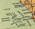 Houtman Abrolhos WA.jpg 303 × 245; 20 KB
-
 JTWC SH0514.gif 1,194 × 836; 28 KB
-
 Part of Plan for Mole Harbour by J.S.Roe Surveyor-General.jpg 2,335 × 2,943; 955 KB
-
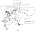
 Perth Wetlands Map1.png 1,253 × 686; 104 KB
-
 Swan River Colony land grants map.png 4,112 × 3,651; 241 KB
-
 T Land Van Eendracht (Emeloort).jpg 800 × 595; 90 KB
-
 T Land Van Eendracht (Waekende Boey).jpg 800 × 612; 64 KB
-
 The Visit of Charles Fraser, map.png 2,799 × 2,321; 8.88 MB
-
 Vicinity of Spencer or Pink Lake to Esperance Townsite and Bay.jpg 6,319 × 4,639; 4.92 MB
-
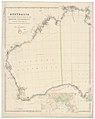
 Western Australia 1838.jpg 3,178 × 2,221; 811 KB


.jpg)
.jpg)

.png)


.jpg)
.jpg)


