Category:Old maps of Windsor
Jump to navigation
Jump to search
Subcategories
This category has only the following subcategory.
M
Media in category "Old maps of Windsor"
The following 8 files are in this category, out of 8 total.
-
 Bodleian Libraries, The First Sheet of an Actual Survey of Berkshire, 1752.jpg 1,000 × 675; 175 KB
-
 Bodleian Libraries, Panorama announcing a View of Windsor.jpg 828 × 1,000; 126 KB
-
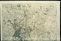
 Ordnance Survey Drawings - Windsor (OSD 153).jpg 3,682 × 4,000; 5.27 MB
-

-
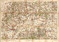 Ordnance Survey One-inch map Maidenhead Windsor and Henley, Published 1912.jpg 12,613 × 8,972; 15.96 MB
-
 Ordnance Survey One-Inch Sheet 114 Windsor, Published 1920.jpg 12,130 × 8,368; 14.07 MB
-
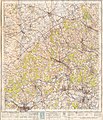
 Ordnance Survey One-Inch Sheet 114 SW London and Windsor, Published 1934.jpg 13,539 × 9,026; 14.45 MB
-
 Ordnance Survey One-Inch Sheet 159 The Chilterns, Published 1945.jpg 8,187 × 9,575; 12.08 MB


.jpg)
%27_(11297472575).jpg)


