Category:Old maps of ancient Germania
Jump to navigation
Jump to search
Media in category "Old maps of ancient Germania"
The following 21 files are in this category, out of 21 total.
-
 02019 1242 (2) Map of Europe in the 2nd century, Ptolomy by Vana, Gąssowski, 1988.jpg 2,331 × 1,535; 632 KB
-
-

-
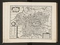
 1657 Jansson Map of Germany (Germania) - Geographicus - Germaniae-jansson-1657.jpg 3,500 × 2,811; 3.38 MB
-

-

-
-
 1832 Delamarche Map of Germany in Roman Times - Geographicus - Germany-d-32.jpg 3,000 × 2,537; 2.01 MB
-
 Orbis Antiqui Descriptio - Germanien Britannien.png 1,557 × 1,211; 4.17 MB
-
 Mitteleuropa BV042518427.jpg 1,954 × 1,337; 291 KB
-
 Butler Germania.jpg 3,178 × 2,066; 1.76 MB
-
 Karte aus dem Buch Römische Provinzen von Theodor Mommsen 1921 05.jpg 2,397 × 2,160; 5.23 MB
-

-

-

-
 Ancient Germania - New York, Harper and Brothers 1849.jpg 1,964 × 1,619; 841 KB
-
 GERMANIA.GIF 1,716 × 1,360; 1.42 MB
-
 Map of Germania by Abraham Ortelius.jpeg 3,051 × 2,350; 2.41 MB
-
 Mitteleuropa BV042518609.jpg 1,012 × 1,178; 163 KB
-
 Slovanské staroitnosti (1902) (14591992660).jpg 3,492 × 2,464; 1.46 MB
-
 Atlas ou Representation du Monde Universel t. 2. 1633 (110098451).jpg 16,070 × 12,039; 33.09 MB
_Map_of_Europe_in_the_2nd_century,_Ptolomy_by_Vana,_G%C4%85ssowski,_1988.jpg)
.jpg)
.jpg)
_-_Geographicus_-_Germaniae-jansson-1657.jpg)
.jpg)

.jpg)


.jpg)
.jpg)
.jpg)


_(14591992660).jpg)
.jpg)