Category:Old maps of the Duchy of Jülich
Jump to navigation
Jump to search
Deutsch:
Diese Kategorie enthält alte Karten des Herzogtum Jülichs.
Der größte Teil des früheren Gebiets vom Herzogtum Jülich liegt heute im deutschen Bundesland Nordrhein-Westfalen, kleinere Teile auch in der niederländischen Provinz Limburg sowie im deutschen Bundesland Rheinland-Pfalz.
Diese Kategorie enthält alte Karten des Herzogtum Jülichs.
Der größte Teil des früheren Gebiets vom Herzogtum Jülich liegt heute im deutschen Bundesland Nordrhein-Westfalen, kleinere Teile auch in der niederländischen Provinz Limburg sowie im deutschen Bundesland Rheinland-Pfalz.
English:
This category contains old maps of the Duchy of Jülich.
The Duchy of Jülich was a historic territory of Germany and the Netherlands and was also a state of the Holy Roman Empire.
This category contains old maps of the Duchy of Jülich.
The Duchy of Jülich was a historic territory of Germany and the Netherlands and was also a state of the Holy Roman Empire.
Nederlands:
Dit categorie bevat oude kaarten van het Hertogdom Gulik.
De grootse deel van de voormaals Gulikse gebieden is nu verdeelt op de Duitse deelstaat Noordrijn-Westfalen, kleinere delen ook op de Nederlandse provincie Limburg en de Duitse deelstaat Rijnland-Palts.
Dit categorie bevat oude kaarten van het Hertogdom Gulik.
De grootse deel van de voormaals Gulikse gebieden is nu verdeelt op de Duitse deelstaat Noordrijn-Westfalen, kleinere delen ook op de Nederlandse provincie Limburg en de Duitse deelstaat Rijnland-Palts.
Media in category "Old maps of the Duchy of Jülich"
The following 26 files are in this category, out of 26 total.
-
 1563 Gelriae Cliviae Iuliae.jpg 737 × 814; 61 KB
-
 1570 Geldria Theatrvm orbis terrarvm.jpg 701 × 538; 94 KB
-
 1573 18 sgrooten bruessler atlas.jpg 1,235 × 1,160; 250 KB
-

-

-

-
 Berghe ducatus Marck comitatus et Coloniensis dioecesis.jpg 4,271 × 3,500; 4.35 MB
-
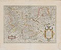
 Blaeu 1645 - Iuliacensis et Montensis Ducatus.jpg 3,631 × 3,031; 1.42 MB
-
-
 Duches de Bergue et Juliers, Electorat de Cologne, Gueldre et comte de Meurs.jpg 4,926 × 4,074; 8.32 MB
-
 Erkelant.jpg 970 × 640; 272 KB
-
 Erkelenz Atlas 1575.jpg 753 × 581; 133 KB
-
 Erkelenz cw.jpg 704 × 562; 99 KB
-
 Franz Johann Joseph von Reilly, Das Herzogthum Iülich (Nro. 285, 1794–1795).jpg 1,131 × 1,017; 508 KB
-

-

-
 Hb Kreuzherrenkloster.jpg 396 × 310; 33 KB
-
 Hertogdom Berg in 1477.JPG 168 × 193; 11 KB
-
 Hohenbusch cw.jpg 663 × 494; 34 KB
-
 Iuliacensis ducatus - CBT 5873865.jpg 5,715 × 4,497; 6.22 MB
-
 Iuliacensis et Montensis ducatus - CBT 5873836.jpg 5,715 × 4,750; 5.05 MB
-
 Pesch CodexWelser.jpg 356 × 286; 23 KB
-
 Sgrothen Limburg Jülich.jpg 1,100 × 1,800; 846 KB
-
 't-Landt-Van-Kessel(1664).png 1,200 × 900; 2.43 MB
-

-
 Territorialkarte der Herzogtümer Jülich, Kleve, Berg, Limburg und der Grafschaft Moers.jpg 4,036 × 4,964; 9.52 MB


.jpg)
.jpg)
.jpg)


.png)

