Category:Old maps of the canton of St. Gallen
Jump to navigation
Jump to search
Cantons of Switzerland: Aargau (AG) · Basel-Stadt (BS) · Basel-Landschaft (BL) · Bern (BE) · Fribourg (FR) · Geneva (GE) · Graubünden (GR) · Jura (JU) · Luzern (LU) · Schwyz (SZ) · Solothurn (SO) · St. Gallen (SG) · Thurgau (TG) · Ticino (TI) · Valais (VS) · Vaud (VD) · Zürich (ZH)
Subcategories
This category has the following 4 subcategories, out of 4 total.
O
R
S
Z
Media in category "Old maps of the canton of St. Gallen"
The following 16 files are in this category, out of 16 total.
-
 Dankaerts-Historis-9265.tif 3,528 × 5,056; 51.07 MB
-
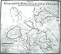
 Grenze Balzers-SG 1818.jpg 1,088 × 848; 270 KB
-
 Charte von Schwaben Tafel 59 Sentis.jpg 2,150 × 2,622; 4.97 MB
-
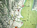
 Gericht Mosnang.jpg 3,038 × 2,686; 2.95 MB
-
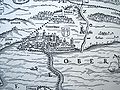
 Karte Fuerstabtei SanktGallen.jpg 1,360 × 1,094; 1.69 MB
-
 Murerplan - Oberes Zürichseegebiet IMG 2383.JPG 2,456 × 1,912; 2.08 MB
-
 Rapperswil Murerplan.jpg 2,592 × 1,944; 1.87 MB
-
 Sankt Gallen Stumpf 1548.jpg 1,834 × 1,902; 1.97 MB
-
 St Gallen stumpf col.jpg 2,013 × 1,617; 4.42 MB
-
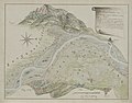
 StGallen1860a retouched.jpg 7,098 × 5,594; 9.6 MB
-
 Stich Linthebene 1811.jpg 1,800 × 742; 935 KB
-
 UBBasel Map 1712 VB A2-2-108 Bremgarten.tiff 10,909 × 8,824, 2 pages; 275.43 MB
-
 WE-Projekt.jpg 519 × 676; 374 KB
-
 Wurmsbach Gygerplan Umzeichnung.jpg 2,592 × 1,944; 1.64 MB
-
 Wurmsbach Gygerplan.jpg 2,592 × 1,944; 1.51 MB
-
 Wurmsbach Murerplan.jpg 2,309 × 1,824; 1.78 MB


