Category:Old submaps of Paris 18e arrondissement
Jump to navigation
Jump to search
Media in category "Old submaps of Paris 18e arrondissement"
The following 7 files are in this category, out of 7 total.
-
-
 Chapelle.Saint.Denis.1814.jpg 620 × 673; 50 KB
-
 Chapelle.Saint.Denis.1860.jpg 463 × 682; 111 KB
-
 Montmartre sur plan de Jaillot (1775).jpg 778 × 764; 232 KB
-
 Partie du Village de Montmartre à environ 11200, D.8021(234) (1 of 2).jpg 3,000 × 1,966; 1.05 MB
-
 Partie du Village de Montmartre à environ 11200, D.8021(234) (2 of 2).jpg 3,000 × 2,064; 1.28 MB
-
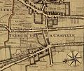 Terroir de La Chapelle.jpg 812 × 681; 459 KB


.jpg)
_(1_of_2).jpg)
_(2_of_2).jpg)
