Category:Oldengaerde
Jump to navigation
Jump to search
 | |||||
| Upload media | |||||
| Instance of | |||||
|---|---|---|---|---|---|
| Part of | |||||
| Location | Dwingeloo, Drenthe, Netherlands | ||||
| Heritage designation |
| ||||
 | |||||
- (nl) Oldengaerde
|
This is a category about rijksmonumentcomplex number 513984
|
Landhuis (hoofdgebouw):
|
This is a category about rijksmonument number 513983
|
Historische tuin- en parkaanleg:
|
This is a category about rijksmonument number 513985
|
Bouwhuis annex boerderij:
|
This is a category about rijksmonument number 513986
|
Grafzerk:
|
This is a category about rijksmonument number 513987
|
Toegangsbrug met hek:
|
This is a category about rijksmonument number 513988
|
Toegangshek:
|
This is a category about rijksmonument number 513989
|
Daglonerswoning:
|
This is a category about rijksmonument number 513990
|
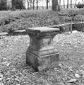
Sokkel:
|
This is a category about rijksmonument number 513991
|
Duiventil:
|
This is a category about rijksmonument number 513992
|
Tuinbeeld:
|
This is a category about rijksmonument number 513993
|
| Address |
|
Media in category "Oldengaerde"
The following 56 files are in this category, out of 56 total.
-
 27havezateoldengaerde.jpg 1,600 × 1,200; 372 KB
-
 28eenvoudigewoning.jpg 1,600 × 1,200; 362 KB
-
 Achtergevel - Dwingeloo - 20065554 - RCE.jpg 1,195 × 1,200; 356 KB
-
 Achtergevel - Dwingeloo - 20065555 - RCE.jpg 1,195 × 1,200; 378 KB
-
 Achtergevel schuur - Dwingeloo - 20065592 - RCE.jpg 1,190 × 1,200; 436 KB
-
 ANWB paddenstoel met het nummer 25178.jpg 1,600 × 1,200; 378 KB
-
 Detail toegangshek - Dwingeloo - 20308811 - RCE.jpg 1,200 × 1,200; 274 KB
-
 Detail tuinvaas - Dwingeloo - 20308812 - RCE.jpg 1,197 × 1,200; 509 KB
-
 Detail tuinvaas - Dwingeloo - 20308813 - RCE.jpg 1,200 × 1,200; 498 KB
-
 Detail tuinvaas - Dwingeloo - 20308814 - RCE.jpg 1,190 × 1,200; 402 KB
-
 Detail tuinvaas - Dwingeloo - 20308815 - RCE.jpg 1,188 × 1,200; 405 KB
-
 Duiventil - Dwingeloo - 20065556 - RCE.jpg 1,190 × 1,200; 408 KB
-
 Duiventil - Dwingeloo - 20065557 - RCE.jpg 1,200 × 1,181; 309 KB
-
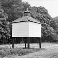 Duiventil - Dwingeloo - 20065563 - RCE.jpg 1,200 × 1,197; 391 KB
-
 Grafzerk - Dwingeloo - 20308810 - RCE.jpg 1,200 × 1,200; 464 KB
-
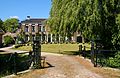
 Havezathe Oldengaerde - panoramio.jpg 2,048 × 1,536; 630 KB
-
 Linker zij- en achtergevel - Dwingeloo - 20065752 - RCE.jpg 1,200 × 1,195; 364 KB
-
 Linker zijgevel - Dwingeloo - 20065751 - RCE.jpg 1,192 × 1,200; 414 KB
-
 Oldengaarden - Dwingeloo - 20065558 - RCE.jpg 1,200 × 957; 360 KB
-
 Oldengaarden - Dwingeloo - 20065559 - RCE.jpg 1,200 × 952; 372 KB
-
 Oldengaerde Dwingeloo door Cornelis Pronk 1732.jpg 1,371 × 655; 190 KB
-
 Oldengaerde nabij Dwingeloo.jpg 1,296 × 858; 219 KB
-
 Oldengaerde.JPG 1,840 × 1,232; 1.06 MB
-
 Overzicht - Dwingeloo - 20065551 - RCE.jpg 1,190 × 1,200; 331 KB
-
 Overzicht - Dwingeloo - 20065561 - RCE.jpg 1,200 × 894; 320 KB
-
 Overzicht - Dwingeloo - 20065585 - RCE.jpg 1,188 × 1,200; 477 KB
-
 Overzicht - Dwingeloo - 20308803 - RCE.jpg 1,184 × 1,200; 471 KB
-
 Overzicht achtergevel - Dwingeloo - 20308808 - RCE.jpg 1,177 × 1,200; 351 KB
-
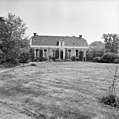
 Overzicht voorgevel - Dwingeloo - 20065562 - RCE.jpg 1,200 × 894; 279 KB
-
 Overzicht voorgevel - Dwingeloo - 20308804 - RCE.jpg 1,195 × 1,200; 504 KB
-
 Rechter zijgevel schuur - Dwingeloo - 20065591 - RCE.jpg 1,200 × 1,190; 453 KB
-
 Restant tuinvaas, detail - Dwingeloo - 20308824 - RCE.jpg 1,197 × 1,200; 427 KB
-
 Restant tuinvaas, detail - Dwingeloo - 20308825 - RCE.jpg 1,188 × 1,200; 387 KB
-
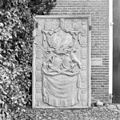
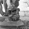
 Stenen Herculesbeeld (XVIII) - Dwingeloo - 20308826 - RCE.jpg 1,190 × 1,200; 482 KB
-
 Stenen Herculesbeeld (XVIII) - Dwingeloo - 20308827 - RCE.jpg 1,197 × 1,200; 347 KB
-
 Stenen Herculesbeeld (XVIII) - Dwingeloo - 20308828 - RCE.jpg 1,192 × 1,200; 340 KB
-
 Stenen Herculesbeeld (XVIII) - Dwingeloo - 20308830 - RCE.jpg 1,195 × 1,200; 304 KB
-
 Stenen Herculesbeeld (XVIII), detail - Dwingeloo - 20308829 - RCE.jpg 1,195 × 1,200; 312 KB
-
 Stenen Herculesbeeld (XVIII), detail sokkel - Dwingeloo - 20308831 - RCE.jpg 1,195 × 1,200; 297 KB
-
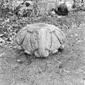
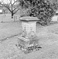 Stenen voetstuk van zonnewijzer - Dwingeloo - 20308816 - RCE.jpg 1,192 × 1,200; 463 KB
-
 Tekening van de voorgevel van Huis Oldengaerde - Dwingeloo - 20065560 - RCE.jpg 1,200 × 709; 150 KB
-
 Toegangshek naar weiland - Dwingeloo - 20308809 - RCE.jpg 1,200 × 1,197; 490 KB
-
 Toegangshek Oldengaerde.JPG 2,968 × 1,936; 5.11 MB
-
 Toegangshek overtuin Oldengaerde.JPG 3,008 × 2,000; 6.56 MB
-
 Tuinvaas - Dwingeloo - 20308817 - RCE.jpg 1,197 × 1,200; 451 KB
-
 Tuinvaas - Dwingeloo - 20308818 - RCE.jpg 1,190 × 1,200; 416 KB
-
 Tuinvaas - Dwingeloo - 20308819 - RCE.jpg 1,195 × 1,200; 476 KB
-
 Tuinvaas - Dwingeloo - 20308820 - RCE.jpg 1,188 × 1,200; 450 KB
-
 Tuinvaas - Dwingeloo - 20308821 - RCE.jpg 1,185 × 1,200; 416 KB
-
 Tuinvaas - Dwingeloo - 20308822 - RCE.jpg 1,192 × 1,200; 447 KB
-
 Tuinvaas - Dwingeloo - 20308823 - RCE.jpg 1,192 × 1,200; 406 KB
-
 Voor- en rechter zijgevel - Dwingeloo - 20065750 - RCE.jpg 1,200 × 1,200; 417 KB
-
 Voor- en zijgevel - Dwingeloo - 20065553 - RCE.jpg 1,200 × 1,195; 447 KB
-
 Voorgevel - Dwingeloo - 20065552 - RCE.jpg 1,197 × 1,200; 327 KB
-
 Voorgevel - Dwingeloo - 20308805 - RCE.jpg 1,185 × 1,200; 360 KB
-
 Voorgevel - Dwingeloo - 20308806 - RCE.jpg 1,197 × 1,200; 407 KB


_-_Dwingeloo_-_20308826_-_RCE.jpg)
_-_Dwingeloo_-_20308827_-_RCE.jpg)
_-_Dwingeloo_-_20308828_-_RCE.jpg)
_-_Dwingeloo_-_20308830_-_RCE.jpg)
,_detail_-_Dwingeloo_-_20308829_-_RCE.jpg)
,_detail_sokkel_-_Dwingeloo_-_20308831_-_RCE.jpg)


