Category:Olomouc-město
Jump to navigation
Jump to search
cadastral area in Olomouc .jpg) Caesarova kašna u olomoucké radnice | |||||
| Upload media | |||||
| Instance of | |||||
|---|---|---|---|---|---|
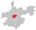
| Location | Olomouc, Olomouc District, Olomouc Region, Czechia | ||||
| Population |
| ||||
| Area |
| ||||
| Said to be the same as | Olomouc | ||||
 | |||||
Čeština: Centrální část Olomouc města Olomouc je vymezena katastrálním územím Olomouc-město.
Subcategories
This category has the following 102 subcategories, out of 102 total.
1
2
8
A
B
- Blažejské náměstí (16 F)
C
D
- Dukelská (Olomouc) (1 F)
G
H
- Hanáckého pluku (2 F)
- Havelkova (Olomouc) (5 F)
J
K
- Kollárovo náměstí (Olomouc) (12 F)
- Kosinova (Olomouc) (14 F)
- Kozí (Olomouc) (4 F)
L
M
- Michalské stromořadí (1 F)
N
- Nábřeží (Olomouc) (9 F)
- Nábřeží Přemyslovců (25 F)
O
P
- Panská (Olomouc) (18 F)
- Pavelčákova (Olomouc) (21 F)
- Praskova (Olomouc) (1 F)
- Purkrabská (Olomouc) (19 F)
R
S
T
U
V
W
Z
Ú
Š
- Šantova (Olomouc) (3 F)
- Šemberova (Olomouc) (5 F)
- Školní (Olomouc) (17 F)
- Švédská (Olomouc) (12 F)
Ž
Media in category "Olomouc-město"
The following 3 files are in this category, out of 3 total.
-
 OL město.png 724 × 597; 23 KB
-
 Olmuetz, Oberring mit Dreifaltigkeitssaeule, Rathaus und Brunnen (24743820828).jpg 1,920 × 1,275; 478 KB
-
 Vančurova, Olomouc.jpg 3,060 × 4,080; 2.64 MB

.jpg)
