Category:Ommerweg 15/17, Balkbrug
Jump to navigation
Jump to search
| Object location | | View all coordinates using: OpenStreetMap |
|---|
house in Hardenberg, Netherlands .JPG) | |||||
| Upload media | |||||
| Instance of | |||||
|---|---|---|---|---|---|
| Part of | |||||
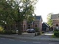
| Location | Balkbrug, Hardenberg, Overijssel, Netherlands | ||||
| Street address |
| ||||
| Located on street |
| ||||
| Heritage designation |
| ||||
 | |||||
Nederlands: Commissiewoningen
|
This is a category about rijksmonument number 515814
|
| Address |
|
Media in category "Ommerweg 15/17, Balkbrug"
The following 3 files are in this category, out of 3 total.
-
 Exterieur overzicht - Balkbrug - 20324117 - RCE.jpg 1,190 × 1,200; 448 KB
-
 Exterieur overzicht - Balkbrug - 20324118 - RCE.jpg 1,186 × 1,200; 430 KB
-
 Ommerweg - Balkbrug (13).JPG 2,592 × 1,944; 1.7 MB

