Category:Onchan
Jump to navigation
Jump to search
village in the parish of Onchan on the Isle of Man  | |||||
| Upload media | |||||
| Instance of | |||||
|---|---|---|---|---|---|
| Location | Onchan, Garff, Isle of Man, Irish Sea | ||||
| official website | |||||
 | |||||
Subcategories
This category has the following 6 subcategories, out of 6 total.
G
H
- Howstrake Camp Halt (8 F)
- Howstrake Holiday Camp (3 F)
O
- Onchan Internment Camp (2 F)
S
- St Peter's church, Onchan (23 F)
Media in category "Onchan"
The following 200 files are in this category, out of 232 total.
(previous page) (next page)-
 "Otter" at Lhen Coan depot - geograph.org.uk - 6179501.jpg 5,202 × 3,465; 3.42 MB
-
 "There May be Trouble Ahead" - geograph.org.uk - 5345679.jpg 640 × 424; 60 KB
-
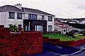
 1930s housing in Onchan - geograph.org.uk - 3148628.jpg 2,592 × 1,936; 1.5 MB
-
 A Happy Hedge^ - geograph.org.uk - 3936812.jpg 424 × 640; 103 KB
-

-
 A11 at Balladroma - geograph.org.uk - 3144583.jpg 3,648 × 2,736; 6.28 MB
-
 A11 Coastal Road towards Groudle Glen - geograph.org.uk - 5479461.jpg 1,440 × 1,080; 951 KB
-
 A11 road bridge - geograph.org.uk - 3786965.jpg 640 × 480; 109 KB
-
 A18 at the Hillberry Grandstand - geograph.org.uk - 4429716.jpg 640 × 424; 76 KB
-
 A18 ^ Footpath to Glenville - geograph.org.uk - 4429718.jpg 640 × 424; 72 KB
-
 A2 at Ballakilmartin - geograph.org.uk - 3148589.jpg 2,592 × 1,936; 1.79 MB
-
 A2 at Bilaboe Beg - geograph.org.uk - 3148579.jpg 2,592 × 1,936; 1.44 MB
-
 A2 in Onchan - geograph.org.uk - 3148601.jpg 2,592 × 1,936; 1.31 MB
-
 A2 in Onchan - geograph.org.uk - 3148605.jpg 2,592 × 1,936; 1.31 MB
-
 A2 in Onchan - geograph.org.uk - 3148610.jpg 2,592 × 1,936; 1.57 MB
-
 A2 in Onchan - geograph.org.uk - 3148623.jpg 2,592 × 1,936; 1.58 MB
-
 A2 in Onchan - geograph.org.uk - 3148636.jpg 2,592 × 1,936; 1.64 MB
-
 A38 Summerhill Rd - geograph.org.uk - 3936820.jpg 424 × 640; 85 KB
-
 Across Port Jack Glen - geograph.org.uk - 3936799.jpg 424 × 640; 95 KB
-
 Approaching the A2 junction with the A18 - geograph.org.uk - 3148643.jpg 2,592 × 1,936; 1.62 MB
-
-
 At Port Jack, Isle of Man - geograph.org.uk - 4870555.jpg 3,551 × 4,693; 3.79 MB
-
 Avondale Road - geograph.org.uk - 3936842.jpg 424 × 640; 82 KB
-

-
 Ballakaighen Farm - geograph.org.uk - 1963325.jpg 2,816 × 2,112; 1.22 MB
-
 Ballakaighen Farm Lane - geograph.org.uk - 1963100.jpg 2,816 × 2,112; 1.09 MB
-
 Ballakaighen Farmyard - geograph.org.uk - 1972901.jpg 2,816 × 2,112; 1.08 MB
-
 Ballakaighen House - geograph.org.uk - 1963095.jpg 640 × 480; 73 KB
-
 Begoade Moar Farm - geograph.org.uk - 5345659.jpg 640 × 424; 85 KB
-
 Bend in Little Mill Road - geograph.org.uk - 4429680.jpg 424 × 640; 87 KB
-
 Bibaloe Beg Road - geograph.org.uk - 1990485.jpg 2,499 × 1,260; 751 KB
-
 Bibaloe Beg Road - geograph.org.uk - 1990500.jpg 2,816 × 2,112; 1.38 MB
-
 Bridge in Groudle Glen - geograph.org.uk - 3781246.jpg 480 × 640; 140 KB
-
 Bus Stop for Signpost Corner - geograph.org.uk - 3936865.jpg 424 × 640; 63 KB
-
 Car 6 and a wagon - geograph.org.uk - 5934823.jpg 4,608 × 3,456; 6.17 MB
-
 Cars racing the tram in Groudle Glen - geograph.org.uk - 3144564.jpg 3,648 × 2,736; 6.95 MB
-
 Cliff View Near Howstrake - geograph.org.uk - 2728741.jpg 1,496 × 1,122; 451 KB
-
 Climbing out of Douglas - geograph.org.uk - 5045168.jpg 640 × 480; 164 KB
-
 Clypse Course.svg 608 × 655; 43 KB
-
 Clypse Moar Road - geograph.org.uk - 4429706.jpg 424 × 640; 46 KB
-
 Coastal Cliff near Lag Birragh - geograph.org.uk - 5479143.jpg 1,440 × 1,080; 984 KB
-
 Creg ny Baa corner on the TT course - geograph.org.uk - 4876288.jpg 4,567 × 3,506; 2.81 MB
-
 Creg-ny-Baa - geograph.org.uk - 3112563.jpg 800 × 399; 63 KB
-
 Cronk-ny-Mona - geograph.org.uk - 3415819.jpg 2,560 × 1,920; 2.71 MB
-

-
 Crossing Groudle Glen - geograph.org.uk - 5045190.jpg 640 × 480; 208 KB
-
 Derby Castle - geograph.org.uk - 4841892.jpg 640 × 480; 54 KB
-
 Derby Castle station - geograph.org.uk - 5935000.jpg 4,608 × 3,456; 5.92 MB
-

-
 Disused shelter, Howstrake Camp - geograph.org.uk - 5101305.jpg 1,024 × 768; 143 KB
-
 Douglas - Queens Promenade ^ shower clouds - geograph.org.uk - 5619574.jpg 5,184 × 2,920; 4.72 MB
-
 Douglas - Summer Hill - geograph.org.uk - 5479132.jpg 1,440 × 1,080; 1.04 MB
-
 Douglas, Derby Castle Station - geograph.org.uk - 4503347.jpg 4,608 × 3,456; 6.1 MB
-
 Douglas, railway cars - geograph.org.uk - 4613892.jpg 1,024 × 803; 174 KB
-
 Downhill towards Groudle Glen - geograph.org.uk - 3144553.jpg 3,648 × 2,736; 6.89 MB
-
 Electric Railway signage - geograph.org.uk - 4714077.jpg 640 × 480; 85 KB
-
 Entrance to Groudle Glen - geograph.org.uk - 6179468.jpg 4,580 × 2,863; 2.98 MB
-
 Entrance to Port Jack Glen Park - geograph.org.uk - 4870551.jpg 3,577 × 4,758; 2.97 MB
-
 Flower Tub in Onchan Park - geograph.org.uk - 3936800.jpg 424 × 640; 79 KB
-
 Flowers and Governors Road - geograph.org.uk - 3936826.jpg 640 × 424; 76 KB
-
 Following the road - geograph.org.uk - 3144569.jpg 3,648 × 2,736; 7.22 MB
-
 Fryers - fish and chips, Onchan - geograph.org.uk - 6287069.jpg 1,024 × 917; 210 KB
-
 Garey Rd and Gorse - geograph.org.uk - 5345630.jpg 640 × 424; 77 KB
-
 Gates by the Garey Rd - geograph.org.uk - 5345641.jpg 640 × 424; 54 KB
-
 Glenholme King Edward Road Onchan Isle of Man - geograph.org.uk - 6287939.jpg 3,690 × 2,460; 2.78 MB
-
 Gorse Beside Waterson's lane - geograph.org.uk - 3936903.jpg 424 × 640; 64 KB
-
 Gorse Lined Path near Groudle Glen - geograph.org.uk - 5345779.jpg 640 × 424; 113 KB
-
 Groudel River in Molly Quirks Glen - geograph.org.uk - 4429649.jpg 640 × 424; 97 KB
-
 Groudle Cottages - geograph.org.uk - 1107486.jpg 640 × 431; 74 KB
-
 Groudle Glen - geograph.org.uk - 3781245.jpg 480 × 640; 145 KB
-
 Groudle Glen Cottages - geograph.org.uk - 3408275.jpg 424 × 640; 70 KB
-
 Groudle Glen Hotel, King Edward Road, Onchan - geograph.org.uk - 6288008.jpg 3,888 × 2,592; 3.8 MB
-
 Groudle Glen path - geograph.org.uk - 6179478.jpg 5,202 × 3,465; 4.57 MB
-
 Groudle Glen path and bridge - geograph.org.uk - 6179540.jpg 5,202 × 3,465; 3.69 MB
-
 Groudle Glen path, and wizard. - geograph.org.uk - 6179537.jpg 5,202 × 3,465; 4.42 MB
-
 Groudle Glen railway - geograph.org.uk - 3144556.jpg 3,648 × 2,736; 6.1 MB
-
 Groudle Glen station, MER - geograph.org.uk - 5934918.jpg 4,608 × 3,456; 6.42 MB
-
 Groudle Glen tram station - geograph.org.uk - 3632954.jpg 640 × 480; 109 KB
-
 Groudle Glen Viaduct - geograph.org.uk - 2109416.jpg 2,112 × 2,816; 1.56 MB
-
 Groudle Glen viaduct - geograph.org.uk - 5059516.jpg 640 × 427; 118 KB
-
 Groudle River - geograph.org.uk - 4429124.jpg 424 × 640; 115 KB
-
 Groudle River Footbridge - geograph.org.uk - 5479475.jpg 1,440 × 1,080; 1.42 MB
-

-
 Harvey Briggs Onchan library (43912608352).jpg 1,024 × 768; 475 KB
-
 Heading into Groudle Glen - geograph.org.uk - 3144560.jpg 3,648 × 2,736; 6.96 MB
-
 Heathery Summit - geograph.org.uk - 1252920.jpg 640 × 480; 102 KB
-
 Holiday bungalows at Groudle Glen - geograph.org.uk - 1121015.jpg 640 × 406; 74 KB
-
 House in Groudle Glen - geograph.org.uk - 3133819.jpg 2,592 × 1,936; 1.67 MB
-
 Houses at Groudle - geograph.org.uk - 5070870.jpg 1,280 × 854; 358 KB
-
 Houses near Molly Quirk's Glen - geograph.org.uk - 5479494.jpg 1,440 × 1,080; 997 KB
-
 Houses on the B20 turning off the A2 - geograph.org.uk - 5479487.jpg 1,440 × 1,080; 1,005 KB
-
 Howe Road - geograph.org.uk - 3133814.jpg 1,936 × 2,592; 1.88 MB
-
 Howstrake - House with Sea View - geograph.org.uk - 5479456.jpg 1,440 × 1,080; 953 KB
-
 Howstrake Camp M.E.R. Shelter - geograph.org.uk - 1825044.jpg 800 × 600; 173 KB
-
 Howstrake Golf Course Club House - geograph.org.uk - 3414510.jpg 2,560 × 1,920; 1.96 MB
-
 Howstrake Golf Course Trig - geograph.org.uk - 3414503.jpg 2,560 × 1,920; 2.69 MB
-
 Ironic signage in Onchan - geograph.org.uk - 2600319.jpg 3,296 × 2,472; 1.89 MB
-
 Isle Of Man Coastal Path At Groudle Glen - geograph.org.uk - 2728768.jpg 1,496 × 1,122; 971 KB
-
 King Edward Bay Golf Club, Isle of Man - geograph.org.uk - 3489752.jpg 1,440 × 1,080; 498 KB
-
 King Edward Road - geograph.org.uk - 3144526.jpg 3,648 × 2,736; 5.9 MB
-
 King Edward Road - geograph.org.uk - 3144531.jpg 3,648 × 2,736; 5.7 MB
-
 King Edward Road - geograph.org.uk - 3144536.jpg 3,648 × 2,736; 5.85 MB
-
 King Edward Road - geograph.org.uk - 3144541.jpg 3,648 × 2,736; 5.98 MB
-
 King Edward Road A11, Onchan - geograph.org.uk - 1878782.jpg 800 × 600; 158 KB
-
 King Edward Road, Port Jack - geograph.org.uk - 5101274.jpg 1,024 × 768; 177 KB
-
 Lhen Coan station looking eastwards - geograph.org.uk - 6179492.jpg 5,202 × 3,465; 4.35 MB
-

-
 Looking towards Sea Lion Cove - geograph.org.uk - 3144549.jpg 3,648 × 2,736; 5.89 MB
-

-
 Majestic Drive, Onchan - geograph.org.uk - 5101294.jpg 1,024 × 768; 119 KB
-
 Manannan's cloak is coming (2) - geograph.org.uk - 6195795.jpg 1,024 × 803; 142 KB
-
 Manannan's cloak is coming - a wider view - geograph.org.uk - 6195794.jpg 1,024 × 776; 135 KB
-
 Manx Coastal Path - geograph.org.uk - 3408248.jpg 424 × 640; 73 KB
-
 Manx Electric Railway - geograph.org.uk - 3144573.jpg 3,648 × 2,736; 6.88 MB
-
-

-
 Manx Electric Railway at Port Jack - geograph.org.uk - 5070854.jpg 1,280 × 853; 454 KB
-
 Manx Humour - geograph.org.uk - 3408229.jpg 424 × 640; 94 KB
-
 Manx Radio Plaque - geograph.org.uk - 3936847.jpg 640 × 640; 125 KB
-
 MER-Onchan-Head.jpg 640 × 480; 85 KB
-
 Michigan Marsh Marigolds.jpg 1,600 × 1,200; 825 KB
-
 Modernist house, King Edward Road, Groudle - geograph.org.uk - 5101324.jpg 1,024 × 768; 158 KB
-
 Molly Quirks Glen - geograph.org.uk - 4429637.jpg 424 × 640; 91 KB
-
 Mountain Road - geograph.org.uk - 2388827.jpg 640 × 480; 129 KB
-
 Mullen Beg - geograph.org.uk - 4429675.jpg 424 × 640; 70 KB
-
 No fun today - geograph.org.uk - 1191359.jpg 640 × 426; 68 KB
-
 Old gate by the Begoade Rd - geograph.org.uk - 5345704.jpg 640 × 424; 94 KB
-
 Old Onchan - Isle of Man - geograph.org.uk - 31582.jpg 640 × 494; 167 KB
-
 On the tram in Groudle Glen - geograph.org.uk - 3143356.jpg 3,648 × 2,736; 6.18 MB
-
 Onchan - Church Road - Large modern home - geograph.org.uk - 1714128.jpg 1,722 × 1,148; 1.66 MB
-
 Onchan - Church Road - Large modern home - geograph.org.uk - 1714133.jpg 1,758 × 1,172; 1.87 MB
-
 Onchan - Church Road - Large modern home - geograph.org.uk - 1714138.jpg 1,730 × 1,153; 1.91 MB
-
 Onchan - Church Road - Molly Carrooin's cottage - geograph.org.uk - 1714102.jpg 1,642 × 1,095; 1.5 MB
-
 Onchan - Church Road - Molly Carrooin's cottage - geograph.org.uk - 1714106.jpg 3,291 × 2,194; 4.61 MB
-
 Onchan - Church Road - Molly Carrooin's cottage - geograph.org.uk - 1714113.jpg 3,444 × 2,295; 5.62 MB
-
 Onchan - Church Road - Shrub at large modern home - geograph.org.uk - 1714146.jpg 1,001 × 1,502; 1.68 MB
-
 Onchan - Electric Railway next to Housing Estate - geograph.org.uk - 5479449.jpg 1,440 × 1,080; 910 KB
-
 Onchan Harbour, Douglas - geograph.org.uk - 3408194.jpg 640 × 424; 80 KB
-
 Onchan Head - Apartments along Sea Cliff Road - geograph.org.uk - 1713511.jpg 1,731 × 1,154; 1.6 MB
-
 Onchan Head - geograph.org.uk - 3408178.jpg 424 × 640; 59 KB
-
 Onchan Head - New apartments along Sea Cliff Road - geograph.org.uk - 1713500.jpg 1,687 × 1,125; 1.46 MB
-
 Onchan Head - New house along Sea Cliff Road - geograph.org.uk - 1713494.jpg 1,577 × 1,051; 1.23 MB
-
 Onchan Head - New house at Sea Cliff Road - geograph.org.uk - 1713481.jpg 1,692 × 1,128; 1.22 MB
-
 Onchan Head from Derby Castle - geograph.org.uk - 6178215.jpg 5,202 × 3,465; 3.19 MB
-
 Onchan Parish Hall - geograph.org.uk - 4613685.jpg 1,024 × 768; 160 KB
-
 Onchan Park Boating Lake - geograph.org.uk - 1954561.jpg 640 × 480; 204 KB
-
 Onchan, churchyard - geograph.org.uk - 4613733.jpg 1,024 × 768; 246 KB
-
 Onchan, Harvey Briggs Library (geograph 4613708).jpg 1,024 × 763; 147 KB
-
 Onchan, Manx Arms - geograph.org.uk - 4613697.jpg 1,024 × 768; 125 KB
-
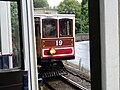 Passing car no. 19 - geograph.org.uk - 5045191.jpg 640 × 480; 162 KB
-

-
 Pasture by the Kerrawdhoo Reservoir - geograph.org.uk - 4429711.jpg 640 × 424; 59 KB
-
 Path Through Molly Quirks Glen - geograph.org.uk - 4429661.jpg 424 × 640; 108 KB
-
 Pathway through Groudle Glen - geograph.org.uk - 5059527.jpg 427 × 640; 122 KB
-
 Phone kiosk and bus shelter at Port Jack - geograph.org.uk - 4870547.jpg 4,666 × 3,510; 4.28 MB
-
 Port Groudle - 2 - geograph.org.uk - 1107625.jpg 640 × 429; 98 KB
-
 Port Groudle - geograph.org.uk - 1107601.jpg 640 × 394; 100 KB
-
 Port Groudle - geograph.org.uk - 1121012.jpg 640 × 420; 127 KB
-
 Port Groudle - geograph.org.uk - 1717523.jpg 1,920 × 1,262; 1.58 MB
-
 Port Groudle - geograph.org.uk - 3408282.jpg 640 × 424; 70 KB
-
 Port Jack Chippy - geograph.org.uk - 3143350.jpg 3,648 × 2,736; 6.48 MB
-
 Port Jack Glen - geograph.org.uk - 3936795.jpg 424 × 640; 66 KB
-
 Red ticket office and Tramcar 21 - geograph.org.uk - 4714211.jpg 640 × 480; 97 KB
-
 Repairs to the permanent way - geograph.org.uk - 3408264.jpg 640 × 424; 72 KB
-
 Road junction, Onchan - geograph.org.uk - 1878777.jpg 800 × 600; 98 KB
-
 Rocky coastline near Lag Birragh - geograph.org.uk - 1717492.jpg 1,920 × 1,263; 1.45 MB
-
 Rounding Howstrake Hill - geograph.org.uk - 3144545.jpg 3,648 × 2,736; 6.04 MB
-
 Ruined Farm at Ballakilmartin - geograph.org.uk - 5345725.jpg 640 × 424; 121 KB
-
 Sea Cliff and Superfluous Signage - geograph.org.uk - 3408238.jpg 640 × 424; 94 KB
-
 Sea Cliff Road descending from King Edward Road - geograph.org.uk - 5101285.jpg 1,024 × 768; 116 KB
-

-
 Shops on the A11 at Onchan - geograph.org.uk - 5479377.jpg 1,440 × 1,080; 1.02 MB
-
 Shoreline, Port Groudle - geograph.org.uk - 4944760.jpg 1,600 × 1,200; 471 KB
-
 Signpost Corner TT Lap ^47 - geograph.org.uk - 3936855.jpg 424 × 640; 83 KB
-
 Slegaby Drive - geograph.org.uk - 4429713.jpg 640 × 424; 51 KB
-
 St Anthonys Church - geograph.org.uk - 1967960.jpg 1,024 × 768; 253 KB
-
 Steps to a Ruined Barn - geograph.org.uk - 5345758.jpg 424 × 640; 100 KB
-
 Stormy sea at Onchan - geograph.org.uk - 4882934.jpg 640 × 427; 53 KB
-
 Strathallan Road, Onchan - geograph.org.uk - 1959838.jpg 1,024 × 768; 164 KB
-
 Stream Beside Garey Rd - geograph.org.uk - 5345613.jpg 424 × 640; 76 KB
-
 Stream Beside King Edward Road - geograph.org.uk - 5345072.jpg 424 × 640; 121 KB
-

-
 The A11 and the Manx Electric Railway leaving Onchan - geograph.org.uk - 5553618.jpg 2,592 × 1,944; 1.43 MB
-
 The Creg-ny-Baa in snow and sunshine - geograph.org.uk - 1191335.jpg 640 × 426; 74 KB
-
 The Gate to Ballikilmartin - geograph.org.uk - 5345740.jpg 424 × 640; 117 KB
-
 The Ironing Bored, Onchan - geograph.org.uk - 6287066.jpg 1,024 × 804; 147 KB
-
 The Mountain Road is Closed - geograph.org.uk - 1654854.jpg 1,528 × 1,920; 793 KB
-
 The North of Groudel Glen - geograph.org.uk - 4429624.jpg 424 × 640; 91 KB
-
 The Old Barns at Bibaloe Beg Farm - geograph.org.uk - 5345594.jpg 424 × 640; 82 KB
-
 The Old Chapel Hillberry - geograph.org.uk - 4429714.jpg 640 × 424; 101 KB
-
 The Rocks of Oncan Harbour - geograph.org.uk - 3408205.jpg 640 × 424; 83 KB
-
 The Start of Ballacotter Rd - geograph.org.uk - 4429699.jpg 640 × 424; 86 KB
-
 The Start of Garey Rd - geograph.org.uk - 5345694.jpg 640 × 424; 85 KB
-

-
 The Village Walk - geograph.org.uk - 3936837.jpg 640 × 424; 67 KB
-
 The Village Walk, Onchan - geograph.org.uk - 6287060.jpg 1,024 × 768; 176 KB
-
 The White Bridge - geograph.org.uk - 4429613.jpg 424 × 640; 63 KB
-
 Tight corner in Groudle Glen - geograph.org.uk - 3143361.jpg 3,648 × 2,736; 6.6 MB
-
 Tilted mudstone strata in Groudle Glen - geograph.org.uk - 5071974.jpg 1,280 × 853; 657 KB
-
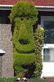
 Topiary on Summerhill - geograph.org.uk - 3936804.jpg 640 × 424; 78 KB


.jpg)


_-_geograph.org.uk_-_6195795.jpg)


.jpg)


