Category:Oostergeest (Warmond)
Jump to navigation
Jump to search
| Object location | | View all coordinates using: OpenStreetMap |
|---|
 | |||||
| Upload media | |||||
| Instance of | |||||
|---|---|---|---|---|---|
| Location | Warmond, South Holland, Netherlands | ||||
| Has part(s) | |||||
| Heritage designation |
| ||||
 | |||||
|
This is a category about rijksmonumentcomplex number 510513
|
Landhuis:
|
This is a category about rijksmonument number 510514
|
Historische aanleg:
|
This is a category about rijksmonument number 510515
|
Koetshuis:
|
This is a category about rijksmonument number 510517
|
Tuinmuur:
|
This is a category about rijksmonument number 510519
|
Koude bakken:
|
This is a category about rijksmonument number 510520
|
Schuur:
|
This is a category about rijksmonument number 510521
|
Tuinkoepel:
|
This is a category about rijksmonument number 510522
|
Tuinkoepel:
|
This is a category about rijksmonument number 510523
|
Prieel:
|
This is a category about rijksmonument number 510524
|
Ooievaarsnest:
|
This is a category about rijksmonument number 510525
|
| Address |
|
Subcategories
This category has the following 2 subcategories, out of 2 total.
F
- Fruitmuur, Oostergeest (Warmond) (11 F)
K
- Kassen, Oostergeest (Warmond) (10 F)
Media in category "Oostergeest (Warmond)"
The following 46 files are in this category, out of 46 total.
-
 Achter - Warmond - 20249777 - RCE.jpg 1,200 × 807; 274 KB
-
 Achterzijde - Warmond - 20249780 - RCE.jpg 1,200 × 955; 314 KB
-
 Beschilderd plafond in de opkamer - Warmond - 20249977 - RCE.jpg 1,190 × 1,200; 331 KB
-
 Beschilderd plafond in de opkamer - Warmond - 20249978 - RCE.jpg 1,190 × 1,200; 299 KB
-
 Detail beschilderd plafond in de opkamer - Warmond - 20249981 - RCE.jpg 1,192 × 1,200; 321 KB
-
 Detail beschilderd plafond in opkamer - Warmond - 20249979 - RCE.jpg 1,195 × 1,200; 361 KB
-
 Detail beschilderd plafond in opkamer - Warmond - 20249980 - RCE.jpg 1,185 × 1,200; 344 KB
-
 Exterieur - Warmond - 20249773 - RCE.jpg 963 × 1,200; 239 KB
-
 Exterieur DE TULPENBOOM IN HET BOS - Warmond - 20300724 - RCE.jpg 1,190 × 1,200; 345 KB
-
 Exterieur GEZICHT BIJ DE MOESTUIN - Warmond - 20300722 - RCE.jpg 1,192 × 1,200; 353 KB
-
 Exterieur OVERZICHT MOESTUIN - Warmond - 20300721 - RCE.jpg 1,190 × 1,200; 319 KB
-
 Exterieur PARK MET UITZICHT OP DE N.H. PASTORIE - Warmond - 20300719 - RCE.jpg 1,183 × 1,200; 242 KB
-
 Exterieur PARK, CROQUETLAAN - Warmond - 20300725 - RCE.jpg 1,200 × 1,180; 335 KB
-
 Exterieur PARK, VIJVER - Warmond - 20300723 - RCE.jpg 1,187 × 1,200; 318 KB
-
 Exterieur voorgevel - Warmond - 20249770 - RCE.jpg 1,200 × 942; 326 KB
-
 Exterieur VOORGEVEL, LINKER ZIJGEVEL - Warmond - 20300720 - RCE.jpg 1,200 × 1,200; 381 KB
-
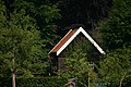 Houten schuur, Huis Oostergeest.JPG 3,072 × 2,048; 2.46 MB
-
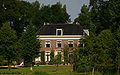 Huis Oostergeest, Warmond.JPG 2,751 × 1,708; 1.8 MB
-
 Interieur beschilderd plafond in het opkamertje. - Warmond - 20249785 - RCE.jpg 1,195 × 1,200; 334 KB
-
 Interieur beschilderd plafond in het opkamertje. - Warmond - 20249786 - RCE.jpg 1,195 × 1,200; 292 KB
-
 Interieur beschilderd plafond in het opkamertje. - Warmond - 20249787 - RCE.jpg 1,200 × 1,200; 323 KB
-
 Interieur rechter voorkamer - Warmond - 20249772 - RCE.jpg 965 × 1,200; 233 KB
-
 Interieur van door hal - Warmond - 20249771 - RCE.jpg 1,200 × 1,010; 206 KB
-
 Kaart van de buitenplaats Oostergeest onder Warmond.jpg 2,608 × 1,873; 236 KB
-
 Koetshuis - Warmond - 20249779 - RCE.jpg 1,200 × 808; 282 KB
-
 Ooievaarsnest op paal, midden in weiland - Warmond - 20385003 - RCE.jpg 916 × 1,200; 147 KB
-
 Oostergeest - Ooievaarsnest, Warmond.jpg 2,048 × 3,072; 1.3 MB
-
 Oostergeest park.jpg 2,154 × 1,476; 542 KB
-
 Oostergeest.jpg 2,148 × 1,476; 568 KB
-
 Overzicht voorgevel - Warmond - 20358410 - RCE.jpg 1,189 × 1,200; 396 KB
-
 Overzicht voorgevel - Warmond - 20358457 - RCE.jpg 1,197 × 1,200; 350 KB
-
 Overzicht voorgevel en linker zijgevel - Warmond - 20358411 - RCE.jpg 1,194 × 1,200; 402 KB
-
 Overzicht voorgevel en linker zijgevel - Warmond - 20358458 - RCE.jpg 1,186 × 1,200; 376 KB
-
 Plafond in achterkamer - Warmond - 20249774 - RCE.jpg 1,200 × 942; 191 KB
-
 Plafond in achterkamer - Warmond - 20249775 - RCE.jpg 1,200 × 947; 236 KB
-
 Plafondschildering in opkamer - Warmond - 20249789 - RCE.jpg 1,200 × 1,190; 293 KB
-
 Plafondschildering in opkamer - Warmond - 20249790 - RCE.jpg 1,200 × 1,190; 304 KB
-
 Plafondschildering Jachtkamer - Warmond - 20249788 - RCE.jpg 1,200 × 1,188; 228 KB
-
 Reproductie van plattegrond - Warmond - 20249769 - RCE.jpg 954 × 1,200; 243 KB
-
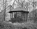 Tuinhuis - Warmond - 20249782 - RCE.jpg 1,200 × 953; 444 KB
-
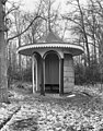 Tuinkoepeltje - Warmond - 20249783 - RCE.jpg 943 × 1,200; 414 KB
-
 Tuinmuur - Warmond - 20249778 - RCE.jpg 1,200 × 801; 338 KB
-
 Voor - Warmond - 20249776 - RCE.jpg 1,200 × 802; 272 KB
-
 Warmond Oostergeest, tuin, bakken.jpg 1,183 × 1,200; 431 KB
-
 Zerk met wapens - Warmond - 20249784 - RCE.jpg 3,308 × 2,232; 1.79 MB
-
 Zijgevel - Warmond - 20249781 - RCE.jpg 1,200 × 956; 329 KB


