Category:OpenStreetMap maps of Bavaria
Jump to navigation
Jump to search
Federal states of Germany:
Subcategories
This category has the following 10 subcategories, out of 10 total.
*
A
H
- OpenStreetMap maps of Landkreis Hof (3497 F)
M
- OpenStreetMap maps of Munich (25 F)
N
- OpenStreetMap maps of Nuremberg (19 F)
S
- OpenStreetMap maps of Swabia (2 F)
Media in category "OpenStreetMap maps of Bavaria"
The following 117 files are in this category, out of 117 total.
-
 AD Bayerisches Vogtland map.png 817 × 613; 451 KB
-
 AD Hochfranken map.png 819 × 614; 483 KB
-
 Algasinger Mühlweiher Karte.png 698 × 569; 88 KB
-
 Aschaffenburg - Lage.jpg 782 × 486; 322 KB
-
 Autobahndreieck Bayerisches Vogtland der A72 und der A9.png 738 × 535; 132 KB
-
 Autobahndreieck Bayerisches Vogtland.svg 1,581 × 1,311; 2.26 MB
-
 Autobahndreieck Hochfranken der A93 und der A72.png 738 × 535; 123 KB
-
 Bahnstrecke Bayreuth–Neuenmarkt-Wirsberg (Karte).svg 248 × 751; 682 KB
-
 Bahnstrecke Neukirchen–Weiden (Karte).svg 1,548 × 752; 2.82 MB
-
 Bahnstrecke Regensburg–Weiden (Karte).svg 315 × 751; 14.73 MB
-
 Bahnstrecke Schweinfurt-Meiningen.png 704 × 704; 535 KB
-
 Bahnstrecke Weiden–Bayreuth (Karte).svg 985 × 751; 7.15 MB
-
 Bahnstrecke Weiden–Oberkotzau (Karte).svg 400 × 751; 12.09 MB
-
 Baumer Weiher (bei Kalling) Karte.png 788 × 811; 127 KB
-

-
 Bayreuth-Thiergarten.png 597 × 529; 245 KB
-
 Berchtesgaden-gatest.svg 974 × 1,070; 883 KB
-
 Brücken in Passau.png 4,675 × 3,138; 5.36 MB
-
 OSM-Chiemgau.png 2,094 × 1,894; 2.82 MB
-
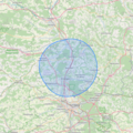 Corona 15km Bewegungsradius Baiersdorf BY.png 820 × 820; 743 KB
-
 Corona 15km Bewegungsradius Erlangen BY.png 820 × 820; 758 KB
-
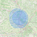
 Corona 15km Bewegungsradius München BY.png 820 × 820; 800 KB
-

-
 Daxau (Isen) auf OpenStreetMap.jpg 1,599 × 839; 129 KB
-
 Dürschnitz map.PNG 716 × 560; 195 KB
-
 Fehr et al (2005).jpg 503 × 750; 238 KB
-
 Flut-Auffangbecken Dorfen.png 758 × 699; 248 KB
-
 Forchheim-burk.jpg 1,040 × 886; 323 KB
-

-
 Stadtpark fuerth osm.png 450 × 675; 132 KB
-
 Fürth OSM 01.png 587 × 519; 500 KB
-
 Fürth OSM 02.png 398 × 475; 329 KB
-
 Fürth OSM 03.png 398 × 475; 240 KB
-
 Geiersberg Karte Deggendorf.png 1,157 × 879; 528 KB
-
 Gemeinde Affing blank.svg 733 × 556; 997 KB
-
 Gemeinde Kürnach.png 1,112 × 881; 510 KB
-
 Gemeindekarte Affing.png 1,166 × 872; 174 KB
-
 Gungoldinger Wacholderheide.svg 800 × 542; 326 KB
-
 Heckerbrücke Karte OpenStreetMap.png 814 × 529; 260 KB
-
 Hochspannungsleitung Mellrichstadt Bad Neustadt.png 1,138 × 972; 487 KB
-
 Hohe Warte Bayreuth.PNG 836 × 562; 208 KB
-
 Höhenzug Hohe Warte.png 1,200 × 911; 2.2 MB
-
 Infrastruktur nach Herzog u. Atabay.png 3,507 × 2,480; 5.81 MB
-
 Introduzione a OpenStreetMap.pdf 2,000 × 1,125, 20 pages; 2.93 MB
-
 Isenauenpark-Flutrückhalte-Weiher Karte.png 867 × 751; 193 KB
-
 Karte Alte Saline Bad Reichenhall.svg 880 × 1,157; 154 KB
-
 Karte Aufteilung Lindenhardter Forst-Nordwest.svg 1,008 × 1,034; 403 KB
-
 Karte Daschendorfer Forst.svg 1,081 × 954; 4.23 MB
-
 Karte der Bahnstrecke München-Garmisch-Partenkirchen.png 1,300 × 2,274; 3.17 MB
-
 Karte der Bahnstrecke Regensburg - Falkenstein.png 2,180 × 1,311; 1.32 MB
-
 Karte Eisenbahnunfall von Burgrain.png 753 × 664; 496 KB
-
 Karte Forst Sankt Georgen.png 1,200 × 911; 2.19 MB
-
 Karte Kirchengemeinde Neunburg.png 767 × 610; 580 KB
-
 Karte Regierungsbezirk Schwaben.jpg 5,320 × 7,920; 28.48 MB
-
 Karte Rosenheimer See.jpg 2,171 × 1,612; 1.39 MB
-
 Karte vom Flughafen München (inkl. geplanter Erweiterung).png 2,644 × 1,675; 1.08 MB
-
 Karte vom Flughafen München (inkl. geplanter Erweiterung).svg 2,644 × 1,675; 717 KB
-
 Karte von Burgkunstadt.jpg 762 × 462; 84 KB
-
 Spaetroemisches Kastell Kellmuenz Plan.png 2,400 × 2,400; 546 KB
-
 Cambodunum Lageplan.png 2,500 × 2,500; 1.74 MB
-
 Kreuz über Bamberg - OSM.png 988 × 736; 405 KB
-
 Lac de Rieg OSM.png 359 × 487; 101 KB
-
 Lage der Halbtrockenrasen bei Sulzdorf.svg 866 × 524; 9.57 MB
-
 Lagekarte Neuburger Wald.png 1,495 × 1,170; 979 KB
-
 Lageskizze Künzing - Quintanis.jpg 888 × 653; 104 KB
-
 Leoprechting Niedertaufk NM-St.-Veit Massing.png 1,502 × 1,362; 1.73 MB
-
 Litzlbacher Weiher Karte.png 632 × 490; 48 KB
-
-

-
 Map-of-5050-Weiden-Oberkotzau.png 1,188 × 882; 1.49 MB
-
 Map-of-5102-Bamberg-Rottendorf.png 1,520 × 883; 924 KB
-
 Map-of-5121-Coburg-Lauscha.png 694 × 644; 434 KB
-
 Map-of-5860-Regensburg–Weiden.png 1,106 × 881; 1.41 MB
-
 Mitterfels.png 1,017 × 814; 257 KB
-
 Mühlhausen.png 1,170 × 882; 281 KB
-
 Oberlandbahn.png 353 × 648; 202 KB
-
 Obertaufkirchen-Kirchkagen, Heldenstein, Isen.png 1,138 × 978; 1.08 MB
-
 OpenStreetMap der Feld- und Waldbahn Riedlhütte.png 467 × 293; 63 KB
-
 Pfarrverband Flossing.jpg 819 × 855; 334 KB
-
 Pfeffersee-Karte.png 807 × 532; 1.23 MB
-
 PV Flossing.png 819 × 855; 711 KB
-
 Railway line Munich–Garmisch-Partenkirchen.png 1,300 × 2,277; 3.17 MB
-
 Ratisbonne OSM 01.png 492 × 506; 421 KB
-
 Ratisbonne OSM 02.png 492 × 506; 596 KB
-
 Ratisbonne OSM 03.png 492 × 506; 460 KB
-
 Regensburg osm.png 2,119 × 945; 1.58 MB
-
 Regio-S-Bahn Regensburg Karte.png 376 × 638; 245 KB
-
 Regnitz.png 472 × 566; 635 KB
-
 Rehbühl WeideninderOberpfalz Karte OSM.png 810 × 664; 318 KB
-
 Karte Rosenheim OSM.png 2,054 × 1,946; 2.03 MB
-
 RothenburgObDerTauberAltstadt2022OSM.png 3,629 × 3,410; 5.55 MB
-
 Schafirrsee Openstreetmap 2.jpg 1,099 × 824; 97 KB
-
 Schafirrsee Openstreetmap.jpg 2,200 × 1,649; 302 KB
-
 Schoenleitenmoos.svg 800 × 606; 203 KB
-
-
 Sprengstoffanschlag von Ansbach – Lageplan.jpg 928 × 672; 258 KB
-
 St. Martin, Grafing, Neumarkt-St. Veit.png 1,564 × 1,136; 1.3 MB
-
 Stadtmauer NOE Urzustand 1000.png 1,000 × 949; 579 KB
-
 StadtmauernWeideninderOberpfalz heute.png 517 × 620; 105 KB
-
 Staffelsee Karte B.jpg 1,632 × 1,472; 1.76 MB
-
 Straßenverlauf Albertsberg Schwarzenbach, Saale (OSM).svg 2,610 × 2,378; 1.1 MB
-
 Straßenverlauf Bussardstraße Rehau (OSM).svg 2,178 × 2,845; 2.98 MB
-
 Straßenverlauf Dr.-Hans-Vogt-Straße Rehau (OSM).svg 3,185 × 1,960; 2.82 MB
-
 Straßenverlauf Veilchenweg Schwarzenbach, Saale (OSM).svg 3,209 × 1,926; 980 KB
-
 Straßenverlauf Würschum Schwarzenbach, Saale (OSM).svg 2,491 × 2,503; 1.5 MB
-
 Tauernradweg.svg 383 × 600; 521 KB
-
 VG Polling.png 819 × 855; 696 KB
-
 VGem Polling.jpg 819 × 855; 344 KB
-

-
 Wank map.gif 914 × 779; 456 KB
-
 Watzlinger Weiher Karte.png 667 × 540; 94 KB
-
 Wesslinger See.svg 636 × 731; 851 KB
-
 Westgartshausen Map.png 900 × 766; 520 KB
-
 Wiespoint.png 1,017 × 814; 258 KB
-
 Wildpark an den Eichen-Map 1.svg 1,610 × 1,485; 1.6 MB
-
 Bahnhoefe Wuerzburg.png 990 × 751; 679 KB
-
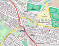
 ÖPNV-Karte Neunkirchen(Weiden).png 834 × 527; 194 KB


.svg)
.svg)

.svg)
.svg)
_Karte.png)
_OSM-Karte_2023_%E2%80%94_uploaded_by_Mattes.jpg)


.jpg)
_auf_OpenStreetMap.jpg)

.jpg)


_OSM-Karte_2023_%E2%80%94_uploaded_by_Mattes.jpg)


.png)
.svg)


.svg)
.svg)
.svg)
.svg)
.svg)


.png)
.svg)
.jpg)