Category:OpenStreetMap maps of Gloucestershire
Jump to navigation
Jump to search
Media in category "OpenStreetMap maps of Gloucestershire"
The following 9 files are in this category, out of 9 total.
-
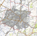
 Cheltenham OSM 01.png 1,190 × 1,164; 2.02 MB
-
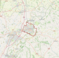
 Cheltenham OSM 02.png 1,190 × 1,164; 2.6 MB
-
 Cheltenham OSM 03.png 1,190 × 1,164; 1.97 MB
-
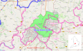 Gloucester & Cheltenham green belt.svg 1,685 × 1,033; 1.7 MB
-
 Kingswood, UK.png 444 × 414; 155 KB
-
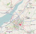
 Location map United Kingdom Gloucester Central.png 2,079 × 1,916; 1.44 MB
-
 Map-of-the-Cotswold-Way-2009-09-17.png 738 × 856; 656 KB
-
 Severn Estuary Crossings.svg 1,663 × 1,536; 1.75 MB
-
 Thornbury branch line.png 1,168 × 1,189; 805 KB


