Category:OpenStreetMap maps of Gotland
Jump to navigation
Jump to search
Media in category "OpenStreetMap maps of Gotland"
The following 25 files are in this category, out of 25 total.
-
 Gotland fsg 1960.jpeg 4,771 × 6,070; 1.3 MB
-
 Gotland kn 1960.jpeg 4,771 × 6,070; 1.22 MB
-
 Gotland runt Alfa.png 1,942 × 3,478; 306 KB
-
 Gotland runt Bravo.png 1,942 × 3,478; 298 KB
-
 Gotland runt Charlie.png 1,942 × 3,478; 297 KB
-
 Gotland runt Classic Yacht.png 1,942 × 3,478; 297 KB
-
 Gotland runt Delta.png 1,942 × 3,478; 295 KB
-
 Gotland runt karta.png 1,942 × 3,478; 288 KB
-
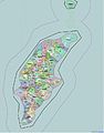
 Gotland2022OSM.png 4,381 × 6,171; 5.59 MB
-
 Karta Bulverket i Tingstäde Träsk.jpg 948 × 768; 372 KB
-
 Lojsta slott karta.jpg 670 × 494; 205 KB
-
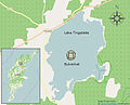
 Lojsta träsk karta.jpg 670 × 524; 213 KB
-
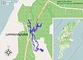 Lummelundsgrottan map.jpg 672 × 494; 216 KB
-
 Torsburgen map.jpg 779 × 670; 311 KB
-
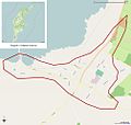 Tätort Burgsvik.jpg 1,002 × 955; 217 KB
-
 Tätort Fårösund.jpg 1,359 × 955; 306 KB
-
 Tätort Havdhem.jpg 1,002 × 955; 212 KB
-
 Tätort Hemse.jpg 1,000 × 955; 264 KB
-
 Tätort Klintehamn.jpg 1,000 × 955; 327 KB
-
 Tätort Ljugarn.jpg 1,002 × 955; 269 KB
-
 Tätort Lärbro.jpg 1,002 × 955; 223 KB
-
 Tätort Roma.jpg 1,002 × 955; 261 KB
-
 Tätort Slite.jpg 1,002 × 955; 228 KB
-
 Tätort Stånga.jpg 627 × 597; 137 KB
-
 Tätort Tingstäde.jpg 1,002 × 955; 234 KB


