Category:OpenStreetMap maps of Manchester
Jump to navigation
Jump to search
Media in category "OpenStreetMap maps of Manchester"
The following 9 files are in this category, out of 9 total.
-
 Bridgewater Canal map.png 1,582 × 1,072; 2.14 MB
-
 Culcheth Linear Park Entrance.png 900 × 900; 282 KB
-
 Manchester bombing.png 1,108 × 536; 279 KB
-
 Manchester OSM 01.png 776 × 863; 1.26 MB
-
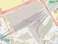
 Manchester Piccadilly plan.png 1,000 × 568; 791 KB
-
 Manchester Victoria plan.png 1,000 × 756; 634 KB
-
 Manchester-Canal Street-Gay Village map.png 1,078 × 1,172; 475 KB
-
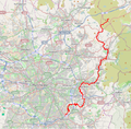
 River Mersey map.png 1,403 × 571; 1.18 MB
-
 River Tame map.png 669 × 660; 361 KB


