Category:OpenStreetMap maps of Oxfordshire
Jump to navigation
Jump to search
Media in category "OpenStreetMap maps of Oxfordshire"
The following 12 files are in this category, out of 12 total.
-
 Banbury map.png 883 × 1,070; 916 KB
-
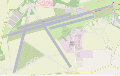 Enstone-airfield-Runways.svg 1,339 × 841; 2.46 MB
-
 Enstone-airfield-the-grand-tour-gravel-test-track-20171223.svg 790 × 273; 1.86 MB
-
 Iffley map small.png 655 × 889; 354 KB
-
 Location map United Kingdom Oxford Central.png 2,556 × 1,540; 2.8 MB
-
 Location map United Kingdom Oxford.svg 1,341 × 1,228; 16.15 MB
-
 Map-of-Oxfordshire-Way-2009-09-17.png 733 × 542; 390 KB
-
 Oxford Canal Map.png 982 × 3,544; 2.86 MB
-
 Oxford Green Belt.svg 1,600 × 1,589; 2.49 MB
-
 Oxford map small.svg 360 × 370; 204 KB
-
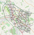 Oxford wards OSM.svg 657 × 676; 1.85 MB
-
 Weston Otmoor ecotown location map.png 1,024 × 768; 549 KB


