Category:OpenStreetMap maps of the canton of Lucerne
Jump to navigation
Jump to search
Media in category "OpenStreetMap maps of the canton of Lucerne"
The following 22 files are in this category, out of 22 total.
-
 A14 Buchrain, map OSM 2022.png 334 × 320; 54 KB
-
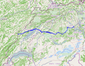 CH-Hauptstrasse10-OSM.png 460 × 360; 303 KB
-
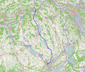
 CH-Hauptstrasse23-OSM.png 440 × 336; 289 KB
-
 CH-Hauptstrasse24-OSM.png 388 × 310; 236 KB
-
 CH-Hauptstrasse26-OSM.png 501 × 426; 379 KB
-
 A2 Dagmersellen, map OSM 2022.png 841 × 353; 111 KB
-
 A14 Emmen-Süd, map OSM 2022.png 286 × 368; 57 KB
-
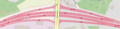 A2 Emmen-Nord, map OSM 2022.png 596 × 142; 51 KB
-
 A2 Emmen-Süd, map OSM 2022.png 345 × 445; 91 KB
-
 A14 Gisikon, map OSM 2022.png 306 × 279; 53 KB
-
 Karte Detail Luftseilbahn Weggis-Rigi Kaltbad.png 1,712 × 955; 1.71 MB
-
 Karte Luftseilbahn Weggis-Rigi Kaltbad.png 1,312 × 779; 1.57 MB
-
 A2 Horw, map OSM 2022.png 344 × 464; 90 KB
-
 A2 Luzern-Kriens , map OSM 2022.png 342 × 631; 165 KB
-
 A2 Luzern-Zentrum, map OSM 2022.png 766 × 732; 399 KB
-
 Luzern Railway Station Map.png 4,181 × 1,842; 4.91 MB
-
 A2 Reiden, map OSM 2022.png 330 × 983; 129 KB
-
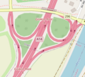
 A4 Rotkreuz, map OSM 2022.png 387 × 464; 93 KB
-
 A2 Rothenburg, map OSM 2022.png 477 × 470; 136 KB
-
 A2 Sempach, map OSM 2022.png 458 × 364; 84 KB
-
 A2 Sursee, map OSM 2022.png 824 × 432; 167 KB
-


_A14(E)_A2(S)_-_detail_map_by_OpenStreetMap_contributors,_2022.png)