Category:Oreton, Shropshire
Jump to navigation
Jump to search
village in United Kingdom  | |||||
| Upload media | |||||
| Instance of | |||||
|---|---|---|---|---|---|
| Location | Farlow, Shropshire, West Midlands, England | ||||
 | |||||
Media in category "Oreton, Shropshire"
The following 23 files are in this category, out of 23 total.
-
 At The End Of The Road - geograph.org.uk - 787935.jpg 640 × 426; 63 KB
-
 Bridleway - geograph.org.uk - 511607.jpg 640 × 480; 126 KB
-
 Footpath off 'The Jack Mytton Way' - geograph.org.uk - 1065380.jpg 640 × 480; 144 KB
-
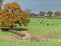
 Grazing by the River Rea, Shropshire - geograph.org.uk - 606089.jpg 640 × 470; 165 KB
-
 Grazing Land near Detton Hall, Shropshire - geograph.org.uk - 606104.jpg 640 × 430; 126 KB
-
 Hardwicke Bridge - geograph.org.uk - 611038.jpg 640 × 480; 91 KB
-
 Make like a heron - geograph.org.uk - 437177.jpg 640 × 469; 128 KB
-
 Methodist Chapel, Stottesdon, Shropshire - geograph.org.uk - 606152.jpg 640 × 476; 158 KB
-
 Methodist Chapel, Stottesdon, Shropshire - geograph.org.uk - 606155.jpg 640 × 497; 144 KB
-
 Old Post Box Stottesdon - geograph.org.uk - 675352.jpg 420 × 640; 82 KB
-

-
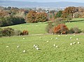 Sheep Grazing near Oreton, Shropshire - geograph.org.uk - 606092.jpg 640 × 475; 148 KB
-

-
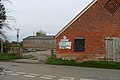
 The Fighting Cocks Stottesdon - geograph.org.uk - 675356.jpg 640 × 423; 70 KB
-
 The Fighting Cocks, Stottesdon - geograph.org.uk - 611050.jpg 640 × 480; 69 KB
-
 Crop Field by The Ford Farm, Shropshire - geograph.org.uk - 606796.jpg 640 × 480; 126 KB
-

-
 Grazing Land near Stottesdon, Shropshire - geograph.org.uk - 605749.jpg 640 × 442; 139 KB
-
 Grazing near Stottesdon, Shropshire - geograph.org.uk - 606251.jpg 640 × 480; 137 KB
-
 Grazing near Stottesdon, Shropshire - geograph.org.uk - 606256.jpg 640 × 480; 136 KB
-
 Prescott Country Road - geograph.org.uk - 675327.jpg 640 × 426; 46 KB
-

-
 Shropshire Farmland near Oreton - geograph.org.uk - 606107.jpg 640 × 441; 143 KB


