Category:Orwell, Cambridgeshire
Jump to navigation
Jump to search
village in Cambridgeshire, United Kingdom  | |||||
| Upload media | |||||
| Instance of | |||||
|---|---|---|---|---|---|
| Location | South Cambridgeshire, Cambridgeshire, East of England, England | ||||
| Population |
| ||||
 | |||||
 | |||||


Subcategories
This category has the following 3 subcategories, out of 3 total.
Media in category "Orwell, Cambridgeshire"
The following 164 files are in this category, out of 164 total.
-
 89 High Street, Orwell - geograph.org.uk - 4764090.jpg 640 × 428; 105 KB
-
 A bend in the road near Malton Farm - geograph.org.uk - 3873351.jpg 841 × 1,024; 1.36 MB
-
 A March morning in Orwell High Street - geograph.org.uk - 3874742.jpg 1,200 × 810; 1.05 MB
-
 A November morning on Mare Way - geograph.org.uk - 3729956.jpg 1,200 × 900; 1.22 MB
-
 A wet field corner by Malton Road - geograph.org.uk - 3873489.jpg 1,200 × 900; 1.4 MB
-
 A winding ditch on a bright March morning - geograph.org.uk - 3873425.jpg 1,200 × 900; 1.24 MB
-
 Accora offices, Orwell - geograph.org.uk - 2921130.jpg 3,872 × 2,592; 2.86 MB
-
 Along Hurdleditch Road - geograph.org.uk - 6555559.jpg 1,024 × 768; 946 KB
-
 Barley field - geograph.org.uk - 4566490.jpg 2,560 × 1,920; 1.02 MB
-
 Big fields and a dead-straight ditch - geograph.org.uk - 3873475.jpg 1,200 × 900; 1.34 MB
-
 Boundary Cottage, High Street, Orwell - geograph.org.uk - 541070.jpg 640 × 480; 93 KB
-
 Bridge over the Cam - geograph.org.uk - 4078176.jpg 1,600 × 1,200; 1,024 KB
-

-
 Cambridge Road, Orwell - geograph.org.uk - 897187.jpg 640 × 480; 82 KB
-
 Club house at New Malton GC - geograph.org.uk - 3286056.jpg 640 × 427; 63 KB
-
 Club House at New Malton Golf Club - geograph.org.uk - 3286037.jpg 640 × 427; 76 KB
-

-
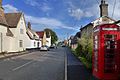 Cmglee Orwell High Street.jpg 3,072 × 2,048; 768 KB
-
 Cottages in High Street, Orwell - geograph.org.uk - 541072.jpg 640 × 480; 90 KB
-
 Cottages in Orwell - geograph.org.uk - 4296461.jpg 4,320 × 3,240; 4.11 MB
-
 Crop field - geograph.org.uk - 6488528.jpg 1,024 × 768; 209 KB
-
 Descending Toot Hill - geograph.org.uk - 4746025.jpg 480 × 640; 119 KB
-
 Dovecote at Malton Farm - geograph.org.uk - 3873369.jpg 1,024 × 1,024; 1.42 MB
-
 Down Hillside - geograph.org.uk - 6556270.jpg 1,024 × 819; 888 KB
-
 Entrance to Accora, Orwell - geograph.org.uk - 2921137.jpg 3,872 × 2,592; 2.89 MB
-
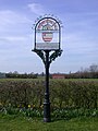 Fairhaven Trophy, Orwell, 2007 - geograph.org.uk - 390559.jpg 480 × 640; 96 KB
-
 Farm track and public footpath - geograph.org.uk - 4738771.jpg 640 × 480; 97 KB
-
 Field above Orwell - geograph.org.uk - 4763966.jpg 640 × 480; 113 KB
-
 Field by Hillside, Orwell - geograph.org.uk - 5571904.jpg 1,933 × 1,448; 853 KB
-
 Fields by Barrington Road - geograph.org.uk - 4566225.jpg 2,560 × 1,920; 1.08 MB
-
 Fields by Orwell - geograph.org.uk - 3271992.jpg 2,592 × 1,944; 2.4 MB
-
 Fishers Lane - Orwell - geograph.org.uk - 2465761.jpg 640 × 480; 62 KB
-
 Footbridge over River Rhee - geograph.org.uk - 5201957.jpg 1,067 × 1,600; 830 KB
-
 Footpath from Orwell - geograph.org.uk - 4566230.jpg 2,560 × 1,920; 1.49 MB
-
 Footpath from Orwell - geograph.org.uk - 4566487.jpg 2,560 × 1,920; 1.61 MB
-
 Footpath from Orwell - geograph.org.uk - 4566503.jpg 2,560 × 1,920; 1.53 MB
-
 Footpath to Malton Road - geograph.org.uk - 4566494.jpg 2,560 × 1,920; 1.75 MB
-
 Footpath to Orwell - geograph.org.uk - 4566517.jpg 2,560 × 1,920; 1.75 MB
-
 Footpath to Orwell - geograph.org.uk - 4566557.jpg 2,560 × 1,920; 1.46 MB
-
 Footpath to Toot Hill - geograph.org.uk - 437379.jpg 640 × 480; 62 KB
-
 Footpath to Whaddon - geograph.org.uk - 4566593.jpg 2,560 × 1,920; 1.93 MB
-
 Footpath towards Orwell - geograph.org.uk - 6013833.jpg 768 × 1,024; 302 KB
-
 Footpath towards Orwell - geograph.org.uk - 6013837.jpg 768 × 1,024; 213 KB
-
 Footpath towards Orwell - geograph.org.uk - 6013840.jpg 768 × 1,024; 202 KB
-
 Gate to Meadow Croft Way sub-station - geograph.org.uk - 2940483.jpg 2,592 × 3,872; 2.87 MB
-
 Grassland outside Orwell - geograph.org.uk - 6494343.jpg 1,024 × 768; 162 KB
-
 Great Eversden Church from Mare Way - geograph.org.uk - 3729431.jpg 1,200 × 900; 1.36 MB
-
 Greenwich Meridian stone, Orwell - geograph.org.uk - 4764148.jpg 640 × 480; 144 KB
-
 Hillside, Orwell - geograph.org.uk - 5571907.jpg 2,014 × 1,490; 767 KB
-
 Hurdleditch Road - geograph.org.uk - 2268069.jpg 640 × 468; 90 KB
-
 Lesser Burdock (Arctium minus) - geograph.org.uk - 897192.jpg 640 × 480; 139 KB
-
 Malton Farm - geograph.org.uk - 3872462.jpg 1,200 × 869; 1.32 MB
-
 Malton Farm, near Orwell - geograph.org.uk - 2828864.jpg 2,592 × 1,944; 2 MB
-
 Malton to Orwell - geograph.org.uk - 3873413.jpg 1,200 × 900; 1.37 MB
-
 Mare Way - geograph.org.uk - 3434813.jpg 800 × 533; 159 KB
-
 Mare Way - geograph.org.uk - 4746032.jpg 640 × 480; 61 KB
-
 Mare Way - geograph.org.uk - 4746034.jpg 640 × 480; 52 KB
-
 Mare Way - geograph.org.uk - 4746035.jpg 480 × 640; 81 KB
-
 Mare Way from Wimpole Road - geograph.org.uk - 3729389.jpg 1,200 × 871; 1.3 MB
-
 Mare Way near Wimpole Road - geograph.org.uk - 3729395.jpg 1,200 × 900; 1.45 MB
-
 Mare Way to Great Eversden - geograph.org.uk - 3729452.jpg 1,200 × 900; 1.37 MB
-
 Mare Way to Great Eversden Church - geograph.org.uk - 3729936.jpg 1,024 × 768; 907 KB
-
 Marker by the footpath - geograph.org.uk - 4566573.jpg 2,560 × 1,920; 1.45 MB
-
 Meadow Croft Way sub-station, Orwell - geograph.org.uk - 2921202.jpg 3,872 × 2,592; 2.98 MB
-
 Meadowcroft Way, Orwell - geograph.org.uk - 2940493.jpg 3,872 × 2,592; 2.78 MB
-
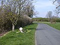 Meridian Marker, Orwell - geograph.org.uk - 390512.jpg 640 × 480; 140 KB
-
 Meridian Marker, Orwell - geograph.org.uk - 390515.jpg 640 × 480; 125 KB
-
 Millennium beacon on Toot Hill, Orwell - geograph.org.uk - 4763996.jpg 640 × 480; 108 KB
-
 Nearing the bridge at Malton Farm - geograph.org.uk - 3872450.jpg 1,200 × 900; 1.28 MB
-
 New Malton Golf Club - geograph.org.uk - 4078167.jpg 1,600 × 1,200; 654 KB
-
 New Malton Golf Club - geograph.org.uk - 4078173.jpg 1,600 × 1,200; 641 KB
-
 New Malton Golf Club near Meldreth - geograph.org.uk - 3286024.jpg 640 × 427; 97 KB
-
 New Malton Golf Club near Meldreth - geograph.org.uk - 3286045.jpg 640 × 427; 64 KB
-
 New Malton Golf Club near Meldreth - geograph.org.uk - 3286075.jpg 640 × 427; 50 KB
-
 New Malton Golf Club near Meldreth - geograph.org.uk - 3286097.jpg 640 × 427; 54 KB
-
 New Malton Golf Club near Meldreth - geograph.org.uk - 3286112.jpg 640 × 427; 53 KB
-
 New Malton Golf Club near Meldreth - geograph.org.uk - 3286124.jpg 640 × 427; 45 KB
-
 Old Milepost by the A603, north of Orwell (geograph 5622599).jpg 295 × 448; 130 KB
-
 On Malton Lane - geograph.org.uk - 6013838.jpg 768 × 1,024; 130 KB
-
 On Malton Lane - geograph.org.uk - 6013841.jpg 768 × 1,024; 117 KB
-
 On Mare Way in November - geograph.org.uk - 3729706.jpg 1,200 × 900; 1.26 MB
-
 On Orwell High Street - geograph.org.uk - 3874161.jpg 1,200 × 841; 1.49 MB
-
 Dovecote, Malton Farm - geograph.org.uk - 390478.jpg 640 × 480; 158 KB
-
 Orwell beacon - geograph.org.uk - 4746023.jpg 480 × 640; 66 KB
-
 Orwell church - geograph.org.uk - 4763951.jpg 640 × 428; 96 KB
-
 Orwell Clunch Pit - geograph.org.uk - 4738784.jpg 640 × 480; 100 KB
-
 Orwell Clunch pit - geograph.org.uk - 4746018.jpg 480 × 640; 85 KB
-
 Orwell Clunch Pit - geograph.org.uk - 4746020.jpg 640 × 480; 99 KB
-
 Orwell footpath - geograph.org.uk - 5550570.jpg 480 × 640; 47 KB
-
 Orwell High Street - geograph.org.uk - 3874146.jpg 977 × 1,024; 1.28 MB
-
 Orwell High Street - geograph.org.uk - 6555197.jpg 1,024 × 682; 783 KB
-
 Orwell High Street, thatcher at work - geograph.org.uk - 3874771.jpg 1,200 × 718; 1 MB
-
 Orwell Methodist Church - geograph.org.uk - 6555434.jpg 1,024 × 682; 867 KB
-
 Orwell Pavilion and Recreation Ground - geograph.org.uk - 3874229.jpg 1,200 × 760; 1.09 MB
-
 Orwell Road, Orwell - geograph.org.uk - 5550569.jpg 640 × 480; 64 KB
-
 Orwell sewage pumping station - geograph.org.uk - 2921152.jpg 2,592 × 3,872; 3.51 MB
-
 Orwell village sign - geograph.org.uk - 3432252.jpg 800 × 600; 130 KB
-
 Orwell village sign - geograph.org.uk - 4296491.jpg 4,320 × 3,240; 4.22 MB
-
 Orwell, Barrington Road - geograph.org.uk - 3874142.jpg 1,024 × 1,024; 1.34 MB
-
 Orwell, brick, plaster, thatch and weatherboard - geograph.org.uk - 3874732.jpg 775 × 1,024; 934 KB
-
 Orwell, Brookside - geograph.org.uk - 6555457.jpg 1,024 × 768; 1.01 MB
-
 Orwell, Cambridgeshire - geograph.org.uk - 5633839.jpg 4,320 × 3,240; 4.8 MB
-
 Orwell, Croft End - geograph.org.uk - 6555494.jpg 1,024 × 682; 764 KB
-
 Orwell, Fisher's Lane - geograph.org.uk - 3875199.jpg 1,200 × 960; 1.38 MB
-
 Orwell, footpath to Wimpole or Whaddon - geograph.org.uk - 6555475.jpg 1,024 × 768; 928 KB
-
 Orwell, from St Andrew's porch - geograph.org.uk - 3874612.jpg 768 × 1,024; 1.12 MB
-
 Orwell, Greenwich Meridian marker - geograph.org.uk - 3874137.jpg 1,200 × 896; 1.51 MB
-
 Orwell, High Street houses - geograph.org.uk - 6555207.jpg 1,024 × 768; 918 KB
-
 Orwell, Hurdleditch Road - geograph.org.uk - 3874237.jpg 1,200 × 965; 1.52 MB
-
 Orwell, in Chapel Orchard - geograph.org.uk - 3874531.jpg 1,024 × 1,024; 1.66 MB
-
 Orwell, Leaden Hill - geograph.org.uk - 3874502.jpg 640 × 640; 445 KB
-
 Orwell, Lotfield Street - geograph.org.uk - 3874205.jpg 1,200 × 865; 1.08 MB
-
 Orwell, nearing the Clunch Pit - geograph.org.uk - 3875185.jpg 768 × 1,024; 1.19 MB
-
 Orwell, new building on Leaden Hill - geograph.org.uk - 6555465.jpg 1,024 × 1,024; 1.47 MB
-
 Orwell, on Fisher's Lane - geograph.org.uk - 3875202.jpg 1,200 × 963; 1.5 MB
-
 Orwell, signpost and roses round the door - geograph.org.uk - 6555180.jpg 819 × 1,024; 1.2 MB
-
 Orwell, St Andrew - from the east - geograph.org.uk - 6555392.jpg 1,024 × 1,024; 1.25 MB
-
 Orwell, St Andrew - south side - geograph.org.uk - 6555222.jpg 1,024 × 768; 1.08 MB
-
 Orwell, thatch and timber frame - geograph.org.uk - 6555185.jpg 1,024 × 768; 907 KB
-
 Orwell, The Chequers - geograph.org.uk - 3874521.jpg 1,200 × 883; 1.19 MB
-
 Orwell, the corner of Town Green Road - geograph.org.uk - 5672184.jpg 819 × 1,024; 1,020 KB
-
 Orwell, the entrance to Chapel Orchard - geograph.org.uk - 3874537.jpg 771 × 1,024; 1.3 MB
-
 Orwell, the start of a footpath - geograph.org.uk - 6555574.jpg 1,024 × 683; 764 KB
-
 Orwell, timber-framed house in Lotfield Street - geograph.org.uk - 3874213.jpg 1,200 × 898; 1.2 MB
-
 Orwell, up Toot Hill - geograph.org.uk - 3875189.jpg 1,200 × 900; 1.47 MB
-
 Orwell, up Town Green Road - geograph.org.uk - 6555429.jpg 1,024 × 732; 1.03 MB
-
 Orwell, view from Toot Hill - geograph.org.uk - 3875182.jpg 1,200 × 893; 1.2 MB
-
 Orwell, viewpoint at Toot Hill - geograph.org.uk - 3875180.jpg 1,200 × 867; 1.12 MB
-
 Path around field - geograph.org.uk - 6488523.jpg 1,024 × 768; 226 KB
-
 Path to Orwell - geograph.org.uk - 4746015.jpg 640 × 480; 57 KB
-
 Path to Orwell - geograph.org.uk - 6494340.jpg 1,024 × 768; 189 KB
-
 Path to Toot Hill, Orwell - geograph.org.uk - 4746017.jpg 480 × 640; 101 KB
-
 Path towards Halfway House - geograph.org.uk - 4746028.jpg 480 × 640; 89 KB
-
 Path towards Halfway House - geograph.org.uk - 4746030.jpg 480 × 640; 96 KB
-
 Path up Toot Hill, Orwell - geograph.org.uk - 4763954.jpg 640 × 480; 99 KB
-
 Pathway towards Mare Way - geograph.org.uk - 4746031.jpg 480 × 640; 53 KB
-
 Ploughed field in December near Malton Farm - geograph.org.uk - 5633816.jpg 4,320 × 3,240; 4.34 MB
-
 Public footpath to Malton - geograph.org.uk - 896181.jpg 640 × 480; 70 KB
-
 Rectory Farm Lane - geograph.org.uk - 3875476.jpg 1,200 × 961; 1.49 MB
-
 River Cam from King's Bridge - geograph.org.uk - 6013832.jpg 768 × 1,024; 286 KB
-
 South on Malton Road - geograph.org.uk - 3874122.jpg 1,200 × 810; 547 KB
-
 St Andrew's Church - geograph.org.uk - 6485841.jpg 1,024 × 768; 188 KB
-
 Thatched Cottage - geograph.org.uk - 5201973.jpg 1,600 × 1,067; 402 KB
-
 The A603 descends Orwell Hill - geograph.org.uk - 3271986.jpg 2,592 × 1,944; 1.19 MB
-
 The access to Trinity Farm - geograph.org.uk - 3272000.jpg 2,592 × 1,944; 1.71 MB
-
 The Cam near Malton Farm - geograph.org.uk - 3872473.jpg 1,200 × 908; 1.49 MB
-
 The Chequers - geograph.org.uk - 1404019.jpg 640 × 480; 210 KB
-
 The Chequers - Orwell - geograph.org.uk - 2465758.jpg 800 × 600; 104 KB
-
 The north side of Malton Farm - geograph.org.uk - 3873360.jpg 1,024 × 1,024; 1.4 MB
-

-

-
 The postman in Orwell - geograph.org.uk - 3874233.jpg 1,200 × 632; 874 KB
-
 The Retreat and the road to Orwell - geograph.org.uk - 3873875.jpg 1,200 × 900; 1.42 MB
-
 The River Cam at Malton Farm - geograph.org.uk - 2828849.jpg 2,592 × 1,944; 2.22 MB
-
 Towards Orwell - geograph.org.uk - 3873503.jpg 1,200 × 900; 1.36 MB
-
 Town Green Road - geograph.org.uk - 2268077.jpg 640 × 436; 62 KB
-

-
 View of Orwell and beyond from Toot Hill - geograph.org.uk - 437413.jpg 640 × 480; 115 KB
-
 Welcome to Orwell - geograph.org.uk - 2921159.jpg 2,592 × 3,872; 3.02 MB
-
 Wheat field - geograph.org.uk - 4566579.jpg 2,560 × 1,920; 2.12 MB
-
 Wheat field and wires - geograph.org.uk - 4566588.jpg 2,560 × 1,920; 1.89 MB
-
 Willows and waterlogged field near Malton Farm - geograph.org.uk - 3872389.jpg 1,200 × 900; 1.59 MB
-
 Wooden bridge on footpath to Orwell - geograph.org.uk - 896171.jpg 640 × 480; 163 KB
-
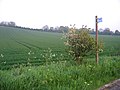 Slopes of Toot Hill, Orwell, Cambs - geograph.org.uk - 171203.jpg 640 × 480; 291 KB


_-_geograph.org.uk_-_897192.jpg)


.jpg)


