Category:Osmaston, Derbyshire Dales
Jump to navigation
Jump to search
Cymraeg: Pentref a chymuned yn Lloegr ydy Osmaston, Dales Swydd Derby; saif yn Nwyrain Canolbarth Lloegr. (→Osmaston, Dales Swydd Derby)
English: Osmaston is a small village in the Derbyshire Dales in the county of Derbyshire in England. (→Osmaston, Derbyshire Dales)
Nederlands: Osmaston is een plaats en civil parish in het bestuurlijke gebied Derbyshire Dales, in het Engelse graafschap Derbyshire. (→Osmaston)
Polski: Osmaston – wieś w Anglii, w hrabstwie Derbyshire, w dystrykcie Derbyshire Dales. Leży 17 km na północny zachód od miasta Derby i 197 km na północny zachód od Londynu. (→Osmaston (Derbyshire Dales))

village and civil parish in Derbyshire Dales district, Derbyshire, England  | |||||
| Upload media | |||||
| Instance of | |||||
|---|---|---|---|---|---|
| Location | Derbyshire Dales, Derbyshire, East Midlands, England | ||||
 | |||||
Subcategories
This category has the following 4 subcategories, out of 4 total.
O
- Osmaston Manor (2 F)
- Osmaston Saw Mill (13 F)
S
- Shoulder of Mutton, Osmaston (8 F)
Media in category "Osmaston, Derbyshire Dales"
The following 95 files are in this category, out of 95 total.
-
 A farm house - geograph.org.uk - 6157392.jpg 2,000 × 1,330; 2.57 MB
-
 A house in the country - geograph.org.uk - 5999594.jpg 2,000 × 1,333; 2.61 MB
-
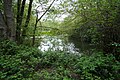
 A lake view - geograph.org.uk - 6157363.jpg 2,000 × 1,330; 2.03 MB
-
 A Line Made By Walking - Bonnie Prince Charlie Walk - geograph.org.uk - 6248042.jpg 5,472 × 3,648; 4.52 MB
-
 A shaded part of the Bridle Way - geograph.org.uk - 6157395.jpg 2,000 × 1,330; 2.81 MB
-
 A shaded pond - geograph.org.uk - 6157378.jpg 2,000 × 1,330; 3.28 MB
-
 An unusual bench - geograph.org.uk - 3611811.jpg 800 × 533; 167 KB
-
 Bonnie Prince Charlie Walk - geograph.org.uk - 3624942.jpg 4,000 × 2,248; 4.08 MB
-
 Church Lane, Osmaston - geograph.org.uk - 3624966.jpg 3,954 × 2,164; 4.93 MB
-
 Close to the Restored Saw mill - geograph.org.uk - 6157362.jpg 2,000 × 1,330; 2.05 MB
-
 Closer to the water wheel - geograph.org.uk - 6157367.jpg 2,000 × 1,330; 3.48 MB
-
 Cottage in Osmaston - geograph.org.uk - 3611804.jpg 800 × 533; 123 KB
-
 Country fields - geograph.org.uk - 5999596.jpg 2,000 × 1,333; 2.17 MB
-
 Derbyshire UK parish map highlighting Osmaston.svg 888 × 1,308; 2.34 MB
-
 Drive to Blake House - geograph.org.uk - 1348161.jpg 640 × 426; 43 KB
-
 Duck pond and village green - geograph.org.uk - 3611813.jpg 800 × 533; 160 KB
-
 Eastside Cottages, Osmaston.jpg 5,456 × 3,632; 2.27 MB
-
 Entrance to Peak Gateway - geograph.org.uk - 358514.jpg 640 × 480; 122 KB
-
 Farmland near Osmaston - geograph.org.uk - 3686227.jpg 4,000 × 3,000; 3.09 MB
-
 Field of Barley - geograph.org.uk - 468178.jpg 640 × 349; 92 KB
-
 Gate and bridge to field on Bonnie Prince Charlie Walk - geograph.org.uk - 3610008.jpg 4,000 × 2,248; 6.25 MB
-
 Glebe House - geograph.org.uk - 3611793.jpg 800 × 533; 103 KB
-
 Horseshoe Bench - geograph.org.uk - 5924012.jpg 1,024 × 768; 349 KB
-
 Lake between Osmaston Park and Shirley Park - geograph.org.uk - 3626658.jpg 3,954 × 2,164; 5.6 MB
-
 Looking at the wood on Copse Hill - geograph.org.uk - 6157388.jpg 2,000 × 1,330; 2.24 MB
-
 Looking towards Bonnie Prince Charlie Walk - geograph.org.uk - 5999586.jpg 2,000 × 1,333; 2.19 MB
-
 Main street, Osmaston - geograph.org.uk - 1348171.jpg 640 × 426; 58 KB
-
 Newly Thatched Cottage - geograph.org.uk - 1020369.jpg 480 × 640; 81 KB
-
 North Lodge, Osmaston Park.jpg 640 × 457; 116 KB
-
 On Quilow Lane - geograph.org.uk - 2588897.jpg 3,648 × 2,736; 5.52 MB
-
 Osmaston Barn - geograph.org.uk - 1701300.jpg 3,264 × 2,448; 3.84 MB
-
 Osmaston C of E Primary School - geograph.org.uk - 3624961.jpg 3,993 × 1,909; 4.47 MB
-
 Osmaston Fields Farm - geograph.org.uk - 2590166.jpg 3,648 × 2,736; 5.88 MB
-
 Osmaston Hall Swimming Pool - geograph.org.uk - 1857165.jpg 3,264 × 2,448; 4.09 MB
-
 Osmaston Hall Terraced Garden - geograph.org.uk - 1993749.jpg 3,264 × 2,448; 3.3 MB
-
 Osmaston Hall Terraced Garden - geograph.org.uk - 1993755.jpg 3,264 × 2,448; 2.98 MB
-
 Osmaston Park - geograph.org.uk - 4101842.jpg 2,784 × 1,568; 2.07 MB
-
 Osmaston Park lake - geograph.org.uk - 6165082.jpg 1,024 × 768; 790 KB
-
 Osmaston Park, down hill to the Sawmill - geograph.org.uk - 6165105.jpg 1,024 × 768; 1.08 MB
-
 Osmaston Park, up hill to Home Farm - geograph.org.uk - 6165091.jpg 1,024 × 768; 1.01 MB
-
 Osmaston Polo Ground - geograph.org.uk - 6157402.jpg 2,000 × 1,330; 1.89 MB
-
 Osmaston Pond - geograph.org.uk - 3626554.jpg 4,000 × 2,248; 5 MB
-
 Osmaston Post Office - geograph.org.uk - 1223966.jpg 639 × 479; 59 KB
-
 Osmaston Primary School - geograph.org.uk - 1223207.jpg 640 × 480; 100 KB
-
 Osmaston Sawmill waterwheel - geograph.org.uk - 6164714.jpg 768 × 1,024; 1.42 MB
-
 Osmaston Sports Pavilion - geograph.org.uk - 1818235.jpg 640 × 427; 303 KB
-
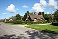
 Osmaston village - geograph.org.uk - 77580.jpg 640 × 480; 28 KB
-
 Osmaston village 724443 3b9f375c.jpg 640 × 426; 84 KB
-
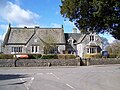
 Osmaston Village Hall - geograph.org.uk - 1223969.jpg 639 × 479; 52 KB
-
 Osmaston Village Hall - geograph.org.uk - 1258495.jpg 640 × 480; 98 KB
-
 Osmaston Village Hall - geograph.org.uk - 3611802.jpg 800 × 436; 73 KB
-
 Osmaston village pond - geograph.org.uk - 1223959.jpg 639 × 479; 56 KB
-
 Osmaston village pond - geograph.org.uk - 1348184.jpg 3,456 × 2,304; 3.6 MB
-
 Osmaston village pond - geograph.org.uk - 360538.jpg 640 × 428; 115 KB
-
 Osmaston Village pond - geograph.org.uk - 5999587.jpg 2,000 × 1,333; 2.39 MB
-
 Osmaston, along Moor Lane - geograph.org.uk - 6165280.jpg 1,024 × 732; 856 KB
-
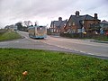
 Osmaston, at the south end of the village - geograph.org.uk - 6165245.jpg 1,024 × 768; 907 KB
-
 Osmaston, Hazelwell Farm - geograph.org.uk - 6163927.jpg 1,024 × 768; 817 KB
-
 Osmaston, on Moor Lane - geograph.org.uk - 6163916.jpg 1,024 × 1,024; 1.09 MB
-
 Osmaston, thatched roofs and tall chimneys - geograph.org.uk - 6163960.jpg 1,024 × 768; 981 KB
-
 Osmaston, The Shoulder of Mutton - geograph.org.uk - 6165274.jpg 1,024 × 819; 968 KB
-
 Osmaston, the south end of Moor Lane - geograph.org.uk - 6165258.jpg 1,024 × 683; 778 KB
-
 Osmaston, towards St Martin's Church - geograph.org.uk - 6163910.jpg 1,024 × 1,024; 1.47 MB
-
 Park View Cottage, Osmaston.jpg 1,024 × 768; 1,005 KB
-
 Path over the hills - geograph.org.uk - 113091.jpg 640 × 480; 71 KB
-
 Pond at Osmaston - geograph.org.uk - 3626546.jpg 3,878 × 2,000; 4.42 MB
-
 Pond in Osmaston, low water - geograph.org.uk - 2588887.jpg 3,648 × 2,736; 5.43 MB
-
 Quilow Farm - geograph.org.uk - 5999589.jpg 2,000 × 1,333; 2.07 MB
-
 Quilow Lane in Osmaston - geograph.org.uk - 3686216.jpg 3,856 × 2,798; 1.75 MB
-
 Rural Scene near Osmaston - geograph.org.uk - 3686207.jpg 4,000 × 3,000; 1.46 MB
-
 Saw Mill in Osmaston Park - geograph.org.uk - 6103073.jpg 2,140 × 3,200; 975 KB
-
 Small pond, Moor Lane, Osmaston - geograph.org.uk - 2588869.jpg 3,648 × 2,736; 6 MB
-
 Telephone Kiosk, Osmaston.jpg 5,456 × 3,632; 3.55 MB
-
 Thatched cottage in Osmaston - geograph.org.uk - 1241038.jpg 639 × 479; 71 KB
-
 Thatched cottage in Osmaston - geograph.org.uk - 3626638.jpg 4,000 × 1,946; 4.01 MB
-
 Thatched cottages, Osmaston - geograph.org.uk - 1348194.jpg 3,456 × 2,304; 3.36 MB
-
 The path to the village - geograph.org.uk - 6157404.jpg 2,000 × 1,330; 2.88 MB
-
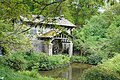
 The restored Saw Mill - geograph.org.uk - 6157365.jpg 2,000 × 1,330; 3.56 MB
-
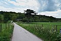
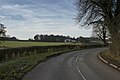 The road to Osmaston - geograph.org.uk - 5999581.jpg 2,000 × 1,333; 2.23 MB
-
 The sun shines on the path - geograph.org.uk - 6157399.jpg 2,000 × 1,330; 3.27 MB
-
 The village pond at Osmaston - geograph.org.uk - 467167.jpg 640 × 480; 85 KB
-
 Tinker's Inn, Dobbin Horse Lane - geograph.org.uk - 2590149.jpg 3,648 × 2,736; 4.7 MB
-

-
 Trees and grassland - geograph.org.uk - 3611787.jpg 800 × 533; 105 KB
-
 Tumulus - Wyaston (geograph 1701807).jpg 1,280 × 960; 397 KB
-
 Village Amenities in Osmaston - geograph.org.uk - 3686213.jpg 3,796 × 2,704; 1.76 MB
-
 Village Scene in Osmaston - geograph.org.uk - 3686211.jpg 3,876 × 2,828; 1.77 MB
-
 Walking along Bonnie Prince Charlie Walk - geograph.org.uk - 6157358.jpg 2,000 × 1,330; 1.67 MB
-
 Whitemeadow Farm - geograph.org.uk - 2588862.jpg 3,648 × 2,736; 4.68 MB
-
 Yeldersley Cross Roads. - geograph.org.uk - 291251.jpg 640 × 480; 114 KB
-
 Circular Pinfold - geograph.org.uk - 341182.jpg 640 × 480; 102 KB
-
 Hazelwell Farm - geograph.org.uk - 467052.jpg 640 × 480; 94 KB
-
 Horseshoe bench at Osmaston - geograph.org.uk - 467183.jpg 640 × 480; 104 KB
-
 Osmaston Village - geograph.org.uk - 467077.jpg 640 × 480; 103 KB
-
 Thatched Garage - geograph.org.uk - 291255.jpg 640 × 480; 116 KB


.jpg)


