Category:Osmington Mills
Jump to navigation
Jump to search
English: Osmington Mills is a coastal village situated between Ringstead Bay (to the east) and the town of Weymouth (to the west) in Dorset, England. It is located within the civil parish of Osmington.
village in United Kingdom  | |||||
| Upload media | |||||
| Instance of | |||||
|---|---|---|---|---|---|
| Location | Osmington, Dorset, South West England, England | ||||
 | |||||
Subcategories
This category has only the following subcategory.
S
- Smugglers Inn, Osmington Mills (16 F)
Media in category "Osmington Mills"
The following 72 files are in this category, out of 72 total.
-
 A Field Above Osmington Mills - geograph.org.uk - 2474298.jpg 1,024 × 768; 162 KB
-

-

-
 Beach at Osmington Mills - geograph.org.uk - 6268511.jpg 800 × 534; 108 KB
-
 Beach near Osmington - geograph.org.uk - 533210.jpg 640 × 426; 94 KB
-
 Beach to the east of Osmington Mills - geograph.org.uk - 1322277.jpg 427 × 640; 104 KB
-
 Between Osmington and Black Head - geograph.org.uk - 533209.jpg 426 × 640; 149 KB
-
 Bridge on the footpath from Ringstead to Osmington Mills - DSC08983.jpg 3,672 × 4,896; 7.41 MB
-
 Camping near Redcliff Point - geograph.org.uk - 906681.jpg 640 × 426; 62 KB
-
 Cliff edge - Osmington Mills - geograph.org.uk - 4644455.jpg 1,024 × 768; 228 KB
-
 Cliffs near osmington mills - panoramio.jpg 2,048 × 1,536; 864 KB
-
 Coast at Osmington Mills - geograph.org.uk - 2306784.jpg 640 × 444; 93 KB
-
 Coast at Osmington Mills - geograph.org.uk - 905011.jpg 640 × 388; 42 KB
-

-
 Coastal path at Osmington Mills - geograph.org.uk - 3075608.jpg 4,752 × 3,168; 4.17 MB
-
 Coastal slopes, Osmington Mills - geograph.org.uk - 2553452.jpg 640 × 480; 64 KB
-
 Coastline at Osmington Mills - geograph.org.uk - 480519.jpg 640 × 618; 107 KB
-
 Coastline cruising near Osmington Mills - geograph.org.uk - 4644461.jpg 1,024 × 768; 233 KB
-
 Countryside near Osmington Mills - geograph.org.uk - 1094559.jpg 640 × 428; 105 KB
-
 Countryside near Osmington Mills - geograph.org.uk - 1094560.jpg 640 × 428; 87 KB
-
 Dairy herd above Ringstead - geograph.org.uk - 266918.jpg 640 × 480; 78 KB
-
 Disused slipway, Osmington Mills - geograph.org.uk - 1322362.jpg 427 × 640; 101 KB
-
 Dorset Coastline, Osmington Mills - geograph.org.uk - 2285069.jpg 640 × 480; 64 KB
-
 Hannah's Ledge - geograph.org.uk - 4438905.jpg 640 × 430; 62 KB
-
 O delta.jpg 886 × 741; 582 KB
-
 On The Up - Flickr - ARG Flickr.jpg 5,472 × 3,080; 8.87 MB
-
 Osmington Mills - beach at low tide - geograph.org.uk - 84303.jpg 640 × 480; 101 KB
-
 Osmington Mills - geograph.org.uk - 1990400.jpg 640 × 480; 75 KB
-
 Osmington Mills from the coast path - geograph.org.uk - 3562661.jpg 3,072 × 2,304; 2.17 MB
-
 Osmington Mills observation post - geograph.org.uk - 2446483.jpg 1,024 × 768; 104 KB
-

-

-
 Osmington Mills, beach and cliffs - geograph.org.uk - 519559.jpg 640 × 429; 87 KB
-

-

-

-
 Osmington Mills, looking west - geograph.org.uk - 1415550.jpg 640 × 480; 61 KB
-

-

-

-

-

-

-

-

-
 Osmington Mills, view over village - geograph.org.uk - 1415566.jpg 640 × 480; 68 KB
-
 Osmington Mills- View towards Black Head (geograph 2024361).jpg 899 × 602; 204 KB
-
 Osmington view towards Black Head - geograph.org.uk - 905013.jpg 640 × 437; 47 KB
-

-
 Ringstead Beach - geograph.org.uk - 226282.jpg 640 × 427; 94 KB
-
 Seaview from Osmington Mills - geograph.org.uk - 2285034.jpg 640 × 480; 49 KB
-
 Stone sign for Osmington Mills on the South West Coast Path - DSC08989.jpg 4,896 × 3,672; 6.89 MB
-
 Strange thing near Osmington Mills - panoramio.jpg 2,048 × 1,536; 869 KB
-
 Sunset from Osmington Mills - geograph.org.uk - 2285048.jpg 640 × 480; 43 KB
-
 Tankers off shore, Osmington Mills - geograph.org.uk - 2413053.jpg 640 × 480; 50 KB
-
 Tankers offshore, Osmington Mills - geograph.org.uk - 2413066.jpg 640 × 480; 68 KB
-
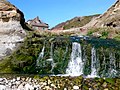
 The Cascade, Osmington Mills - geograph.org.uk - 1322354.jpg 640 × 427; 113 KB
-

-
-

-

-
 View south from Osmington Mills - geograph.org.uk - 905015.jpg 640 × 426; 75 KB
-
 Waterfall, Osmington Mills Beach - geograph.org.uk - 2306790.jpg 640 × 480; 122 KB
-
 Welcome to Osmington Mills^ - geograph.org.uk - 3075620.jpg 4,752 × 3,168; 3.52 MB
-
 Beach at Perry Ledge, west of Ringstead - geograph.org.uk - 203794.jpg 480 × 640; 487 KB
-
 Cliff face west of Bran Point - geograph.org.uk - 23884.jpg 640 × 480; 174 KB
-
 Coastguard helicopter off Bran Point - geograph.org.uk - 203787.jpg 640 × 480; 56 KB
-
 Cows near South Down Farm, Ringstead - geograph.org.uk - 266958.jpg 640 × 480; 106 KB
-
 Lane to South Down car park - geograph.org.uk - 267038.jpg 640 × 480; 69 KB
-

-
 South Down Farm, Ringstead - geograph.org.uk - 94364.jpg 640 × 480; 201 KB
-
 Stile on South Down, Ringstead - geograph.org.uk - 266965.jpg 480 × 640; 112 KB


.jpg)


