Category:Ostring (Kiel)
Jump to navigation
Jump to search
street in Kiel, Germany  | |||||
| Upload media | |||||
| Instance of | |||||
|---|---|---|---|---|---|
| Part of | |||||
| Location | |||||
| Length |
| ||||
 | |||||
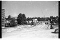
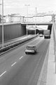
Deutsch: Der Ostring ist eine Straße in Kiel am Ostufer (Gaarden-Süd und -Ost, Ellerbek, Wellingsdorf, Neumühlen-Dietrichdorf) und trug vor 1947 noch die Bezeichnungen Germaniaring, Planckstraße, Brommystraße und Gebhardstraße. Der Ostring bildet zusammen mit dem Westring und dem Theodor-Heuss-Ring das sogenannte „Kieler Hufeisen”, das hufeisenförmig um die Kieler Förde herumläuft.
English: The Ostring is a street in Kiel on the eastern bank (district of Kiel Gaarden-Süd and -Ost, Ellerbek, Wellingsdorf, Neumühlen-Dietrichdorf) and before 1947 it was called Germaniaring, Planckstrasse, Brommystrasse and Gebhardstrasse. The Ostring, together with the Westring and the Theodor-Heuss-Ring, forms the so-called „Kiel Horseshoe”, which runs in a horseshoe shape around the Kiel Fjord.
Subcategories
This category has the following 11 subcategories, out of 11 total.
B
- Brommystraße (Kiel) (2 F)
- Brücke Schwanenseepark (3 F)
E
- Erdgasspeicher (Kiel) (9 F)
G
- Gebhardstraße (Kiel) (3 F)
H
- Dr. Carl Hahn KG (Kiel) (19 F)
J
M
S
T
V
Media in category "Ostring (Kiel)"
The following 76 files are in this category, out of 76 total.
-

-
 Bau der Abfahrt Wischhofstraße vom Ostring in Wellingdorf (Kiel 55.078).jpg 1,004 × 673; 131 KB
-
 Bau der Bundesstraße B 76 in Gaarden (Kiel 50.576).jpg 1,024 × 686; 145 KB
-
 Bau der Kreisstraße K 31 nach Laboe (Kiel 44.443).jpg 1,024 × 683; 96 KB
-
 Bau der Kreisstraße K 31 nach Laboe (Kiel 44.444).jpg 1,024 × 677; 115 KB
-
 Bau der Kreisstraße K 31 Richtung Wellingdorf und Laboe (Kiel 46.293).jpg 1,024 × 683; 86 KB
-

-

-
 Blick auf Neumühlen-Dietrichsdorf.jpg 3,648 × 2,736; 2.12 MB
-

-
 Bundesstraße B 502 (Ostring) in Wellingdorf (Kiel 55.668).jpg 1,024 × 667; 106 KB
-
 Bushaltestelle Tiefe Allee Sonnenuntergang 01.jpg 4,128 × 3,096; 3.08 MB
-
 Bushaltestelle Tiefe Allee Sonnenuntergang 02.jpg 4,128 × 3,096; 3.07 MB
-
 Bushaltestelle Tiefe Allee Sonnenuntergang 03.jpg 4,128 × 3,096; 2.72 MB
-
 Bushaltestelle Tiefe Allee Sonnenuntergang 04.jpg 4,128 × 3,096; 4.26 MB
-
 Bushaltestelle Tiefe Allee Sonnenuntergang 05.jpg 4,128 × 3,096; 6.02 MB
-
 Bushaltestelle Tiefe Allee Sonnenuntergang 06.jpg 4,128 × 3,096; 2.72 MB
-
 Bushaltestelle Tiefe Allee Sonnenuntergang 07.jpg 4,128 × 3,096; 3.03 MB
-
 Eiserne Hochzeit bei Margarethe und Hermann Bamberg (Kiel 56.566).jpg 1,024 × 1,522; 153 KB
-
 Ellerbek (Kiel 55.501).jpg 1,003 × 669; 149 KB
-
 Ellerbek (Kiel 55.550).jpg 1,006 × 670; 166 KB
-
 Ernestinenstraße vom Ostring aus gesehen, Kiel-Gaarden-Ost.jpg 2,992 × 2,992; 3.33 MB
-
 Fußgängertunnel Stoschstraße unter dem Ostring im Bau (Kiel 67.246).jpg 1,024 × 682; 166 KB
-
 Fußgängertunnel Stoschstraße unter dem Ostring im Bau (Kiel 67.504).jpg 1,024 × 1,526; 337 KB
-
 Gaarden und Volkspark (Werftpark) (Kiel 48.394).jpg 1,024 × 681; 85 KB
-
 Geflügelschau vom Ellerbeker Rassegeflügelzuchtverein (Kiel 37.199).jpg 1,024 × 1,502; 204 KB
-
 Kleingartengelände Dockhöhe am Ostring in Gaarden (Kiel 68.057).jpg 1,024 × 676; 178 KB
-
 Kreisstraße K 31 in Neumühlen-Dietrichsdorf (Kiel 47.869).jpg 1,024 × 673; 138 KB
-
 Kreisstraße K 31 in Neumühlen-Dietrichsdorf (Kiel 47.871).jpg 1,024 × 673; 82 KB
-

-

-
 Kruppsche Arbeiterkolonie am Ostring mit dem "Schiefen Turm" (Kiel 50.832).jpg 1,024 × 1,500; 178 KB
-
 Luftaufnahme Gaarden (Kiel 35.670).jpg 1,024 × 674; 134 KB
-
 Luftaufnahme Schwentinebrücken (Kiel 41.703).jpg 1,024 × 676; 178 KB
-
 Luftaufnahme Schwentinebrücken (Kiel 41.708).jpg 1,024 × 682; 165 KB
-
 Luftaufnahme Schwentinebrücken (Kiel 41.711).jpg 1,024 × 1,544; 306 KB
-
 Luftaufnahme Schwentinebrücken (Kiel 41.712).jpg 1,024 × 1,544; 352 KB
-
 Luftaufnahme Wellingdorf (Kiel 41.707).jpg 1,024 × 682; 182 KB
-
 Luftaufnahme Wohnsiedlung am August-Sievers-Ring in Ellerbek (Kiel 48.531).jpg 1,024 × 678; 125 KB
-
 Lärmschutzwände in Neumühlen-Dietrichsdorf.jpg 3,648 × 2,736; 2.08 MB
-

-

-

-

-
 Neue Schwentinebrücke (Kiel 42.854).jpg 1,024 × 686; 151 KB
-

-
 Ostring (Kiel 43.386).jpg 1,024 × 689; 81 KB
-
 Ostring 100-106 Kiel.jpg 2,576 × 1,932; 2.16 MB
-
 Ostring 108-112 Kiel.jpg 2,576 × 1,932; 1.85 MB
-
 Ostring 61 Kiel.jpg 2,576 × 1,932; 1.26 MB
-
 Ostring 63-75 Kiel.jpg 2,576 × 1,932; 1.73 MB
-
 Ostring 79-83 Kiel.jpg 2,576 × 1,932; 1.85 MB
-
 Ostring 85 Kiel.jpg 2,576 × 1,932; 2.08 MB
-
 Ostring Ecke Helmholtzstraße, Kiel-Gaarden-Ost.jpg 3,000 × 3,000; 4.76 MB
-
 Ostring mit den Schwentinebrücken (Kiel 57.159).jpg 1,024 × 686; 119 KB
-
 Ruine in der Großen Ziegelstraße, Ecke Ostring (Kiel 51.488).jpg 1,024 × 1,520; 384 KB
-
 Röntgenstraße Ecke Ostring, Kiel-Gaarden-Ost.jpg 3,000 × 3,000; 4.45 MB
-
 St. Markuskirche am Ostring in Gaarden (Kiel 34.774).jpg 1,024 × 674; 147 KB
-
 Straßenbauarbeiten am Ostring (Kiel 43.351).jpg 1,024 × 679; 128 KB
-
 Straßenbauarbeiten am Ostring (Kiel 65.715).jpg 1,024 × 685; 133 KB
-
 Straßenbauarbeiten am Ostring (Kiel 66.682).jpg 1,024 × 682; 172 KB
-
 Straßenbauarbeiten am Ostring (Kiel 66.683).jpg 1,024 × 1,516; 306 KB
-

-
 Straßenbauarbeiten an der Auffahrt zur Schwentinebrücke (Kiel 37.978).jpg 1,000 × 662; 118 KB
-
 Straßenbauarbeiten an der Auffahrt zur Schwentinebrücke (Kiel 39.046).jpg 1,000 × 662; 168 KB
-
 Straßenbauarbeiten an der Auffahrt zur Schwentinebrücke (Kiel 39.047).jpg 1,000 × 662; 106 KB
-
 Straßenbauarbeiten an der Auffahrt zur Schwentinebrücke (Kiel 39.051).jpg 1,000 × 662; 121 KB
-
 Straßenbauarbeiten im Ostring (Bundesstraße 502) (Kiel 69.961).jpg 1,024 × 677; 125 KB
-
 Straßenbauarbeiten im Ostring (Kiel 65.828).jpg 1,024 × 681; 153 KB
-
 Trümmerräumung und Wiederaufbau (Kiel 50.368).jpg 1,024 × 633; 75 KB
-
-

-

-

-
 Wischhofstraße (Kiel 55.667).jpg 1,024 × 667; 106 KB
-
 Wohngebiet an der Julius-Brecht-Straße in Ellerbek (Kiel 37.185).jpg 1,024 × 669; 189 KB
_in_Wellingdorf_(Kiel_69.964).jpg)
.jpg)
.jpg)
.jpg)
.jpg)
.jpg)
_(Kiel_51.302).jpg)
_(Kiel_52.821).jpg)

_(Kiel_55.666).jpg)
_in_Wellingdorf_(Kiel_55.668).jpg)


.jpg)
.jpg)
.jpg)

.jpg)
.jpg)
_(Kiel_48.394).jpg)
.jpg)
.jpg)
.jpg)
.jpg)
.jpg)
.jpg)
.jpg)
.jpg)
.jpg)
.jpg)
.jpg)
.jpg)
.jpg)
.jpg)

_in_Wellingdorf_(Kiel_66.345).jpg)
_in_Wellingdorf_(Kiel_66.347).jpg)
_in_Wellingdorf_(Kiel_66.346).jpg)
_(Kiel_46.717).jpg)
.jpg)
.jpg)
.jpg)


.jpg)
.jpg)

.jpg)
.jpg)
.jpg)
.jpg)
.jpg)
.jpg)
.jpg)
.jpg)
.jpg)
.jpg)
_(Kiel_69.961).jpg)
.jpg)
.jpg)
.jpg)
_(Kiel_54.171).jpg)
_(Kiel_54.172).jpg)
_von_Vogel-Doktor_Karl_Jessen_am_Ostring_296._(Kiel_29.725).jpg)
.jpg)
.jpg)