Category:Otford
Aller à la navigation
Aller à la recherche
English: Otford is a village and civil parish in the Sevenoaks District of Kent. The village is located on the River Darent, flowing north down its valley from its source on the North Downs. The name is a contraction of Otterford, possibly derived from Offa, the King of Mercia who fought a battle at Otford against the Kentish Saxons in 776 at the Battle of Otford.
Français : Otford est un village et une paroisse civile du district de Sevenoaks, dans l'ouest du Kent. Il compte habitants (2001).
Nederlands: Otford is een plaats en civil parish in het bestuurlijke gebied Sevenoaks, in het Engelse graafschap Kent. De plaats telt 3.528 inwoners.
Norsk bokmål: Otford er en landsby i det nordvestlige Kent i England. Den tilhører distriktet Sevenoaks. Befolkningstallet i Otford og Shoreham er tilsammen 4381 (2002), og flertallet av disse bor i Shoreham.
localité britannique du comté anglais du Kent  | |||||
| Téléverser des médias | |||||
| Nature de l’élément | |||||
|---|---|---|---|---|---|
| Lieu | Sevenoaks, Kent, Angleterre du Sud-Est, Angleterre | ||||
| À ne pas confondre avec | |||||
 | |||||
Sous-catégories
Cette catégorie comprend 10 sous-catégories, dont les 10 ci-dessous.
Média dans la catégorie « Otford »
Cette catégorie comprend 407 fichiers, dont les 200 ci-dessous.
(page précédente) (page suivante)-
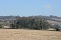
 14th Tee Austin Lodge Golf Course - geograph.org.uk - 1315056.jpg 640 × 480 ; 72 kio
-
-

-
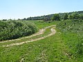
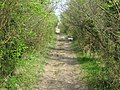
 A muddy North Downs Way, Otford Mount - geograph.org.uk - 2190433.jpg 640 × 430 ; 192 kio
-
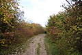
 A quiet Kentish byway - geograph.org.uk - 940930.jpg 640 × 430 ; 112 kio
-
 A quiet Kentish byway passing through the trees - geograph.org.uk - 940932.jpg 640 × 430 ; 121 kio
-
 A Stile near Greenhill Wood - geograph.org.uk - 87301.jpg 640 × 480 ; 90 kio
-
 A wet day on the M26 - geograph.org.uk - 2154785.jpg 640 × 303 ; 52 kio
-
 A225 at Vestry Road junction - geograph.org.uk - 2728915.jpg 640 × 428 ; 67 kio
-
 A225 bridge over M26 - geograph.org.uk - 635108.jpg 640 × 426 ; 65 kio
-
 An old chalk quarry, Otford - geograph.org.uk - 2191192.jpg 640 × 430 ; 62 kio
-
 An old Victorian Chapel - geograph.org.uk - 1722400.jpg 640 × 427 ; 55 kio
-
 Autumn colours starting to show at Otford - geograph.org.uk - 5150131.jpg 4 194 × 3 255 ; 3,25 Mio
-
 Beechy Lees Rd, Kemsing - geograph.org.uk - 940055.jpg 640 × 430 ; 91 kio
-
 Beechy Lees Road, Kemsing - geograph.org.uk - 3156976.jpg 2 048 × 1 536 ; 1,42 Mio
-
 Beginning of a footpath near Otford. - geograph.org.uk - 940100.jpg 640 × 430 ; 138 kio
-
 Bird Hide - geograph.org.uk - 188225.jpg 640 × 480 ; 82 kio
-
 Border Leicester Sheep - geograph.org.uk - 1917250.jpg 1 024 × 768 ; 275 kio
-
 Border Leicester Sheep - geograph.org.uk - 1917256.jpg 1 024 × 768 ; 249 kio
-
 Bridge at the end of Telston Lane - geograph.org.uk - 1720671.jpg 640 × 427 ; 115 kio
-
 Bridge Cottage, Pilgrim's Way West - geograph.org.uk - 1722135.jpg 640 × 427 ; 98 kio
-
 Bridge Cottages, High Street, Otford - geograph.org.uk - 5001396.jpg 640 × 427 ; 117 kio
-
 Bridleway between Otford and Shoreham - geograph.org.uk - 3168437.jpg 1 600 × 1 200 ; 457 kio
-
 Bridleway bridge over the railway - geograph.org.uk - 1447980.jpg 640 × 480 ; 140 kio
-
 Bridleway in the Darent Valley - geograph.org.uk - 6148221.jpg 4 000 × 3 000 ; 4,75 Mio
-
 Bridleway near Otford - geograph.org.uk - 6148218.jpg 4 000 × 3 000 ; 4,79 Mio
-
 Broughton Road, Otford - geograph.org.uk - 5044259.jpg 3 083 × 2 313 ; 1,67 Mio
-
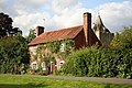
 Bubblestone Farmhouse - geograph.org.uk - 509494.jpg 640 × 427 ; 75 kio
-
 Bubblestone Road, Otford - geograph.org.uk - 1306197.jpg 640 × 480 ; 81 kio
-
 Bubblestone Road, Otford - geograph.org.uk - 5042970.jpg 3 264 × 2 448 ; 2,83 Mio
-
 Bus Stop, Pilgrim's Way West - geograph.org.uk - 1722124.jpg 640 × 427 ; 131 kio
-
 By the railway - geograph.org.uk - 3447339.jpg 640 × 317 ; 69 kio
-
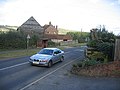
 Car Dealer, Otford, Kent - geograph.org.uk - 1126484.jpg 640 × 480 ; 57 kio
-
 Car Dealer, Sevenoaks, Kent - geograph.org.uk - 959470.jpg 640 × 480 ; 67 kio
-
 Car Park, Otford Village Hall - geograph.org.uk - 1722371.jpg 640 × 427 ; 58 kio
-
 Castle Underline Bridge - geograph.org.uk - 6294184.jpg 3 120 × 4 160 ; 2,19 Mio
-
 Chalk Grassland - geograph.org.uk - 4309405.jpg 640 × 480 ; 72 kio
-
 Chantry Cottage - geograph.org.uk - 509503.jpg 640 × 427 ; 94 kio
-
 Climbing up the Chalk escarpment near Otford. - geograph.org.uk - 940077.jpg 640 × 430 ; 82 kio
-
 Clump of trees by the Darent Valley Path - geograph.org.uk - 1720667.jpg 640 × 427 ; 82 kio
-
 Clump of trees in a chalky field - geograph.org.uk - 1720643.jpg 640 × 427 ; 72 kio
-

-
 Coombe Road, Otford - geograph.org.uk - 5043011.jpg 3 264 × 2 448 ; 2,05 Mio
-
 Coronation sundial - geograph.org.uk - 509350.jpg 427 × 640 ; 75 kio
-
 Cows relaxing in a field - geograph.org.uk - 188228.jpg 640 × 480 ; 58 kio
-
 Cut through to Coombe Rd, Otford - geograph.org.uk - 2191184.jpg 640 × 430 ; 105 kio
-
 Darent Valley - geograph.org.uk - 6126750.jpg 1 024 × 768 ; 147 kio
-
 Darent Valley Path - geograph.org.uk - 6126748.jpg 1 024 × 768 ; 255 kio
-

-
 Darent Valley Path at Otford Kent UK.JPG 3 264 × 2 448 ; 1,92 Mio
-
 Darent Valley Path heading north - geograph.org.uk - 1725170.jpg 640 × 427 ; 76 kio
-

-

-

-
 Darent valley, west side - geograph.org.uk - 5002537.jpg 640 × 427 ; 79 kio
-
 Darenth Valley Path heading toward Sevenoaks - geograph.org.uk - 1447999.jpg 640 × 480 ; 95 kio
-
 Darnets Field, Otford - geograph.org.uk - 5044090.jpg 3 264 × 2 448 ; 2,07 Mio
-
 Disused Chalk Quarry, Otford - geograph.org.uk - 2191190.jpg 640 × 430 ; 103 kio
-
 Earth in the Otford Solar System Model - geograph.org.uk - 1447960.jpg 640 × 480 ; 73 kio
-
 Farmland in the Darent Valley - geograph.org.uk - 3447718.jpg 640 × 430 ; 65 kio
-
 Farmland near Twitton - geograph.org.uk - 3899449.jpg 640 × 347 ; 37 kio
-
 Farmland seen from the railway line - geograph.org.uk - 3899448.jpg 640 × 347 ; 30 kio
-
 Farmland south of Twitton - geograph.org.uk - 3449793.jpg 640 × 393 ; 33 kio
-
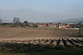
 Field alongside Otford Road - geograph.org.uk - 3336014.jpg 4 000 × 3 000 ; 4,37 Mio
-
 Field alongside Rye Lane - geograph.org.uk - 3206315.jpg 4 000 × 3 000 ; 4,27 Mio
-
 Field of Lavender near Otford - geograph.org.uk - 2390183.jpg 640 × 430 ; 62 kio
-
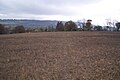
 Field on the outskirts of Otford - geograph.org.uk - 3206301.jpg 4 000 × 3 000 ; 3,71 Mio
-
 Field on top of the Downs - geograph.org.uk - 2190416.jpg 640 × 430 ; 111 kio
-
 Field, Otford - geograph.org.uk - 1306213.jpg 640 × 480 ; 40 kio
-
 Fields of Lavender, Telston Lane - geograph.org.uk - 1721898.jpg 640 × 427 ; 79 kio
-
 Fields of Lavender, Telston Lane - geograph.org.uk - 1722033.jpg 640 × 427 ; 46 kio
-
 Filston Lane crossing the railway, Twitton - geograph.org.uk - 3156993.jpg 2 043 × 1 469 ; 1,09 Mio
-
 Flash flood at Otford - geograph.org.uk - 5012113.jpg 4 608 × 3 456 ; 3,58 Mio
-
 Flooding at Otford - geograph.org.uk - 5014495.jpg 4 608 × 3 456 ; 3,53 Mio
-
 Foot and Rail Bridges over the M26 near Otford - geograph.org.uk - 3688555.jpg 640 × 480 ; 250 kio
-
 Footbridge over the Twitton Brook - geograph.org.uk - 1574222.jpg 640 × 427 ; 107 kio
-
 Footpath junction below Sepham Farm - geograph.org.uk - 1574363.jpg 640 × 427 ; 131 kio
-
 Footpath junction near Sepham Farm - geograph.org.uk - 1331581.jpg 640 × 480 ; 110 kio
-
 Footpath junction on Darenth Valley Path - geograph.org.uk - 1447975.jpg 640 × 480 ; 80 kio
-
 Footpath on Home Farm access road - geograph.org.uk - 1331409.jpg 640 × 480 ; 90 kio
-
 Footpath on the outskirts of Otford - geograph.org.uk - 3206293.jpg 4 000 × 3 000 ; 4,17 Mio
-

-
 Footpath to Otford Station - geograph.org.uk - 2191194.jpg 640 × 430 ; 135 kio
-
 Footpath to Pluto - geograph.org.uk - 1574375.jpg 640 × 427 ; 76 kio
-
 Footpath to Sepham Farm - geograph.org.uk - 1574390.jpg 640 × 427 ; 67 kio
-
 Footpath to Shoreham Road (A225) - geograph.org.uk - 3800789.jpg 640 × 428 ; 174 kio
-
 Footpath towards Filston Hall - geograph.org.uk - 3168461.jpg 1 600 × 1 200 ; 369 kio
-
 Footpath towards Otford - geograph.org.uk - 1978037.jpg 640 × 428 ; 149 kio
-
 Footpath towards Otford - geograph.org.uk - 3168455.jpg 1 600 × 1 200 ; 636 kio
-
 Footpath towards Sepham Farm - geograph.org.uk - 1574212.jpg 640 × 427 ; 77 kio
-
 Footpath towards Sepham Farm - geograph.org.uk - 1574217.jpg 640 × 427 ; 65 kio
-
 Forge House restaurant - geograph.org.uk - 509333.jpg 640 × 427 ; 83 kio
-
 Forge House Restaurant, Otford - geograph.org.uk - 1722362.jpg 640 × 427 ; 73 kio
-
 Former Otford Lane Mission Church - geograph.org.uk - 817217.jpg 640 × 426 ; 115 kio
-
 Former Wesleyan Chapel, Otford.JPG 1 800 × 2 000 ; 1,06 Mio
-
 Frog Farm, Wickham Field - geograph.org.uk - 64488.jpg 640 × 480 ; 82 kio
-
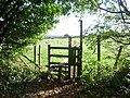
 Gate on the North Downs Way near Otford - geograph.org.uk - 2769882.jpg 640 × 480 ; 127 kio
-
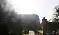
 Gatehouse base Otford front.jpg 3 024 × 4 032 ; 4,79 Mio
-
 Graffitied Scout Hut - geograph.org.uk - 2191196.jpg 640 × 430 ; 133 kio
-
 Grassland by the railway - geograph.org.uk - 3447362.jpg 640 × 293 ; 49 kio
-
 Greenhill Road, Otford - geograph.org.uk - 5043017.jpg 3 264 × 2 448 ; 2,26 Mio
-
 Greenhill Road, Otford - geograph.org.uk - 5043342.jpg 3 264 × 2 448 ; 2,02 Mio
-
 Greenhill Road, Otford - geograph.org.uk - 5043346.jpg 3 264 × 2 448 ; 2,37 Mio
-
 Greenhill Wood - geograph.org.uk - 2190427.jpg 640 × 430 ; 213 kio
-
 Hale Lane, Otford - geograph.org.uk - 1722083.jpg 640 × 427 ; 56 kio
-
 Half timbered cottages, Pilgrim's Way West - geograph.org.uk - 1722404.jpg 640 × 427 ; 81 kio
-
 Heading east on the M26 - geograph.org.uk - 2728600.jpg 640 × 428 ; 55 kio
-
 Heather Cottage, Otford - geograph.org.uk - 1447968.jpg 640 × 480 ; 119 kio
-
 Heavy rain on the M26 - geograph.org.uk - 2154787.jpg 640 × 350 ; 56 kio
-
 Hedge by the Darent Valley Path - geograph.org.uk - 1725162.jpg 640 × 427 ; 104 kio
-
 High Street antiques - geograph.org.uk - 509337.jpg 640 × 427 ; 82 kio
-
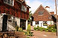 High Street Cottages - geograph.org.uk - 509330.jpg 640 × 427 ; 98 kio
-
 High Street Otford - geograph.org.uk - 3156704.jpg 2 048 × 1 536 ; 1,46 Mio
-
 High Street Otford - geograph.org.uk - 3158308.jpg 2 048 × 1 536 ; 1,43 Mio
-
 High Street, Otford - geograph.org.uk - 3613579.jpg 3 488 × 2 616 ; 3,4 Mio
-
 High Street, Otford - geograph.org.uk - 5043477.jpg 3 264 × 2 448 ; 1,88 Mio
-
 High Street, Otford - geograph.org.uk - 5043506.jpg 3 264 × 2 448 ; 2,09 Mio
-
 High Street, Otford - geograph.org.uk - 5043515.jpg 3 264 × 2 448 ; 2,16 Mio
-
 Hillydeal Road, Otford - geograph.org.uk - 5043012.jpg 3 264 × 2 448 ; 2,34 Mio
-
 Horses by Lower Barn - geograph.org.uk - 1725179.jpg 640 × 427 ; 95 kio
-
 Houses on the edge of Otford - geograph.org.uk - 1722013.jpg 640 × 368 ; 41 kio
-
 Industry by the railway - geograph.org.uk - 3447354.jpg 640 × 297 ; 59 kio
-

-
 Information board for Otford Palace - geograph.org.uk - 5036961.jpg 4 608 × 3 456 ; 3,54 Mio
-
 Inquisitive horse - geograph.org.uk - 6148226.jpg 4 000 × 3 000 ; 4,88 Mio
-
 Junction of The Old Walk and The Butts, Otford - geograph.org.uk - 5001426.jpg 640 × 427 ; 101 kio
-
 Kentish byway, East of Shoreham, Kent - geograph.org.uk - 940924.jpg 640 × 430 ; 124 kio
-

-
 Knighton Road, Otford - geograph.org.uk - 5044103.jpg 3 264 × 2 448 ; 1,84 Mio
-
 Lane behind Otford Station - geograph.org.uk - 2191199.jpg 640 × 430 ; 131 kio
-
 Large house off Pilgrim's Way West - geograph.org.uk - 1722384.jpg 640 × 385 ; 49 kio
-
 Large house, Village Green, Otford - geograph.org.uk - 1722245.jpg 640 × 444 ; 72 kio
-
 Large tree, Pilgrim's Way West - geograph.org.uk - 1722115.jpg 640 × 427 ; 70 kio
-
 Lavender Field - geograph.org.uk - 4513527.jpg 640 × 426 ; 42 kio
-
 Lavender Field - geograph.org.uk - 4685253.jpg 640 × 426 ; 50 kio
-
 Lavender field in winter - geograph.org.uk - 5798926.jpg 640 × 354 ; 33 kio
-
 Lavender field in winter - geograph.org.uk - 6433288.jpg 1 024 × 681 ; 110 kio
-
 Lavender Fields - geograph.org.uk - 4008275.jpg 640 × 430 ; 60 kio
-
 Lavender Fields - geograph.org.uk - 4008277.jpg 640 × 430 ; 76 kio
-
 Lavender fields - geograph.org.uk - 5109815.jpg 640 × 426 ; 64 kio
-
 Lavender, Telston Lane - geograph.org.uk - 1721900.jpg 640 × 427 ; 63 kio
-
 Lavender, Telston Lane - geograph.org.uk - 1721904.jpg 640 × 427 ; 64 kio
-
 Leonard Avenue, Otford - geograph.org.uk - 3613591.jpg 3 488 × 2 616 ; 2,72 Mio
-
 Leonard Avenue, Otford - geograph.org.uk - 5043471.jpg 3 264 × 2 448 ; 1,99 Mio
-
 London bound train goes below Telston Lane - geograph.org.uk - 1721883.jpg 640 × 427 ; 82 kio
-
 Long Lodge Farm Road - geograph.org.uk - 1447880.jpg 640 × 480 ; 111 kio
-
 Long Lodge Oast - geograph.org.uk - 3447373.jpg 640 × 457 ; 53 kio
-
 Long Lodge Oast - geograph.org.uk - 3447376.jpg 640 × 364 ; 46 kio
-
 Long Lodge, Otford - geograph.org.uk - 1447869.jpg 640 × 480 ; 79 kio
-
 Looking along Rye Lane - geograph.org.uk - 3206268.jpg 4 000 × 3 000 ; 3,83 Mio
-
 Looking along Station Road - geograph.org.uk - 3269814.jpg 640 × 427 ; 110 kio
-
 Looking down Rowdow Lane - geograph.org.uk - 4061162.jpg 4 000 × 3 000 ; 4,47 Mio
-
 Looking towards Polhill Tunnel - geograph.org.uk - 3626679.jpg 4 000 × 3 000 ; 3,92 Mio
-
 Looking towards Riverside Retail Park - geograph.org.uk - 3336016.jpg 4 000 × 3 000 ; 3,99 Mio
-
 Lower Barn - geograph.org.uk - 1725206.jpg 640 × 427 ; 86 kio
-
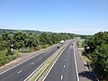
 M26 - geograph.org.uk - 3447364.jpg 640 × 464 ; 52 kio
-
 M26 - geograph.org.uk - 3545627.jpg 640 × 384 ; 33 kio
-
 M26 crosses Rye Lane - geograph.org.uk - 1720525.jpg 640 × 427 ; 85 kio
-
 M26 Motorway - geograph.org.uk - 5042933.jpg 3 264 × 2 448 ; 2,76 Mio
-
 M26 near Otford - geograph.org.uk - 3688356.jpg 640 × 480 ; 266 kio
-
 M26, Otford Road (A225) Bridge - geograph.org.uk - 3688361.jpg 640 × 480 ; 224 kio
-
 Main Line at Otford Junction - geograph.org.uk - 6429555.jpg 1 200 × 804 ; 1,28 Mio
-
 Mars in Otford Solar System Model - geograph.org.uk - 1447962.jpg 480 × 640 ; 89 kio
-
 Moated house by the River Darent - geograph.org.uk - 1725144.jpg 640 × 427 ; 93 kio
-
 Mobile Phone Mast in Greenhill Wood - geograph.org.uk - 1315089.jpg 360 × 640 ; 53 kio
-
 Motorway Bridge over Rye Lane, near Dunton Green - geograph.org.uk - 5044264.jpg 3 264 × 2 448 ; 1,78 Mio
-
 Muddy Field - geograph.org.uk - 4361239.jpg 640 × 480 ; 59 kio
-
 New Barn Cottages, Telston Lane - geograph.org.uk - 1722014.jpg 640 × 427 ; 101 kio
-
 North Downs Way - geograph.org.uk - 2191182.jpg 640 × 430 ; 111 kio
-
 North Downs Way above Otford - geograph.org.uk - 228071.jpg 640 × 480 ; 144 kio
-

-
 North Downs Way at Otford - geograph.org.uk - 2765255.jpg 480 × 640 ; 115 kio
-
 North Downs Way at Otford Mount - geograph.org.uk - 2769879.jpg 640 × 480 ; 106 kio
-
 North Downs Way descending the scarp slope - geograph.org.uk - 2190420.jpg 640 × 430 ; 206 kio
-
 North Downs Way descending to Otford - geograph.org.uk - 2191177.jpg 640 × 430 ; 109 kio
-
 North Downs Way entering Otford - geograph.org.uk - 2191181.jpg 640 × 430 ; 122 kio
-
 North Downs Way heading East - geograph.org.uk - 1578246.jpg 640 × 427 ; 65 kio
-
 North Downs Way heading West - geograph.org.uk - 1447978.jpg 640 × 480 ; 116 kio
-
 North Downs Way meets Birchin Cross Road - geograph.org.uk - 25203.jpg 640 × 480 ; 110 kio
-
 North Downs Way meets Pilgrims Way - geograph.org.uk - 2191185.jpg 640 × 430 ; 127 kio
-
 North Downs Way Sign - geograph.org.uk - 1920602.jpg 1 024 × 768 ; 288 kio
-
 North Downs Way to Otford - geograph.org.uk - 2190422.jpg 640 × 430 ; 213 kio
-
 North Downs Way up to Otford Mount - geograph.org.uk - 1256057.jpg 640 × 480 ; 158 kio
-
 Northwestward View across the Village Pond, Otford (July 2012).JPG 2 400 × 1 800 ; 1,2 Mio
-
 Old Forge Cottage Restaurant, Otford - geograph.org.uk - 1722154.jpg 640 × 427 ; 73 kio
-
 Old Otford Road, cut in two - geograph.org.uk - 1447889.jpg 640 × 480 ; 69 kio
-
 Old Otford Road, near Sevenoaks - geograph.org.uk - 5042912.jpg 3 264 × 2 448 ; 2,3 Mio
-
 Old Otford Road, near Sevenoaks - geograph.org.uk - 5042924.jpg 3 264 × 2 448 ; 2,27 Mio
-
 Old property in Otford - geograph.org.uk - 2280556.jpg 1 023 × 713 ; 204 kio
-
 Old shed, Stursdon Farm - geograph.org.uk - 2126463.jpg 640 × 428 ; 150 kio
-
 Open space, Otford - geograph.org.uk - 1306223.jpg 640 × 480 ; 76 kio
-
 Otford - geograph.org.uk - 2206534.jpg 1 160 × 786 ; 392 kio
-
 Otford - panoramio (1).jpg 2 048 × 1 536 ; 266 kio
-
 Otford - panoramio.jpg 2 700 × 1 800 ; 774 kio
-
 Otford Allotments - geograph.org.uk - 1725131.jpg 640 × 416 ; 77 kio
-
 Otford Cemetery - geograph.org.uk - 2728615.jpg 640 × 480 ; 139 kio
-
 Otford cricket match - geograph.org.uk - 509588.jpg 640 × 427 ; 57 kio
-
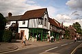
 Otford High Street - geograph.org.uk - 509343.jpg 640 × 427 ; 84 kio
-
 Otford High Street - geograph.org.uk - 509362.jpg 640 × 427 ; 66 kio
-
 Otford Library - geograph.org.uk - 1331460.jpg 640 × 480 ; 106 kio


_-_geograph.org.uk_-_3800789.jpg)


_Bridge_-_geograph.org.uk_-_3688361.jpg)


.JPG)


.jpg)


