Category:Otternish
Jump to navigation
Jump to search
village in the Outer Hebrides, Scotland, UK .jpg) | |||||
| Upload media | |||||
| Instance of | |||||
|---|---|---|---|---|---|
| Location | Outer Hebrides, Scotland | ||||
 | |||||
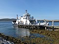
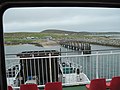
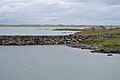
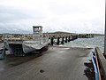
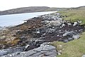
English: Otternish is the former North Uist terminal for the ferry to Berneray. The slipway lies 6 miles (10 km) north of Lochmaddy. When the causeway was completed in December 1998, the slipway was no longer needed. Ancient human remains were found here in 1870.
Media in category "Otternish"
The following 45 files are in this category, out of 45 total.
-
 Approaching Berneray - geograph.org.uk - 2645642.jpg 1,333 × 1,000; 1.23 MB
-
 Berneray, the ferry has arrived - geograph.org.uk - 3274729.jpg 640 × 480; 74 KB
-
 Boats on Loch nam Ban - geograph.org.uk - 4541213.jpg 1,600 × 900; 401 KB
-
 Breakwater - geograph.org.uk - 2986481.jpg 640 × 426; 58 KB
-

-
 CalMac Ferry at Berneray - geograph.org.uk - 2599489.jpg 2,560 × 1,920; 2.02 MB
-
 CalMac's 'Loch Portain' at Borve-Borgh - geograph.org.uk - 4987524.jpg 3,264 × 2,448; 4.24 MB
-
 Caolas Bheàrnaraigh - geograph.org.uk - 6504443.jpg 1,024 × 931; 197 KB
-
 Causeway - geograph.org.uk - 3634935.jpg 3,648 × 2,736; 3.65 MB
-
-
 Causeway between North Uist and Berneray - geograph.org.uk - 4122995.jpg 640 × 480; 197 KB
-
 Causeway from North Uist to Berneray - geograph.org.uk - 3079878.jpg 640 × 427; 57 KB
-
 Coastline at Loch nam Ban - geograph.org.uk - 2044814.jpg 3,214 × 1,726; 1.19 MB
-
 Cracanais, Berneray - geograph.org.uk - 2592944.jpg 2,560 × 1,920; 2.42 MB
-
 Done for the Day (geograph 2593025).jpg 2,560 × 1,920; 2.1 MB
-
 Ferry at Berneray - geograph.org.uk - 3110479.jpg 640 × 425; 98 KB
-
 Ferry From Leverburgh Arrives at Berneray - geograph.org.uk - 2739738.jpg 4,000 × 3,000; 2.6 MB
-
 Ferry terminal, Bearnaraigh - geograph.org.uk - 3343998.jpg 640 × 480; 60 KB
-
 Headland , Loch nam Ban - geograph.org.uk - 3482973.jpg 4,608 × 3,072; 1.39 MB
-
 Leaving Berneray - geograph.org.uk - 2448749.jpg 3,648 × 2,736; 2.57 MB
-
 Loch Bhuirgh - geograph.org.uk - 3216732.jpg 1,600 × 1,200; 653 KB
-
 Loch Bhuirgh - geograph.org.uk - 6224789.jpg 1,024 × 768; 619 KB
-
 Loch Borve - Loch Bhuirgh - geograph.org.uk - 2592969.jpg 2,560 × 1,920; 2.2 MB
-
 Loch nam Ban - geograph.org.uk - 2044805.jpg 2,448 × 3,264; 1.46 MB
-
 Loch nam Ban - geograph.org.uk - 2593034.jpg 2,560 × 1,920; 2.37 MB
-
 Loch Portain arriving for the night at Otternish - geograph.org.uk - 4541846.jpg 1,800 × 1,013; 1.13 MB
-
 Loch Portain arriving from Leverburgh - geograph.org.uk - 4541888.jpg 1,800 × 1,013; 994 KB
-

-
 Mole End at Leac Bhan - geograph.org.uk - 2590513.jpg 2,560 × 1,920; 2.35 MB
-
 Newton Jetty - geograph.org.uk - 2265174.jpg 1,749 × 1,122; 153 KB
-
-
 Old Boat , Loch Bhuirgh - geograph.org.uk - 2991784.jpg 640 × 426; 43 KB
-
 Old ferry jetty - geograph.org.uk - 3482956.jpg 4,608 × 3,072; 1.69 MB
-
 Old Harbour Wall, Berneray - geograph.org.uk - 2592963.jpg 2,560 × 1,920; 2.26 MB
-
 Old jetty, Berneray - geograph.org.uk - 2872517.jpg 1,024 × 681; 269 KB
-
 Otairnis - geograph.org.uk - 6504446.jpg 1,024 × 705; 153 KB
-
 Otairnis - Otternish - geograph.org.uk - 2590506.jpg 2,560 × 1,920; 2.29 MB
-
 Otternish Slipway (geograph 2542276).jpg 1,600 × 1,200; 334 KB
-
 Pier, Otternish (geograph 3343131).jpg 640 × 480; 50 KB
-
 Shoreline , Loch nam Ban - geograph.org.uk - 3482963.jpg 4,608 × 3,072; 1.75 MB
-
 Shoreline at Cràcanais - geograph.org.uk - 6224787.jpg 1,024 × 756; 712 KB
-
 Sound of Harris ferry - geograph.org.uk - 3634943.jpg 640 × 480; 67 KB
-
 South of Loch Bhuirgh - geograph.org.uk - 2991736.jpg 640 × 426; 61 KB
-
 The causeway from Berneray-Bearnaraigh - geograph.org.uk - 4987545.jpg 3,264 × 2,448; 4.41 MB
-
 The Slipway at Otternish - geograph.org.uk - 1361750.jpg 640 × 480; 65 KB


.jpg)
.jpg)


