Category:Oud Kraggenburg
Jump to navigation
Jump to search
| Object location | | View all coordinates using: OpenStreetMap |
|---|
| Upload media | |||||
| Instance of | |||||
|---|---|---|---|---|---|
| Location | Noordoostpolder, Flevoland, Netherlands | ||||
| Located in or next to body of water | |||||
| Has part(s) | |||||
| Inception |
| ||||
 | |||||
|
This is a category about rijksmonument number 30726
|
| Address |
|
Subcategories
This category has the following 3 subcategories, out of 3 total.
F
- Former harbor of Kraggenburg (6 F)
L
- Lichtopstand Kraggenburg (8 F)
- Lighthouse Kraggenburg (21 F)
Media in category "Oud Kraggenburg"
The following 7 files are in this category, out of 7 total.
-
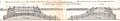 Dwarsdoorsnede van het Zwolsche Diep in 1857.jpg 4,993 × 877; 1.09 MB
-
 NL-LlsHFA 0230 06389.tif 646 × 636; 1.2 MB
-
 NL-LlsHFA 0230 18221.tif 1,294 × 933; 3.48 MB
-
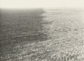
 Overzicht - Kraggenburg - 20332558 - RCE.jpg 1,190 × 1,200; 293 KB
-
 Overzicht - Kraggenburg - 20332559 - RCE.jpg 1,181 × 1,200; 327 KB
-
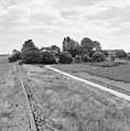 Overzicht bebouwing rondom - Kraggenburg - 20332560 - RCE.jpg 1,185 × 1,200; 329 KB
-
 Situatie van het Zwolsche Diep in 1857.jpg 6,649 × 8,695; 8.85 MB


