Category:Oude Delft 64, Delft
Jump to navigation
Jump to search
| Object location | | View all coordinates using: OpenStreetMap |
|---|
building in Delft, Netherlands  | |||||
| Upload media | |||||
| Instance of | |||||
|---|---|---|---|---|---|
| Location | Delft, South Holland, Netherlands | ||||
| Street address |
| ||||
| Located on street | |||||
| Heritage designation |
| ||||
 | |||||
|
This is a category about rijksmonument number 12075
|
| Address |
|
Media in category "Oude Delft 64, Delft"
The following 6 files are in this category, out of 6 total.
-
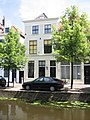 Delft - Oude Delft 64.jpg 1,944 × 2,592; 1.7 MB
-
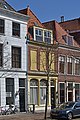 Delft Oude Delft 62.jpg 4,000 × 6,000; 19.48 MB
-
 Gevels - Delft - 20052539 - RCE.jpg 803 × 1,200; 239 KB
-
 Overzicht - Delft - 20052544 - RCE.jpg 1,200 × 956; 330 KB
-
 Overzicht - Delft - 20052545 - RCE.jpg 1,200 × 958; 348 KB
-
 Overzicht - Delft - 20052546 - RCE.jpg 1,200 × 961; 339 KB


