Category:Oude Rijn 48, Leiden
Jump to navigation
Jump to search
| Object location | | View all coordinates using: OpenStreetMap |
|---|
 | |||||
| Upload media | |||||
| Instance of |
| ||||
|---|---|---|---|---|---|
| Location | Leiden, South Holland, Netherlands | ||||
| Street address |
| ||||
| Heritage designation |
| ||||
 | |||||
|
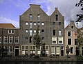
This is a category about rijksmonument number 25305
|
| Address |
|
Media in category "Oude Rijn 48, Leiden"
The following 6 files are in this category, out of 6 total.
-
 Gevels - Leiden - 20136752 - RCE.jpg 805 × 1,200; 167 KB
-
 Graanmagazijn Oude Rijn Leiden.jpg 2,048 × 1,536; 1.79 MB
-
 Leiden - Oude Rijn 48.JPG 2,736 × 3,648; 4.73 MB
-
 Leiden - Overzicht Oude Rijn 36A-60.jpg 4,032 × 3,024; 3.07 MB
-

-
 Wiki Takes Leiden 2017-11.jpg 4,466 × 3,477; 8.94 MB


