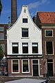
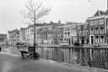
Category:Oude Singel 128, Leiden
Jump to navigation
Jump to search
| Object location | | View all coordinates using: OpenStreetMap |
|---|
 | |||||
| Upload media | |||||
| Instance of |
| ||||
|---|---|---|---|---|---|
| Location | Leiden, South Holland, Netherlands | ||||
| Street address |
| ||||
| Heritage designation |
| ||||
 | |||||
|
This is a category about rijksmonument number 25368
|
| Address |
|
Media in category "Oude Singel 128, Leiden"
The following 8 files are in this category, out of 8 total.
-
 Gevels - Leiden - 20136841 - RCE.jpg 802 × 1,200; 172 KB
-
 Leiden - Oude Singel 128.JPG 2,736 × 3,648; 3.81 MB
-
 Oude singel 128.JPG 2,775 × 4,163; 1.75 MB
-
 Overzicht - Leiden - 20136778 - RCE.jpg 1,200 × 800; 222 KB
-
 Overzicht - Leiden - 20136779 - RCE.jpg 1,200 × 806; 214 KB
-
 Overzicht - Leiden - 20136780 - RCE.jpg 1,200 × 808; 249 KB
-
 Rozebeurs-leiden-2019.jpg 1,600 × 1,180; 1.55 MB
-
 Voorgevel - Leiden - 20136845 - RCE.jpg 960 × 1,200; 259 KB


