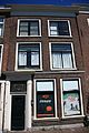
Category:Oude Singel 14, Leiden
Jump to navigation
Jump to search
| Object location | | View all coordinates using: OpenStreetMap |
|---|
building in Leiden, Netherlands  | |||||
| Upload media | |||||
| Instance of | |||||
|---|---|---|---|---|---|
| Location | Leiden, South Holland, Netherlands | ||||
| Street address |
| ||||
| Heritage designation |
| ||||
 | |||||
|
This is a category about rijksmonument number 25333
|
| Address |
|
Media in category "Oude Singel 14, Leiden"
The following 9 files are in this category, out of 9 total.
-
 Gevel - Leiden - 20136798 - RCE.jpg 804 × 1,200; 191 KB
-
 Gevel - Leiden - 20136799 - RCE.jpg 803 × 1,200; 183 KB
-
 Leiden - Oude Singel 14.JPG 2,736 × 3,648; 4.69 MB
-
 Leiden - Oude Singel 14.jpg 2,947 × 4,530; 1.54 MB
-
 Oude singel 10, 12, 14.JPG 4,272 × 2,848; 2.34 MB
-
 Oude singel 14, 16, 18, 20, 24, 26, 28.JPG 4,272 × 2,848; 1.99 MB
-
 Oude singel 14.JPG 2,848 × 4,272; 2.1 MB
-
 Oude singel 8, 10, 12, 14, 16.JPG 4,272 × 2,848; 2.3 MB
-
 Overzicht - Leiden - 20136790 - RCE.jpg 1,200 × 805; 233 KB


