Category:Oude Singel 76, Leiden
Jump to navigation
Jump to search
| Object location | | View all coordinates using: OpenStreetMap |
|---|
 | |||||
| Upload media | |||||
| Instance of |
| ||||
|---|---|---|---|---|---|
| Location | Leiden, South Holland, Netherlands | ||||
| Street address |
| ||||
| Heritage designation |
| ||||
 | |||||
|
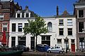
This is a category about rijksmonument number 25351
|
| Address |
|
Media in category "Oude Singel 76, Leiden"
The following 5 files are in this category, out of 5 total.
-
 Gevels - Leiden - 20136833 - RCE.jpg 1,200 × 805; 170 KB
-
 Leiden - Oude Singel 76.JPG 2,736 × 3,648; 3.91 MB
-
 Marepoortsebrug voorbij (oude Singel) - Leiden - 20133795 - RCE.jpg 1,200 × 803; 194 KB
-
 Oude singel 74, 76.JPG 4,272 × 2,848; 1.97 MB
-
 Overzicht - Leiden - 20136783 - RCE.jpg 1,200 × 803; 204 KB

_-_Leiden_-_20133795_-_RCE.jpg)

