Category:Oude Waal 42, Amsterdam
Jump to navigation
Jump to search
| Object location | | View all coordinates using: OpenStreetMap |
|---|
.jpg) | |||||
| Upload media | |||||
| Instance of |
| ||||
|---|---|---|---|---|---|
| Location | Amsterdam, North Holland, Netherlands | ||||
| Street address |
| ||||
| Located on street | |||||
| Heritage designation |
| ||||
 | |||||
|
This is a category about rijksmonument number 6242
|
| Address |
|
Media in category "Oude Waal 42, Amsterdam"
The following 5 files are in this category, out of 5 total.
-
 Stadsarchief Amsterdam, Afb 012000005301.jpg 2,035 × 1,480; 487 KB
-
 WLM - andrevanb - amsterdam, oude waal 40.jpg 900 × 1,200; 458 KB
-
 WLM - andrevanb - amsterdam, oude waal 42 - detail (1).jpg 1,200 × 960; 266 KB
-
 WLM - andrevanb - amsterdam, oude waal 42 - detail.jpg 809 × 1,200; 275 KB
-
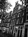
 WLM - andrevanb - amsterdam, oude waal 42.jpg 738 × 1,200; 312 KB


