Category:Oudegracht 325, Utrecht
Jump to navigation
Jump to search
| Object location | | View all coordinates using: OpenStreetMap |
|---|
 | |||||
| Upload media | |||||
| Instance of |
| ||||
|---|---|---|---|---|---|
| Location | Utrecht, Netherlands | ||||
| Street address |
| ||||
| Located on street | |||||
| Heritage designation |
| ||||
 | |||||
|
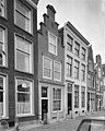
This is a category about rijksmonument number 36571
|
| Address |
|
Media in category "Oudegracht 325, Utrecht"
The following 6 files are in this category, out of 6 total.
-
 Oudegracht 325.JPG 2,592 × 3,456; 4.28 MB
-
 Overzicht - Utrecht - 20236812 - RCE.jpg 1,200 × 960; 237 KB
-
 Utrecht, RM-panden aan de Oudegracht 317-329oneven foto4 2015-11-01 09.16.jpg 4,320 × 2,435; 6.97 MB
-
 Voorgevels - Utrecht - 20236837 - RCE.jpg 807 × 1,200; 196 KB
-
 Voorgevels - Utrecht - 20236838 - RCE.jpg 955 × 1,200; 234 KB
-
 Voorgevels - Utrecht - 20236839 - RCE.jpg 959 × 1,200; 252 KB


