Category:Oudegracht 86, Utrecht
Jump to navigation
Jump to search
| Object location | | View all coordinates using: OpenStreetMap |
|---|
 | |||||
| Upload media | |||||
| Instance of | |||||
|---|---|---|---|---|---|
| Location | Utrecht, Netherlands | ||||
| Street address |
| ||||
| Located on street | |||||
| Heritage designation |
| ||||
| Inception |
| ||||
 | |||||
|
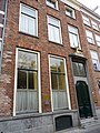
This is a category about rijksmonument number 31038
|
| Address |
|
Media in category "Oudegracht 86, Utrecht"
The following 9 files are in this category, out of 9 total.
-
 Exterieur VOORGEVELS - Utrecht - 20305951 - RCE.jpg 788 × 1,200; 252 KB
-
 Exterieur VOORGEVELS - Utrecht - 20305952 - RCE.jpg 788 × 1,200; 203 KB
-
 Hertenhuis" - Utrecht - 20236478 - RCE.jpg 807 × 1,200; 206 KB
-
 Huis met hert.JPG 3,456 × 5,184; 5.87 MB
-
 Kamerbetimmering in achterhuis - Utrecht - 20236475 - RCE.jpg 952 × 1,200; 253 KB
-
 Oudegracht 86.JPG 2,592 × 3,456; 4.25 MB
-
 Overzicht - Utrecht - 20236477 - RCE.jpg 1,200 × 809; 238 KB
-
 Schouw in achterhuis - Utrecht - 20236476 - RCE.jpg 952 × 1,200; 231 KB
-
 Wijk C, Utrecht, Netherlands - panoramio (4).jpg 2,048 × 1,155; 705 KB


.jpg)