Category:Oudestraat 166, Kampen
Jump to navigation
Jump to search
| Object location | | View all coordinates using: OpenStreetMap |
|---|
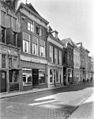
house in Kampen, Netherlands .JPG) | |||||
| Upload media | |||||
| Instance of | |||||
|---|---|---|---|---|---|
| Location | Kampen, Overijssel, Netherlands | ||||
| Heritage designation |
| ||||
 | |||||
|
This is a category about rijksmonument number 23192
|
| Address |
|
Media in category "Oudestraat 166, Kampen"
The following 5 files are in this category, out of 5 total.
-
 Kampen Oudestraat (43).JPG 1,944 × 2,592; 1.46 MB
-
 Met houtzagerssteeg - Kampen - 20123364 - RCE.jpg 956 × 1,200; 271 KB
-
 Panden naast het gotische huis - Kampen - 20404157 - RCE.jpg 937 × 1,200; 204 KB
-
 Panden naast het gotische huis - Kampen - 20404159 - RCE.jpg 945 × 1,200; 240 KB
-
 Voorgevel - Kampen - 20123366 - RCE.jpg 810 × 1,200; 197 KB


