Category:Oudezijds Voorburgwal 223, Amsterdam
Jump to navigation
Jump to search
| Object location | | View all coordinates using: OpenStreetMap |
|---|
18th-century building in Amsterdam  | |||||
| Upload media | |||||
| Instance of |
| ||||
|---|---|---|---|---|---|
| Location | Amsterdam, North Holland, Netherlands | ||||
| Street address |
| ||||
| Located on street | |||||
| Heritage designation |
| ||||
 | |||||
|
This is a category about rijksmonument number 6088
|
| Address |
|
Media in category "Oudezijds Voorburgwal 223, Amsterdam"
The following 8 files are in this category, out of 8 total.
-
 Oudezijds Voorburgwal 215-217.jpg 2,592 × 1,936; 2.24 MB
-
 Oudezijds Voorburgwal 217 Amsterdam.jpg 2,592 × 1,936; 2.37 MB
-
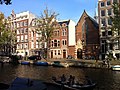
 Amsterdam - Oudezijds Voorburgwal - houses general view.JPG 3,264 × 2,448; 1.91 MB
-
 Amsterdam - Oudezijds Voorburgwal 229.JPG 2,592 × 1,936; 2.35 MB
-
 Amsterdam - Oudezijds Voorburgwal 233-237.JPG 2,592 × 1,936; 2.78 MB
-
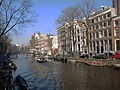 Amsterdam Oudezijds Voorburgwal.jpg 3,264 × 2,448; 2.52 MB
-
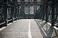 Bridge in Amsterdam (6178391152).jpg 3,872 × 2,592; 3.04 MB
-
 Oudezijds Voorburgwal 223 Amsterdam.jpg 1,936 × 2,592; 2.64 MB


.jpg)