Category:Oudezijds Voorburgwal 71, Amsterdam
Jump to navigation
Jump to search
| Object location | | View all coordinates using: OpenStreetMap |
|---|
 | |||||
| Upload media | |||||
| Instance of |
| ||||
|---|---|---|---|---|---|
| Location | Amsterdam, North Holland, Netherlands | ||||
| Street address |
| ||||
| Located on street | |||||
| Heritage designation |
| ||||
 | |||||
|
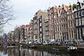
This is a category about rijksmonument number 6047
|
| Address |
|
Media in category "Oudezijds Voorburgwal 71, Amsterdam"
The following 6 files are in this category, out of 6 total.
-
 11-25-1954 12933 1 Oudezijds Voorburgwal (4072118356).jpg 2,048 × 1,611; 495 KB
-
 Amsterdam, 03.01.11-50.JPG 2,896 × 1,944; 1.25 MB
-
 Exterieur VOORGEVEL, OVERZICHT - Amsterdam - 20298726 - RCE.jpg 963 × 1,200; 281 KB
-
 RM6047 Amsterdam - Oudezijds Voorburgwal 71.jpg 1,944 × 2,592; 1.71 MB
-
 RM6048 Amsterdam - Oudezijds Voorburgwal 73.jpg 1,944 × 2,592; 1.45 MB
-
 Voorgevels - Amsterdam - 20021531 - RCE.jpg 803 × 1,200; 232 KB
.jpg)


