Category:Owstwick
Jump to navigation
Jump to search
English: Owstwick is a hamlet in the East Riding of Yorkshire, England, in an area known as Holderness. It is situated approximately 11 miles (18 km) east of Kingston upon Hull city centre and 5 miles (8 km) north west of Withernsea. It lies to the west of the B1242 road.

village in United Kingdom  | |||||
| Upload media | |||||
| Instance of | |||||
|---|---|---|---|---|---|
| Location | Roos, East Riding of Yorkshire, Yorkshire and the Humber, England | ||||
 | |||||
Media in category "Owstwick"
The following 37 files are in this category, out of 37 total.
-
 A wellington tree at Owstwick (geograph 2211193).jpg 800 × 600; 299 KB
-
 Blenkins Farm, Owstwick - geograph.org.uk - 447093.jpg 480 × 640; 116 KB
-
 Bowmere Hill - geograph.org.uk - 448132.jpg 457 × 640; 104 KB
-
 Burncrofts - geograph.org.uk - 498786.jpg 480 × 640; 76 KB
-
 By New Road, Owstwick (geograph 5511507).jpg 640 × 480; 324 KB
-
 Communication mast - geograph.org.uk - 45435.jpg 480 × 640; 57 KB
-
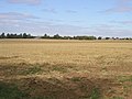
 Farmland View from Longbrough Lane - geograph.org.uk - 204044.jpg 640 × 480; 143 KB
-
 Farmland West of Hilston - geograph.org.uk - 72559.jpg 640 × 480; 133 KB
-
 Friends Meeting House, Owstwick, East Yorkshire, England.jpg 552 × 278; 141 KB
-
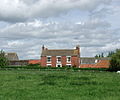
 Grange Farm near Owstwick (geograph 2211201).jpg 800 × 600; 278 KB
-
 Longbrough Lane - geograph.org.uk - 203782.jpg 640 × 480; 112 KB
-
 Longbrough Lane - geograph.org.uk - 448156.jpg 640 × 502; 115 KB
-
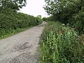 Longbrough Lane and Wild Poppies - geograph.org.uk - 496207.jpg 640 × 480; 149 KB
-
 Looking towards Owstwick - geograph.org.uk - 45308.jpg 640 × 480; 98 KB
-
 New Road to Owstwick (geograph 2211184).jpg 800 × 600; 200 KB
-
 Ostwick Carr - geograph.org.uk - 1893985.jpg 640 × 480; 58 KB
-
 Owstwick Grange (geograph 5384042).jpg 1,024 × 768; 183 KB
-
 Owstwick Hill - geograph.org.uk - 447071.jpg 491 × 640; 166 KB
-
 Owstwick Hill - geograph.org.uk - 447075.jpg 640 × 469; 175 KB
-
 Primrose Hill, Owstwick - geograph.org.uk - 448127.jpg 640 × 531; 86 KB
-
 Quaker Road, Owstwick (geograph 1796594).jpg 640 × 480; 57 KB
-
 Quaker Road, Owstwick (geograph 2213457).jpg 800 × 600; 217 KB
-
 Quaker Road, Owstwick - geograph.org.uk - 2064700.jpg 800 × 600; 312 KB
-
 Quaker Road, Owstwick - geograph.org.uk - 498782.jpg 640 × 468; 91 KB
-
 Quaker Road, Owstwick.jpg 465 × 640; 123 KB
-
 Smithy Garth, Owstwick (geograph 5511524).jpg 640 × 480; 192 KB
-
 South of Quaker Road, near Owstwick (geograph 5511629).jpg 640 × 444; 93 KB
-
 The Burton Pidsea to Roos road - geograph.org.uk - 46344.jpg 640 × 480; 65 KB
-
 The Elms, Owstwick - geograph.org.uk - 498779.jpg 480 × 640; 104 KB
-
 The entrance to Owstwick Hall Farm, Roos - geograph.org.uk - 2213447.jpg 800 × 600; 168 KB
-
 The Grange, Owstwick (geograph 1796598).jpg 640 × 480; 44 KB
-
 The road to Owstwick - geograph.org.uk - 45299.jpg 640 × 480; 95 KB
-
 The road to Owstwick - geograph.org.uk - 45419.jpg 640 × 480; 84 KB
-
 Track to Kenby Farm from Longbrough Lane (Tk) - geograph.org.uk - 2707731.jpg 3,264 × 2,448; 1.73 MB
-
 Track to Kenby Farm, Owstwick (geograph 1796592).jpg 640 × 480; 50 KB
-
 Trackside Wild Poppies - geograph.org.uk - 494541.jpg 480 × 640; 124 KB
-
 West of Owstwick - geograph.org.uk - 448117.jpg 466 × 640; 110 KB
.jpg)


.jpg)


.jpg)


.jpg)

.jpg)


.jpg)
.jpg)


.jpg)
.jpg)


.jpg)


_-_geograph.org.uk_-_2707731.jpg)
.jpg)

