Category:PEF map of Western Palestine (details of sheet 3)
Jump to navigation
Jump to search
Media in category "PEF map of Western Palestine (details of sheet 3)"
The following 22 files are in this category, out of 22 total.
-

-

-
 AcreNorth1870s.jpg 1,000 × 869; 207 KB
-
 Historical map series for the area of al-Bassa (1870s).jpg 749 × 752; 254 KB
-
 Historical map series for the area of al-Ghabisiyya (1870s).jpg 748 × 752; 203 KB
-
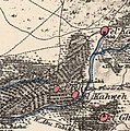
 Historical map series for the area of al-Kabri (1870s).jpg 748 × 752; 235 KB
-
 Historical map series for the area of Al-Manshiyya, Acre (1870s).jpg 747 × 751; 169 KB
-
 Historical map series for the area of Al-Nabi Rubin, Acre (1870s).jpg 749 × 752; 253 KB
-
 Historical map series for the area of al-Nahr (1870s).jpg 748 × 752; 233 KB
-
 Historical map series for the area of al-Sumayriyya (1870s).jpg 748 × 751; 145 KB
-
 Historical map series for the area of al-Tall, Acre (1870s).jpg 748 × 752; 235 KB
-
 Historical map series for the area of Arab al-Samniyya (1870s).jpg 748 × 752; 236 KB
-
 Historical map series for the area of Iqrit (1870s).jpg 749 × 752; 251 KB
-
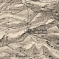 Historical map series for the area of Khirbat Iribbin (1870s).jpg 749 × 752; 242 KB
-
 Historical map series for the area of Khirbat Jiddin (1870s).jpg 748 × 752; 252 KB
-
 Historical map series for the area of Kuwaykat (1870s).jpg 748 × 751; 197 KB
-
 Historical map series for the area of Suhmata (1870s).jpg 748 × 752; 259 KB
-
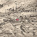
 Historical map series for the area of Suruh (1870s).jpg 749 × 752; 256 KB
-
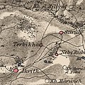 Historical map series for the area of Tarbikha (1870s).jpg 749 × 752; 252 KB
-
 Historical map series for the area of Umm al-Faraj (1870s).jpg 748 × 752; 208 KB
-

-
 Umm al Amad in the Survey of Western Palestine 1880.03 (cropped).jpg 455 × 317; 78 KB
.jpg)
.jpg)

.jpg)
.jpg)
.jpg)
.jpg)
.jpg)
.jpg)
.jpg)
.jpg)
.jpg)
.jpg)
.jpg)
.jpg)
.jpg)
.jpg)
.jpg)
.jpg)
.jpg)
.jpg)
.jpg)