Category:Palakkad district
Vai alla navigazione
Vai alla ricerca

English: Palakkad (Malayalam:പാലക്കാട് ജില്ല), Tamil:பாலக்காடு மாவட்டம்) is also known as Palghat or Palakkattussery. It is one of the 14 districts of Kerala state in South India. The city of Palakkad is the district headquarters. Palakkad is bordered on the northwest by the Malappuram district, on the southwest by the Thrissur district and on the east by Coimbatore district of Tamil Nadu.
The name is believed to be a fusion of two Malayalam words, Pala, a tree (Alstonia scholaris) that is found abundantly in Palakkad, and Kkaadu (ക്കാട്), which means "forest". During the British colonial era, this region is referred to as Palghat (mountain pass with Pala trees), which is phonetically similar to Palakkad.
Palakkad district has no coastal line and is notable for the Palakkad Gap – a fertile valley with a width of 32 to 40 kilometers – that connects Kerala to the rest of India. The valley is one of the main granaries of Kerala and an artery of essential supplies between Kerala and the rest of the country. The district is home to tropical evergreen forests, historic sites, tourist spots and educational centers.distretto indiano   | |||||
| Carica un file multimediale | |||||
| Istanza di | |||||
|---|---|---|---|---|---|
| Luogo | Kerala, India | ||||
| Capitale | |||||
| Data di fondazione o creazione |
| ||||
| Popolazione |
| ||||
| Superficie |
| ||||
| Ha sostituito |
| ||||
| Distinto da | |||||
| sito web ufficiale | |||||
 | |||||
Sottocategorie
Questa categoria contiene le 10 sottocategorie indicate di seguito, su un totale di 10.
*
R
File nella categoria "Palakkad district"
Questa categoria contiene 4 file, indicati di seguito, su un totale di 4.
-

-
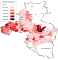 Density of Population in Palakkad District.svg 1 935 × 2 009; 1,41 MB
-
 Edumart Palakkad.jpg 3 512 × 2 752; 1,88 MB
-
 Protest by Plachimada people.jpg 4 000 × 3 000; 2,32 MB


