Category:Panchkula district
Jump to navigation
Jump to search
district of Haryana, India  | |||||
| Upload media | |||||
| Instance of | |||||
|---|---|---|---|---|---|
| Location | Ambala division, Haryana, India | ||||
| Capital | |||||
| Population |
| ||||
| Area |
| ||||
| official website | |||||
 | |||||
Panchkula (Hindi: पंचकुला़) is the 17th district of Haryana state in India. As formed 15 August 1995, it comprises two subdivisions, two Tehsils, 264 villages and four towns in the district named Kalka, Panchkula, Pinjore and Raipur Rani.
Subcategories
This category has the following 8 subcategories, out of 8 total.
Media in category "Panchkula district"
The following 27 files are in this category, out of 27 total.
-
 03E1AF4F-A5B4-45C2-9420-16BuAA55C078F.jpg 1,440 × 1,080; 363 KB
-
 Cliff on the Fault-Line - panoramio.jpg 1,600 × 1,200; 436 KB
-
 Deforested Land - panoramio.jpg 640 × 480; 76 KB
-
 Fennel flowers in spring season 01.jpg 640 × 480; 70 KB
-

-
 Haryana district location map Panchkula.svg 1,639 × 1,852; 745 KB
-
 HaryanaPanchkula.png 600 × 700; 46 KB
-
 Himalayan Expressway, Tipra, Panchkula District, Haryana, India.jpeg 4,208 × 3,120; 1.2 MB
-
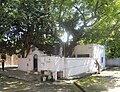 Historical Gurdwara Raipur Rani Guru Gobind Singh.JPG 893 × 687; 643 KB
-
 Mansa Devi temple main shrine.jpg 3,264 × 2,448; 2.66 MB
-
 Morus alba tree fruit in spring season 15.jpg 640 × 480; 75 KB
-
 Morus alba tree in spring season 14.jpg 640 × 480; 74 KB
-
 National Highway 22 old road to Pinjore Kalka Baddi Nalagarh (off Himalayan Expressway).jpeg 4,208 × 3,120; 1.25 MB
-
 On The Way To Heaven.jpg 988 × 741; 273 KB
-
 View of fields in spring season in Saketri, Haryana, India 08.jpg 640 × 480; 76 KB
-
 View of fields in spring season in Saketri, Haryana, India 09.jpg 640 × 480; 76 KB
-
 View of fields in spring season in Saketri, Haryana, India 10.jpg 640 × 480; 75 KB
-
 View of fields in spring season in Saketri, Haryana, India 11.jpg 640 × 480; 76 KB
-
 View of fields in spring season in Saketri, Haryana, India 12.jpg 640 × 480; 72 KB
-
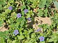
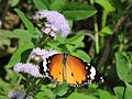 Weed flowers in spring season 02.jpg 640 × 480; 75 KB
-
 Weed flowers in spring season 03.jpg 480 × 640; 59 KB
-
 Weed flowers in spring season 04.jpg 640 × 480; 76 KB
-
 Weed flowers in spring season 05.jpg 640 × 480; 73 KB
-
 Weed flowers in spring season 06.jpg 640 × 480; 75 KB
-
 Weed flowers in spring season 07.jpg 640 × 480; 70 KB
-
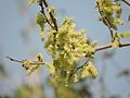
 Wild tree flowers in spring season 13.jpg 640 × 480; 56 KB
-


.jpeg)


