Category:Parish Church of St. Paul's Shipwreck, Munxar
Jump to navigation
Jump to search
| Object location | | View all coordinates using: OpenStreetMap |
|---|
Media in category "Parish Church of St. Paul's Shipwreck, Munxar"
The following 5 files are in this category, out of 5 total.
-
 20201226 125619 Munxar Parish Church.jpg 2,268 × 4,032; 2.33 MB
-
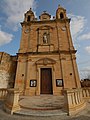
 Munxar parish church.jpg 1,965 × 1,264; 299 KB
-
 Munxar Parish church.jpg 3,600 × 4,800; 8.28 MB
-
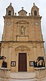
 Parish Church of St. Paul's Shipwreck, Munxar.jpg 1,726 × 1,361; 316 KB
-
 Parish Church of St. Paul's Shipwreck.jpg 2,048 × 1,362; 303 KB


