Category:Penbryn
Jump to navigation
Jump to search
hamlet and community in Ceredigion, Wales  St. Mihangel, Penbryn - Cereigion, Wales  | |||||
| Upload media | |||||
| Instance of | |||||
|---|---|---|---|---|---|
| Location | Ceredigion, Wales | ||||
| Population |
| ||||
| Area |
| ||||
 | |||||
 | |||||


English: Penbryn is a village and community on the coast of Ceredigion in Wales, some ten miles up the coast from Cardigan. It consists mostly of farms and caravan sites. Penbryn Beach is owned by the National Trust and was used for location filming for the James Bond film Die Another Day.
Subcategories
This category has the following 12 subcategories, out of 12 total.
2
A
- Aerial views of Penbryn (32 F)
B
C
- Capel Glynarthen (2 F)
- Capel Penmorfa (6 F)
- Capel Tan-y-groes (4 F)
I
P
S
T
Media in category "Penbryn"
The following 169 files are in this category, out of 169 total.
-
 552 Cardi Bach bus at Penbryn (18995917765).jpg 2,880 × 1,623; 2.01 MB
-
 A glimpse of Penbryn beach - geograph.org.uk - 6024288.jpg 2,304 × 1,728; 1.64 MB
-
 A section of the Ceredigion Coast Path - geograph.org.uk - 2662102.jpg 640 × 480; 116 KB
-
 A small boat swamped - by brambles - geograph.org.uk - 2661811.jpg 640 × 480; 105 KB
-
 A steep drop to the sea - geograph.org.uk - 6024923.jpg 2,234 × 1,630; 1.49 MB
-

-
 A487 approaching Sarnau - geograph.org.uk - 3557226.jpg 640 × 436; 43 KB
-
 A487 approaching Temple Bar - geograph.org.uk - 3557210.jpg 640 × 398; 54 KB
-
 Aberporth and Cribach Bay - geograph.org.uk - 2842046.jpg 3,264 × 2,448; 3.02 MB
-
 Allt-y-cordde, Penbryn - geograph.org.uk - 986039.jpg 640 × 480; 126 KB
-
 Army Surplus Store - Sarnau - geograph.org.uk - 2983464.jpg 4,288 × 2,798; 3.02 MB
-
 Army Surplus store at Sarnau - geograph.org.uk - 6084590.jpg 640 × 480; 56 KB
-
 B4334 approaching Nant-y-brenni - geograph.org.uk - 3554955.jpg 640 × 425; 90 KB
-
 B4334 south from Nant-y-brenni - geograph.org.uk - 3554956.jpg 640 × 480; 80 KB
-

-
 Caravan and campsite near Penbryn - geograph.org.uk - 2662009.jpg 640 × 480; 105 KB
-
 Caravan Park site office ^ shop - geograph.org.uk - 2679505.jpg 3,648 × 2,736; 1.96 MB
-
 Carreg y Ty - geograph.org.uk - 6022526.jpg 2,196 × 1,572; 1.57 MB
-
 Carreg y Ty - geograph.org.uk - 6022529.jpg 2,304 × 1,728; 1.85 MB
-
 Carreg y Ty - geograph.org.uk - 6023153.jpg 2,304 × 1,728; 1.93 MB
-
 Carreg-y-ty on the Ceredigion coast - geograph.org.uk - 2662713.jpg 640 × 480; 74 KB
-

-

-
 Cartws at Penbryn - geograph.org.uk - 4126241.jpg 640 × 360; 73 KB
-
 Ceredigion Coast - geograph.org.uk - 6023167.jpg 2,304 × 1,728; 1.87 MB
-
 Coastal Path near Penbryn - geograph.org.uk - 4025064.jpg 900 × 600; 288 KB
-
 Coastal path near Penbryn - geograph.org.uk - 4126210.jpg 640 × 360; 80 KB
-
-
 Colourful Cliff, Traeth Penbryn - geograph.org.uk - 5330492.jpg 6,016 × 4,016; 5.51 MB
-
 Corbalengi Stone - geograph.org.uk - 40156.jpg 480 × 640; 102 KB
-

-
 Cove near Llangranog - geograph.org.uk - 2622195.jpg 4,000 × 3,000; 4.05 MB
-
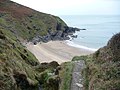 Cove on the Ceredigion Coast Path - geograph.org.uk - 2662106.jpg 640 × 480; 88 KB
-
 Cows lying in a field access track - geograph.org.uk - 2661934.jpg 640 × 480; 92 KB
-
 Crossroads at Bwlchcrwys from A487 - geograph.org.uk - 3557196.jpg 640 × 488; 48 KB
-
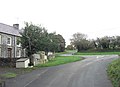 Crossroads at Croes-y-byrn - geograph.org.uk - 2679527.jpg 3,648 × 2,638; 1.73 MB
-
 Earth bank near Castell Bach - geograph.org.uk - 6022670.jpg 1,728 × 2,304; 1.73 MB
-
 End of the road at Traeth Penbryn - geograph.org.uk - 6399188.jpg 5,179 × 3,451; 5.2 MB
-

-
 Footbridge and steps - geograph.org.uk - 952272.jpg 426 × 640; 141 KB
-
 Footbridge near Traeth Bach on the Coastal Path - geograph.org.uk - 6023031.jpg 2,304 × 1,728; 1.72 MB
-
 Footbridge on Wales Coast Path - geograph.org.uk - 6399157.jpg 5,179 × 3,451; 4.3 MB
-
 Footbridge over Hoffnant, Penbryn - geograph.org.uk - 6399206.jpg 5,179 × 3,451; 4.56 MB
-
 Footbridge over the Hoffnant - geograph.org.uk - 6023683.jpg 2,304 × 1,728; 1.64 MB
-

-
 Footpath near Gaer Lwyd - geograph.org.uk - 2661989.jpg 640 × 480; 82 KB
-
 Footpath near Penbryn - geograph.org.uk - 4025069.jpg 900 × 600; 327 KB
-
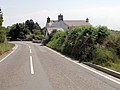 Fronlwyd from B4333 - geograph.org.uk - 3556403.jpg 640 × 480; 85 KB
-
 Gaer Pwntan - geograph.org.uk - 4666997.jpg 2,560 × 1,920; 2.74 MB
-
 Gate on coastal footpath - geograph.org.uk - 952258.jpg 640 × 426; 52 KB
-
 Ger - Near Castell Bach - geograph.org.uk - 4122286.jpg 640 × 480; 65 KB
-
 Gogerddan Arms at Tanygroes - geograph.org.uk - 2983479.jpg 3,799 × 2,592; 2.76 MB
-
 Headland on north east part of Penbryn Beach - geograph.org.uk - 6399165.jpg 5,184 × 3,456; 6.08 MB
-
 Headland with cave, Penbryn Beach - geograph.org.uk - 4022537.jpg 2,560 × 1,812; 2.72 MB
-

-
 House at Tan-y-Groes - geograph.org.uk - 4881595.jpg 3,372 × 2,495; 1.05 MB
-

-
 Internal Fire Museum of Power - 2009 - geograph.org.uk - 6297140.jpg 640 × 480; 73 KB
-
 Internal Fire Museum of Power - 2009 - geograph.org.uk - 6297365.jpg 640 × 480; 67 KB
-

-

-

-

-

-

-

-
 Internal Fire Museum of Power - geograph.org.uk - 6297051.jpg 640 × 427; 83 KB
-

-

-

-

-

-

-

-

-
 Ivy covered lamp, Penbryn - geograph.org.uk - 2118699.jpg 480 × 640; 86 KB
-
 Junction on the Llangrannog road - geograph.org.uk - 6022407.jpg 2,304 × 1,728; 1.8 MB
-
 Lane end at Penbryn - geograph.org.uk - 4126245.jpg 640 × 360; 44 KB
-
 Lane junction near Penmorfa - geograph.org.uk - 2661821.jpg 640 × 480; 108 KB
-
 Lane junction southeast of Morfa Farm - geograph.org.uk - 2679054.jpg 3,648 × 2,736; 3.04 MB
-
 Lane to the east of Cnwcyrhyglyn - geograph.org.uk - 2679061.jpg 3,648 × 2,642; 1.82 MB
-

-
 Masts beside the Wales Coast Path - geograph.org.uk - 4126180.jpg 640 × 360; 40 KB
-

-
 Minor lane passing Drws y Coed - geograph.org.uk - 3554970.jpg 640 × 541; 106 KB
-
 Mission Hall, Tanygroes.jpg 640 × 480; 142 KB
-
 National Trust car park at Penbryn - geograph.org.uk - 6023672.jpg 2,304 × 1,728; 1.74 MB
-
 Near Fronfelen Ganol - geograph.org.uk - 6398925.jpg 5,179 × 3,451; 4.6 MB
-
 Northeast end of Traeth Penbryn - geograph.org.uk - 4022551.jpg 2,560 × 1,831; 2.27 MB
-
 NW to Cardigan Bay from A487 near Tan-y-Groes - geograph.org.uk - 4747485.jpg 2,384 × 1,429; 3.15 MB
-

-

-

-

-

-
 On the Wales Coast Path - geograph.org.uk - 6023035.jpg 2,304 × 1,728; 1.83 MB
-

-

-

-

-
 Ordnance Survey 1GL Bolt - geograph.org.uk - 4668510.jpg 480 × 640; 94 KB
-
 Ordnance Survey Flush Bracket S0553 - geograph.org.uk - 3486488.jpg 4,000 × 3,000; 2.83 MB
-
 Ordnance Survey Flush Bracket S7792 - geograph.org.uk - 4747352.jpg 4,000 × 3,000; 4.16 MB
-
 Ordnance Survey Flush Bracket S7793 - geograph.org.uk - 3486493.jpg 4,000 × 3,000; 3.18 MB
-
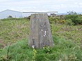 Ordnance Survey Trig Pillar S5813 - geograph.org.uk - 3486116.jpg 4,000 × 3,000; 3.84 MB
-
-

-

-
 Penbryn - geograph.org.uk - 6023671.jpg 2,304 × 1,728; 1.93 MB
-
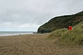 Penbryn Beach looking northeast - geograph.org.uk - 2679551.jpg 3,072 × 2,048; 1.18 MB
-
 Penbryn Beach looking west - geograph.org.uk - 2679544.jpg 3,072 × 2,048; 1.16 MB
-
 Penbryn Beach Road and Phone Box - geograph.org.uk - 470137.jpg 640 × 480; 106 KB
-
 Penbryn beach taken from Wales coastal path - geograph.org.uk - 4960096.jpg 2,048 × 1,536; 691 KB
-
 Penbryn beach, Ceredigion, Wales - geograph.org.uk - 37156.jpg 640 × 479; 61 KB
-
 Penbryn18.jpg 300 × 225; 18 KB
-

-

-
 Road junction north of Aberbarre Bridge - geograph.org.uk - 5504101.jpg 4,608 × 3,456; 4.04 MB
-
 Road to Brynhoffnant - geograph.org.uk - 6398944.jpg 5,184 × 3,456; 6.76 MB
-

-
 Rocky islet on the Ceredigion coast - geograph.org.uk - 2662109.jpg 640 × 480; 36 KB
-
 Run aground boat in Ceredigion - geograph.org.uk - 2661793.jpg 640 × 480; 148 KB
-
 Sea cave in Carreg-y-Ty - geograph.org.uk - 2622179.jpg 4,000 × 3,000; 2.1 MB
-
 Sea cave, Traeth Penbryn - geograph.org.uk - 2118901.jpg 640 × 480; 80 KB
-

-

-
 Small islet off the Ceredigion coast - geograph.org.uk - 2662668.jpg 640 × 480; 57 KB
-
 Small quarry near Tal-sarn, Penbryn - geograph.org.uk - 986033.jpg 640 × 461; 128 KB
-
 Staggered crossroads at Bwlchcrwys - geograph.org.uk - 791242.jpg 640 × 480; 64 KB
-
 Start of track from Penbryn to clifftop - geograph.org.uk - 6399220.jpg 5,179 × 3,451; 5.81 MB
-
 Steep lane south of Llanborth - geograph.org.uk - 2679518.jpg 3,648 × 2,588; 2.3 MB
-
 Stone stile near Penmorfa - geograph.org.uk - 953484.jpg 640 × 426; 135 KB
-
 Sunshine on a cove near Llangrannog - geograph.org.uk - 3076169.jpg 640 × 480; 71 KB
-
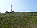 Telecommunications mast near the Wales Coast Path - geograph.org.uk - 6023168.jpg 2,304 × 1,728; 1.98 MB
-
 The Ceredigion coast near Penbryn - geograph.org.uk - 2662033.jpg 640 × 480; 71 KB
-
 The Plwmp Tart^ - geograph.org.uk - 5330500.jpg 3,852 × 5,782; 3.12 MB
-
 The Wales Coast Path - geograph.org.uk - 6023043.jpg 1,728 × 2,304; 1.75 MB
-
 The Wales Coast Path - geograph.org.uk - 6023154.jpg 2,304 × 1,728; 1.62 MB
-
 The Wales Coast Path - geograph.org.uk - 6023155.jpg 1,728 × 2,304; 1.81 MB
-
 The Wales Coast Path - geograph.org.uk - 6024287.jpg 1,728 × 2,304; 1.53 MB
-
 The Wales Coast Path passes a Caravan Park near Aberporth - geograph.org.uk - 6024956.jpg 2,304 × 1,728; 1.89 MB
-
 The walk to Penbryn - geograph.org.uk - 2580172.jpg 2,048 × 1,536; 2.27 MB
-
 The Welsh Coast Path - geograph.org.uk - 6023660.jpg 2,304 × 1,728; 1.8 MB
-
 Traeth Penbryn - geograph.org.uk - 2118911.jpg 640 × 481; 78 KB
-
 Traeth Penbryn - geograph.org.uk - 2118914.jpg 640 × 481; 87 KB
-
 Traeth Penbryn - geograph.org.uk - 2118924.jpg 640 × 481; 72 KB
-
 Traeth Penbryn Beach - geograph.org.uk - 6023675.jpg 2,304 × 1,728; 1.75 MB
-
 Traeth Penbryn from a Cave on the Beach (geograph 6896421).jpg 3,146 × 1,404; 1.32 MB
-
 Tresaith beach - geograph.org.uk - 6493142.jpg 1,280 × 853; 703 KB
-
 Tresaith waterfall - geograph.org.uk - 6305309.jpg 5,184 × 3,888; 4.2 MB
-
 Uwchlaw - Above Carreg y Gwylan - geograph.org.uk - 4122305.jpg 640 × 480; 66 KB
-

-
-
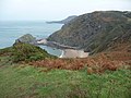
 Wales Ceredigion Community Penbryn map.svg 512 × 428; 788 KB
-
 Wales Coast Path - geograph.org.uk - 6022524.jpg 1,728 × 2,304; 1.85 MB
-
 Wales Coast Path - geograph.org.uk - 6023001.jpg 2,304 × 1,728; 1.77 MB
-
 Wales Coast Path - geograph.org.uk - 6024917.jpg 2,304 × 1,728; 1.67 MB
-
 Wales Coast Path - geograph.org.uk - 6024918.jpg 1,728 × 2,304; 1.83 MB
-
 Wales Coast Path - geograph.org.uk - 6024921.jpg 1,728 × 2,304; 1.84 MB
-
 Wales Coast Path south of Llangrannog - geograph.org.uk - 6023019.jpg 2,304 × 1,728; 1.67 MB
-
-
 Waterfall, Hoffnant, Penbryn - geograph.org.uk - 6398961.jpg 5,179 × 3,451; 5.79 MB
-
 Buildings at Castell Pridd - geograph.org.uk - 531381.jpg 640 × 492; 97 KB
-
 Zigzagging down the hillside towards Traeth Bach - geograph.org.uk - 6023023.jpg 2,304 × 1,728; 1.78 MB
-
 Llanborth - geograph.org.uk - 25371.jpg 640 × 480; 61 KB
-
 Lunch-time lay-by on the coast road - geograph.org.uk - 577663.jpg 640 × 480; 66 KB
-
 Penbryn Beach from coastal path - geograph.org.uk - 629983.jpg 640 × 429; 59 KB
-
 Penbryn Beach Road and Ty yr Odyn - geograph.org.uk - 470130.jpg 640 × 480; 115 KB
-
 Start of bridleway into the mist - geograph.org.uk - 577635.jpg 640 × 480; 88 KB
.jpg)


.jpg)


