Category:Pendlebury
Jump to navigation
Jump to search
English: Pendlebury is situated in the Salford City Council ward of Pendlebury in the City of Salford
town in the City of Salford, in Greater Manchester, England  | |||||
| Upload media | |||||
| Instance of | |||||
|---|---|---|---|---|---|
| Location | Salford, Greater Manchester, North West England, England | ||||
 | |||||
Subcategories
This category has the following 10 subcategories, out of 10 total.
A
- Agecroft Colliery (3 F)
- Agecroft Hall, Lancashire (10 F)
B
P
- Pendlebury War Memorial (1 F)
S
- Swinton and Pendlebury (7 F)
T
Media in category "Pendlebury"
The following 103 files are in this category, out of 103 total.
-
 117 Station Road, Pendlebury.jpg 1,731 × 2,364; 1.4 MB
-
 7 Torkington Avenue, Newtown - geograph.org.uk - 2915522.jpg 640 × 412; 63 KB
-
 A bridge over the River Irwell seen from Drinkwater Park - geograph.org.uk - 4346934.jpg 4,488 × 2,986; 6.9 MB
-
 A fingerpost - geograph.org.uk - 5189638.jpg 2,939 × 4,416; 6.45 MB
-
 A pylon in Forest Bank Park - geograph.org.uk - 4346957.jpg 4,592 × 3,056; 6.79 MB
-
 A6044 Agecroft Road - geograph.org.uk - 5213680.jpg 640 × 513; 40 KB
-
 A666 Bolton Road - geograph.org.uk - 5213682.jpg 640 × 513; 87 KB
-
 Across the Irwell - geograph.org.uk - 6392569.jpg 3,939 × 2,954; 3.05 MB
-
 Agecroft Bridge - geograph.org.uk - 1773938.jpg 2,816 × 2,112; 2.02 MB
-
 Agecroft Bridge over the River Irwell - geograph.org.uk - 4388904.jpg 1,600 × 1,200; 951 KB
-
 Agecroft Community Fire Station - geograph.org.uk - 4339714.jpg 4,630 × 2,911; 1.98 MB
-
 Agecroft fire station - geograph.org.uk - 607168.jpg 640 × 427; 183 KB
-
 Agecroft Road - geograph.org.uk - 1773934.jpg 2,592 × 1,944; 1,006 KB
-
 Agecroft Road - geograph.org.uk - 49702.jpg 640 × 480; 77 KB
-
 Agecroft Road - geograph.org.uk - 6392574.jpg 4,000 × 3,000; 3.31 MB
-
 Agecroft Road, Pendlebury - geograph.org.uk - 1381032.jpg 640 × 480; 181 KB
-
 Agecroftclubhouse.jpg 300 × 212; 57 KB
-
 An overgrown car park - geograph.org.uk - 5910301.jpg 1,280 × 960; 1.65 MB
-
 Bilash - geograph.org.uk - 4339709.jpg 5,184 × 3,131; 1.87 MB
-
 Bolton Road at the top of Agecroft Road - geograph.org.uk - 3151567.jpg 3,872 × 2,592; 3.28 MB
-
 Bolton Road passing Rivington Crescent - geograph.org.uk - 3151559.jpg 3,872 × 2,592; 2.12 MB
-
 Bolton Road, Pendlebury, Looking North - geograph.org.uk - 1381040.jpg 640 × 480; 156 KB
-

-
 Brindleheath Cemetery - geograph.org.uk - 362669.jpg 640 × 480; 154 KB
-
 Broomhall Road, Pendlebury - geograph.org.uk - 1381039.jpg 640 × 480; 139 KB
-
 Broomhall Road, Pendlebury - geograph.org.uk - 3150021.jpg 3,872 × 2,592; 3.33 MB
-
 Charles Street - geograph.org.uk - 4339721.jpg 4,353 × 3,456; 1.6 MB
-
 Clifton Hall Colliery - geograph.org.uk - 5568460.jpg 5,184 × 3,456; 1.68 MB
-
 Clifton Hall Colliery disaster memorial.JPG 1,536 × 2,048; 2.14 MB
-
 Clifton Junction - geograph.org.uk - 5093045.jpg 5,184 × 3,456; 1.92 MB
-
 Cliveley Road - geograph.org.uk - 5568457.jpg 5,184 × 3,456; 1.74 MB
-
 Clively Avenue, Pendlebury - geograph.org.uk - 2919870.jpg 640 × 480; 118 KB
-
 Cobden Street - geograph.org.uk - 2283838.jpg 800 × 600; 238 KB
-
 Cobden Street Civic Amenity Site - geograph.org.uk - 3204746.jpg 640 × 458; 71 KB
-
 Cussons Soap factory - geograph.org.uk - 6513124.jpg 4,032 × 3,024; 1.77 MB
-
 Cut mark with bolt - geograph.org.uk - 3155467.jpg 640 × 425; 374 KB
-
 Demolished buildings, Pendlebury - geograph.org.uk - 2601183.jpg 627 × 640; 81 KB
-
 Doveleys Road - geograph.org.uk - 6194466.jpg 1,280 × 1,210; 993 KB
-
 Ethel Street Pendlebury - geograph.org.uk - 2318010.jpg 640 × 480; 56 KB
-
 Falcon Crescent - geograph.org.uk - 4254274.jpg 3,888 × 2,520; 1.59 MB
-
 Farmland near Clifton Junction - geograph.org.uk - 3381763.jpg 640 × 530; 98 KB
-
 Flats, Pendlebury - geograph.org.uk - 3381758.jpg 640 × 525; 93 KB
-
 Footbridge over R Irwell W of Drinkwater Park, Rainsough - geograph.org.uk - 6014683.jpg 5,184 × 2,920; 6.79 MB
-
 Footbridge over R Irwell, Salford, NE of Britannia St - geograph.org.uk - 6014661.jpg 5,184 × 2,920; 5.98 MB
-
 Footbridge over the A6 underpass - geograph.org.uk - 2063160.jpg 3,872 × 2,592; 4.12 MB
-
 Footbridge over the River Irwell - geograph.org.uk - 4388905.jpg 1,600 × 1,200; 612 KB
-
 Footbridge over the River Irwell to Forest Bank Park - geograph.org.uk - 4347585.jpg 4,386 × 2,918; 7.23 MB
-
 Footpath, Livia, Silverdale - geograph.org.uk - 4347069.jpg 4,526 × 2,981; 7.92 MB
-
 Geoff Bent headstone.JPG 960 × 1,280; 1.19 MB
-
 Giant hogweed, LIVIA Forest Park, Clifton Jct - geograph.org.uk - 6014688.jpg 5,184 × 2,920; 6.8 MB
-
 Harbinger of Spring - geograph.org.uk - 6392905.jpg 4,000 × 3,000; 4.83 MB
-
 Hogg's Bridge - geograph.org.uk - 5092391.jpg 5,184 × 3,456; 1.94 MB
-
 Junction of Agecroft Road at Rainsough Brow - geograph.org.uk - 1876538.jpg 4,224 × 2,816; 5.45 MB
-
 Kersal Avenue off Bolton Road - geograph.org.uk - 2585545.jpg 800 × 600; 256 KB
-
 Kilcoby Avenue from Agecroft Road - geograph.org.uk - 5213681.jpg 640 × 480; 55 KB
-
 Labtec Street from Bolton Road - geograph.org.uk - 5213683.jpg 640 × 480; 47 KB
-
 Little remains of the soap factory - geograph.org.uk - 4388903.jpg 1,600 × 1,200; 480 KB
-
 Lumn's Lane - Pendlebury - geograph.org.uk - 2318053.jpg 640 × 480; 40 KB
-
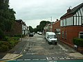
 Manchester Road (A6), Pendlebury - geograph.org.uk - 2109998.jpg 640 × 480; 135 KB
-
 Melksham Close, Salford - geograph.org.uk - 5724353.jpg 3,840 × 2,160; 2.21 MB
-
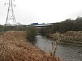 Motorway bridge over the River Irwell near Clifton - geograph.org.uk - 4390621.jpg 1,600 × 1,200; 597 KB
-
 New Barton Street, Irlam o'th' Heights - geograph.org.uk - 5496237.jpg 3,840 × 2,160; 3.19 MB
-
 New Street off Bolton Road - geograph.org.uk - 2585550.jpg 800 × 600; 250 KB
-
 Outwood Trail - geograph.org.uk - 115250.jpg 640 × 480; 101 KB
-
 Park Street, Pendlebury - geograph.org.uk - 3150057.jpg 3,872 × 2,592; 2.89 MB
-
 Path by the River Irwell - geograph.org.uk - 4743534.jpg 1,024 × 576; 197 KB
-
 Path junction, LIVIA, Silverdale - geograph.org.uk - 4672524.jpg 1,600 × 900; 569 KB
-

-
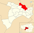 Pendlebury (Salford City Council ward).png 2,000 × 1,902; 302 KB
-
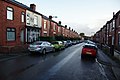
 Pendlebury - geograph.org.uk - 4254300.jpg 3,888 × 1,732; 1.49 MB
-
Pendlebury Colliery (1901).webm 5 min 24 s, 960 × 720; 50.85 MB
-
 Pendlebury from the air - geograph.org.uk - 4248054.jpg 640 × 480; 191 KB
-
 Pendlebury Social Club - geograph.org.uk - 2429780.jpg 1,024 × 623; 98 KB
-
 Pendleton Bowling and Social Club - geograph.org.uk - 6216409.jpg 5,438 × 3,534; 1.85 MB
-
 Pilkington Tile Works - geograph.org.uk - 5323723.jpg 1,600 × 1,058; 280 KB
-
 Pilkington's Tiles - geograph.org.uk - 6189983.jpg 3,958 × 4,271; 1.71 MB
-

-
 Railway Bridge, Agecroft Road - geograph.org.uk - 1775941.jpg 2,816 × 2,112; 1.16 MB
-

-
 River Irwell - geograph.org.uk - 4254285.jpg 3,888 × 2,277; 1.48 MB
-
 River Irwell - geograph.org.uk - 46887.jpg 640 × 480; 71 KB
-
 River Irwell - geograph.org.uk - 5093043.jpg 4,527 × 2,920; 1.71 MB
-
 River Irwell - geograph.org.uk - 6189975.jpg 4,000 × 5,696; 2.03 MB
-
 Riverside - geograph.org.uk - 4254284.jpg 3,780 × 1,932; 1.76 MB
-
 Rivington Avenue, Pendlebury - geograph.org.uk - 4743659.jpg 1,024 × 576; 133 KB
-

-
 Roundabout marking the entrance to Agecroft Enterprise Park - geograph.org.uk - 4346919.jpg 4,494 × 2,466; 5.56 MB
-
 Site of former factory - geograph.org.uk - 5910316.jpg 1,280 × 960; 1.29 MB
-
 Slip road to everywhere - geograph.org.uk - 5714685.jpg 1,280 × 960; 1.3 MB
-
 Sports Field - geograph.org.uk - 6488699.jpg 4,011 × 2,507; 1.73 MB
-
 Stapleton Street - geograph.org.uk - 5714694.jpg 1,280 × 897; 783 KB
-

-
 Swinton and Pendlebury from the air - geograph.org.uk - 4248022.jpg 640 × 480; 157 KB
-
 Tallyman Way, Agecroft, Greater Manchester - geograph.org.uk - 2429773.jpg 1,024 × 728; 113 KB
-
 The banks of the River Irwell - geograph.org.uk - 2780194.jpg 3,872 × 2,592; 6.99 MB
-
 The path heads for a tunnel under the railway - geograph.org.uk - 4347629.jpg 4,444 × 2,958; 6.03 MB
-
 The River Irwell - geograph.org.uk - 4347445.jpg 4,592 × 3,056; 7.02 MB
-
 The Windmill Hotel - geograph.org.uk - 2585563.jpg 600 × 800; 223 KB
-
 Trinity Point - geograph.org.uk - 5190528.jpg 5,183 × 2,526; 1.66 MB
-
 Underpass - geograph.org.uk - 5093047.jpg 4,448 × 3,363; 2.01 MB
-
 Underpass - geograph.org.uk - 6513118.jpg 4,000 × 2,855; 1.7 MB
-
 Wedgwood Road, Pendlebury - geograph.org.uk - 2919874.jpg 640 × 480; 128 KB
-
 Woodland, Clifton Green - geograph.org.uk - 3381765.jpg 640 × 440; 79 KB


,_Pendlebury_-_geograph.org.uk_-_2109998.jpg)


.png)


