Category:Penrhyndeudraeth
Jump to navigation
Jump to search
town in Gwynedd, Wales  | |||||
| Upload media | |||||
| Instance of | |||||
|---|---|---|---|---|---|
| Location | Gwynedd, Wales | ||||
 | |||||
Cymraeg: Pentref ar arfordir gogledd eithaf Meirionnydd (de Gwynedd) yw Penrhyndeudraeth gyda'r Traeth Mawr a'r Traeth Bach ar y naill ochr iddo gydag Afon Glaslyn yn ei wahanu oddi wrth Eifionydd a'r hen Sir Gaernarfon. Yn wreiddiol, roedd y pentref mewn dau blwyf, sef plwyfi Llanfrothen a Llandecwyn a hynny cyn i'r plwyf newydd gael ei greu ym 1859.
Deutsch: Penrhyndeudraeth (Landzunge mit zwei Stränden auf Walisisch) ist eine Ortschaft mit 1500 Einwohnern in Gwynedd, Wales, in der Nähe des River Dwyryd.
English: Penrhyndeudraeth , the estuary of the Afon Dwyryd. The village is close to the mouth of the Afon Dwyryd on the A487 from Porthmadog, and has a population of 2,031.
Magyar: Penrhyndeudraeth egy település Walesben, az Egyesült Királyságban. Nevének jelentése: „hegyfok a két folyótorkolatnál”. Népessége 1858 fő.
Italiano: Penrhyndeudraeth è un villaggio presso Gwynedd, nel Galles, Regno Unito. È situato vicino al fiume Dwyryd e vicino alla Strada A487.
Svenska: Penrhyndeudraeth är ett samhälle i Gwynedd i Wales i Storbritannien. Namnet betyder halvö med två stränder.
Subcategories
This category has the following 9 subcategories, out of 9 total.
B
C
H
M
P
- Penrhyn railway station (25 F)
- Penrhyndeudraeth F.C. (7 F)
- Penrhyndeudraeth railway station (12 F)
Media in category "Penrhyndeudraeth"
The following 200 files are in this category, out of 901 total.
(previous page) (next page)-
 "Aren't you too young to be out alone" - geograph.org.uk - 1841021.jpg 3,872 × 2,592; 2.86 MB
-
 "Follow me, kids" - geograph.org.uk - 1841017.jpg 3,872 × 2,592; 4.66 MB
-
 "Model T" Ford, Gwyndy Bank, Minffordd, Gwynedd - geograph.org.uk - 1840811.jpg 3,872 × 2,592; 6.3 MB
-
 "Model T" Ford, Gwyndy Bank, Minffordd, Gwynedd - geograph.org.uk - 1840819.jpg 3,872 × 2,592; 5.14 MB
-
 "What are you doing in MY field" - geograph.org.uk - 1841288.jpg 3,872 × 2,592; 5.05 MB
-
 "William Riley" Arrives at Porthmadog, Gwynedd - geograph.org.uk - 1840746.jpg 3,872 × 2,592; 4.89 MB
-
 "William Riley" Arrives at Porthmadog, Gwynedd - geograph.org.uk - 1840760.jpg 3,872 × 2,592; 4.7 MB
-
 'David Lloyd George' at Penrhyn - geograph.org.uk - 6224550.jpg 3,576 × 2,384; 7.77 MB
-
 'David Lloyd George' on The Cob - geograph.org.uk - 6224267.jpg 3,720 × 2,480; 7.79 MB
-
 'Lyd' at Cei Mawr - geograph.org.uk - 3097145.jpg 4,275 × 3,000; 6.4 MB
-
 'Lyd' at Cei Mawr - geograph.org.uk - 6224587.jpg 3,732 × 2,487; 7.71 MB
-
 'Lyd' at Penrhyn - geograph.org.uk - 6224541.jpg 3,960 × 2,640; 7.71 MB
-
 'Lyd' at Penrhyn - geograph.org.uk - 6224547.jpg 3,778 × 2,519; 7.64 MB
-
 'Lyd' on Cei Mawr, Gwynedd - geograph.org.uk - 3100679.jpg 4,500 × 3,000; 7.85 MB
-
 'Lyd' on The Cob - geograph.org.uk - 6224272.jpg 4,020 × 2,680; 7.7 MB
-
 'Snowdonia Business Park' - geograph.org.uk - 4774983.jpg 480 × 640; 212 KB
-
 1830s wrought iron rails at Boston Lodge Works - geograph.org.uk - 4533985.jpg 1,024 × 768; 203 KB
-
 50 shades of blue - geograph.org.uk - 3199282.jpg 640 × 436; 49 KB
-
 A pseudo petrol pump - geograph.org.uk - 4472720.jpg 480 × 640; 73 KB
-
 A pylon by the Dwyryd Estuary - geograph.org.uk - 4775007.jpg 640 × 480; 88 KB
-
 A seat to rest a while - geograph.org.uk - 6085172.jpg 3,771 × 2,829; 3.46 MB
-
 A train for Pwllheli departing from Minffordd - geograph.org.uk - 6006539.jpg 1,024 × 576; 419 KB
-
 A train on The Cob - geograph.org.uk - 5537248.jpg 4,915 × 3,149; 5.21 MB
-
 A train on the Cob - geograph.org.uk - 6132883.jpg 1,024 × 576; 327 KB
-
 A tree just asking to be climbed - geograph.org.uk - 6081809.jpg 3,000 × 4,000; 2.59 MB
-

-

-
 A view towards Snowdon from Minffordd - geograph.org.uk - 5604026.jpg 640 × 480; 149 KB
-
 A way down to the beach - geograph.org.uk - 5537283.jpg 6,000 × 4,000; 7.66 MB
-
 A4085 in Penrhyndeudraeth - geograph.org.uk - 4599879.jpg 640 × 428; 96 KB
-

-
 Aberglaslyn Estuary, Boston Lodge, Gwynedd - geograph.org.uk - 3362727.jpg 4,000 × 2,213; 5.4 MB
-
 Above the Piazza at Portmeirion - geograph.org.uk - 4474673.jpg 640 × 480; 118 KB
-

-

-
 Across the Afon Dwyryd, Gwynedd - geograph.org.uk - 3364760.jpg 4,000 × 2,666; 5.72 MB
-
 Across the Dipping Pond (1) - geograph.org.uk - 3101550.jpg 3,600 × 2,400; 7.59 MB
-
 Across the Dipping Pond (2) - geograph.org.uk - 3101562.jpg 4,800 × 3,200; 5.54 MB
-
 Across the estuary from Boston Lodge - geograph.org.uk - 3199267.jpg 640 × 420; 55 KB
-
 Across the estuary towards Penrhyn - geograph.org.uk - 3205846.jpg 640 × 414; 58 KB
-
 Across the river from A496 - geograph.org.uk - 3699173.jpg 640 × 480; 52 KB
-
 Afon Dwyryd - geograph.org.uk - 3884590.jpg 3,264 × 2,448; 3.42 MB
-
 Afon Dwyryd - geograph.org.uk - 4600760.jpg 640 × 428; 81 KB
-
 Afon Dwyryd at Pont Brewit - geograph.org.uk - 4967155.jpg 4,608 × 3,456; 5.28 MB
-
 Afon Dwyryd Estuary at Portmeirion - geograph.org.uk - 4339193.jpg 4,072 × 3,054; 2.57 MB
-
 Afon Dwyryd Estuary at Portmeirion - geograph.org.uk - 4339574.jpg 4,072 × 3,054; 3.01 MB
-
 Afon Dwyryd Estuary at Portmeirion - geograph.org.uk - 4339576.jpg 3,072 × 2,304; 1.14 MB
-
 Afon Dwyryd estuary from Portmeirion - geograph.org.uk - 4799634.jpg 1,024 × 768; 121 KB
-
 Afon Dwyryd estuary near Penrhyndeudraeth - geograph.org.uk - 1916070.jpg 1,600 × 831; 229 KB
-
 Afon Dwyryd Estuary, Penrhyndeudraeth, Gwynedd - geograph.org.uk - 2108277.jpg 4,592 × 3,056; 7.72 MB
-
 Afon Dwyryd Estuary, Penrhyndeudraeth, Gwynedd - geograph.org.uk - 2108292.jpg 3,600 × 2,395; 2.73 MB
-
 Afon Dwyryd Estuary, Portmeirion - geograph.org.uk - 2371432.jpg 1,024 × 683; 270 KB
-
 Afon Dwyryd from near Bridge House - geograph.org.uk - 5509265.jpg 640 × 427; 99 KB
-
 Afon Dwyryd from Pont Briwet - geograph.org.uk - 2884645.jpg 3,872 × 2,592; 3.01 MB
-
 Afon Dwyryd from railway bridge - geograph.org.uk - 3205837.jpg 640 × 480; 55 KB
-
 Afon Glaslyn - geograph.org.uk - 4600171.jpg 640 × 428; 76 KB
-
 Afon Glaslyn and Traeth Mawr - geograph.org.uk - 6006974.jpg 1,024 × 576; 295 KB
-
 Afon Glaslyn at Portmeirion - geograph.org.uk - 4206805.jpg 1,024 × 768; 126 KB
-
 Afon Glaslyn estuary from the Ffestiniog Railway (8132).jpg 4,288 × 2,848; 4.78 MB
-
 Afon Glaslyn estuary from the Ffestiniog Railway (8133).jpg 4,288 × 2,848; 4.71 MB
-
 Afon Glaslyn estuary from the Ffestiniog Railway (8136).jpg 4,288 × 2,848; 4.68 MB
-
 Afon Glaslyn estuary from the Ffestiniog Railway (8137).jpg 4,288 × 2,848; 4.48 MB
-
 Afon Glaslyn estuary from the Ffestiniog Railway (8138).jpg 4,288 × 2,848; 6.1 MB
-
 Afon Glaslyn estuary from the Ffestiniog Railway (8140).jpg 4,288 × 2,848; 5.34 MB
-
 Afon Glaslyn estuary from the Ffestiniog Railway (8142).jpg 4,288 × 2,848; 5.74 MB
-
 Afon Glaslyn estuary from the Ffestiniog Railway (8146).jpg 4,288 × 2,848; 5.07 MB
-
 Afon Glaslyn estuary from the Ffestiniog Railway (8147).jpg 4,288 × 2,848; 4.95 MB
-
 Afon Glaslyn estuary from the Ffestiniog Railway (8358).jpg 4,288 × 2,848; 4.88 MB
-
 Afon Glaslyn estuary from the Ffestiniog Railway (8360).jpg 4,288 × 2,848; 6.09 MB
-
 Afon Glaslyn estuary from the Ffestiniog Railway (8362).jpg 4,288 × 2,848; 5.59 MB
-
 Afon Glaslyn estuary from the Ffestiniog Railway (8364).jpg 4,288 × 2,848; 6.26 MB
-

-
 Afon Glaslyn viewed from the Cob - geograph.org.uk - 5605304.jpg 640 × 480; 152 KB
-
 Alarch dof (mute swan), Glaslyn estuary - geograph.org.uk - 4533244.jpg 1,024 × 768; 131 KB
-
 Along the Bridleway, Portmeirion, Gwynedd - geograph.org.uk - 3362603.jpg 4,000 × 2,666; 7.06 MB
-
 Along the Bridleway, Portmeirion, Gwynedd - geograph.org.uk - 3362638.jpg 4,000 × 2,666; 7.11 MB
-
 Along the Bridleway, Portmeirion, Gwynedd - geograph.org.uk - 3362643.jpg 4,000 × 2,666; 7.32 MB
-
 Along the Bridleway, Portmeirion, Gwynedd - geograph.org.uk - 3362648.jpg 4,000 × 2,666; 7.36 MB
-
 Along the Lane at Penrhyndeudraeth, Gwynedd - geograph.org.uk - 2114755.jpg 4,592 × 3,056; 4.72 MB
-
 Amis Reunis (view from the Stone Boat) - geograph.org.uk - 4339233.jpg 4,072 × 3,054; 2.5 MB
-

-
 Archway - geograph.org.uk - 3235459.jpg 425 × 640; 532 KB
-
 Bare trees at Minffordd - geograph.org.uk - 6006594.jpg 1,024 × 769; 480 KB
-
 Beach near Portmeirion - geograph.org.uk - 2597137.jpg 2,816 × 2,112; 1.33 MB
-
 Beach on the estuary of the Afon Dwyryd - geograph.org.uk - 6249271.jpg 2,000 × 1,470; 2.07 MB
-
 Beach west of Portmeirion - geograph.org.uk - 3582684.jpg 1,024 × 681; 143 KB
-
 Beach west of Portmeirion - geograph.org.uk - 3582688.jpg 1,024 × 681; 157 KB
-
 Beach, Portmeirion - geograph.org.uk - 2365948.jpg 1,024 × 683; 300 KB
-
 Beach, Portmeirion - geograph.org.uk - 2366007.jpg 1,024 × 683; 461 KB
-
 Beach, Portmeirion - geograph.org.uk - 2366683.jpg 1,024 × 683; 403 KB
-
 Belfast Store - geograph.org.uk - 2756426.jpg 2,592 × 1,944; 1.36 MB
-
 Bench above Traeth Bach - geograph.org.uk - 5537347.jpg 6,000 × 4,000; 6.78 MB
-
 Bends in the channels at low tide - geograph.org.uk - 3198811.jpg 640 × 427; 77 KB
-

-
 Beneath the bridge over Minffordd station - geograph.org.uk - 6006550.jpg 1,024 × 576; 378 KB
-
 Beneath the bridge over Minffordd station - geograph.org.uk - 6006556.jpg 1,024 × 576; 401 KB
-
 Berthen Gron, Penrhyndeudraeth NLW3363902.jpg 596 × 429; 51 KB
-

-

-
 Bont Briwet Completed - geograph.org.uk - 4567762.jpg 640 × 417; 79 KB
-
 Boots—boots—boots—boots - geograph.org.uk - 3703701.jpg 4,000 × 2,250; 7.48 MB
-
 Borth-y-Gest from Penrhyn-isaf - geograph.org.uk - 6223947.jpg 5,760 × 2,880; 7.65 MB
-
 Boston Lodge - geograph.org.uk - 4600755.jpg 640 × 428; 86 KB
-
 Boston Lodge Construction Work - geograph.org.uk - 6082897.jpg 1,024 × 683; 220 KB
-
 Boston Lodge Halt - geograph.org.uk - 6128589.jpg 1,024 × 684; 197 KB
-
 Boston Lodge Halt - geograph.org.uk - 6233102.jpg 1,024 × 674; 209 KB
-
 Boston Lodge, Ffestiniog Railway - geograph.org.uk - 6006957.jpg 1,024 × 576; 403 KB
-
 Boston Lodge, Gwynedd - geograph.org.uk - 3366806.jpg 4,000 × 2,666; 6.68 MB
-
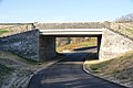 Bridge carrying the Porthmadog bypass - geograph.org.uk - 2901630.jpg 3,872 × 2,592; 4.22 MB
-
 Bridge House, Portmeirion - geograph.org.uk - 6248951.jpg 1,366 × 2,000; 2.39 MB
-
 Bridge reflection at Portmeirion - geograph.org.uk - 4094294.jpg 800 × 519; 201 KB
-
 Bridges over Porthmadog bypass - geograph.org.uk - 5505092.jpg 640 × 360; 63 KB
-
 Bridleway by Boston Lodge Halt - geograph.org.uk - 2901829.jpg 3,872 × 2,592; 5.71 MB
-
 Britannia Terrace heading into Boston Lodge - geograph.org.uk - 5219015.jpg 1,500 × 999; 275 KB
-

-
 Bron Meirion Surgery, Penrhyndeudraeth - geograph.org.uk - 6085337.jpg 4,000 × 3,000; 2.3 MB
-
 Bron-y-Garth Hospital - geograph.org.uk - 6085242.jpg 4,000 × 3,000; 2.55 MB
-
 Bronze Bust of Clough Williams-Ellis - geograph.org.uk - 4339600.jpg 4,072 × 3,054; 2.59 MB
-
 Building at former explosives works - geograph.org.uk - 3781442.jpg 1,000 × 663; 186 KB
-

-
 Building on "down" platform at Minffordd Station - geograph.org.uk - 6142075.jpg 1,024 × 768; 150 KB
-
 By pass close to entrance to quarry - geograph.org.uk - 3204535.jpg 640 × 342; 42 KB
-
 Cae Du Farm near Penrhyndeudraeth, Gwynedd 01.jpg 2,725 × 4,089; 1.94 MB
-
 Cae Du Farm near Penrhyndeudraeth, Gwynedd 02.jpg 4,272 × 2,848; 5.85 MB
-
 Cae Du Farm near Penrhyndeudraeth, Gwynedd 03.jpg 2,848 × 4,272; 4.37 MB
-
 Cambrian Line - geograph.org.uk - 4600150.jpg 640 × 428; 103 KB
-
 Cannons to the left of me cannons to the right - geograph.org.uk - 4799673.jpg 1,024 × 768; 136 KB
-
 Capel Fron - geograph.org.uk - 3532569.jpg 640 × 470; 78 KB
-
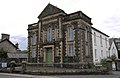
 Capel Fron Evangelical Church - geograph.org.uk - 2895199.jpg 3,872 × 2,592; 4.12 MB
-
 Capel Fron near Penrhyn Station - geograph.org.uk - 2598649.jpg 2,816 × 2,112; 2.02 MB
-
 Capel Fron, Eglwys Efengylaidd - geograph.org.uk - 3111623.jpg 4,000 × 3,000; 3.6 MB
-
 Capel Fron, Penrhyndeudraeth - geograph.org.uk - 4130666.jpg 640 × 413; 74 KB
-
 Capel Fron, Penrhyndeudraeth, Gwynedd - geograph.org.uk - 2629883.jpg 3,306 × 2,200; 7.28 MB
-
 Capel Gorffwysfa, Penrhyndeudraeth - geograph.org.uk - 4130614.jpg 640 × 414; 63 KB
-
 Capel Gorphwysfa - geograph.org.uk - 6175775.jpg 1,024 × 713; 215 KB
-

-
 Car park Minffordd Station - geograph.org.uk - 3111444.jpg 4,000 × 3,000; 4.08 MB
-
 Careg-y-ro, Ynys - geograph.org.uk - 3582668.jpg 1,024 × 682; 204 KB
-
 Castell Deudraeth - geograph.org.uk - 4170176.jpg 640 × 480; 58 KB
-
 Castell Deudraeth - geograph.org.uk - 4206796.jpg 1,024 × 768; 173 KB
-
 Castell Deudraeth garden - geograph.org.uk - 4170175.jpg 640 × 480; 100 KB
-
 Castelldeudraeth - geograph.org.uk - 2870810.jpg 4,000 × 3,000; 3.53 MB
-
 Castelldeudraeth - geograph.org.uk - 2870812.jpg 4,000 × 3,000; 3.27 MB
-
 Castelldeudraeth - geograph.org.uk - 2870814.jpg 4,000 × 3,000; 3.46 MB
-
 Castelldeudraeth - geograph.org.uk - 3362657.jpg 640 × 480; 78 KB
-
 Castelldeudraeth - geograph.org.uk - 3739435.jpg 2,288 × 1,712; 926 KB
-
 Castelldeudraeth - geograph.org.uk - 5840605.jpg 1,600 × 1,200; 580 KB
-
 Caves at Trwynypenrhyn - geograph.org.uk - 6084919.jpg 4,000 × 3,000; 2.88 MB
-

-
 Cei Mawr, 1966 - geograph.org.uk - 2188722.jpg 640 × 428; 105 KB
-
 Cei Tyddyn Isaf Wharf on the Afon Dwyryd - geograph.org.uk - 5063107.jpg 640 × 427; 102 KB
-
 Cei Tyddyn Isaf Wharf, Afon Dwyryd - geograph.org.uk - 5063098.jpg 640 × 413; 113 KB
-
 Cemetery near Minffordd - geograph.org.uk - 2901685.jpg 3,872 × 2,592; 3.23 MB
-
 Centre of Portmeirion - geograph.org.uk - 4206801.jpg 1,024 × 768; 187 KB
-
 Cerdd - A Poem - geograph.org.uk - 575460.jpg 640 × 428; 187 KB
-
 Chapel beside Penrhyn station - geograph.org.uk - 5071523.jpg 640 × 427; 78 KB
-

-
 Churchyard, Holy Trinity Church - geograph.org.uk - 6085339.jpg 4,000 × 3,000; 3.05 MB
-
 Cnicht and the Moelwyns, Gwynedd - geograph.org.uk - 1842458.jpg 3,872 × 2,592; 3.81 MB
-
 Coin covered tree stump - geograph.org.uk - 3362835.jpg 640 × 480; 106 KB
-
 Coming and Going - geograph.org.uk - 3101516.jpg 4,800 × 3,200; 6.51 MB
-
 Comma Butterfly, Boston Lodge, Gwynedd - geograph.org.uk - 3365287.jpg 2,839 × 1,583; 4.32 MB
-
 Concrete yacht at Portmeirion - geograph.org.uk - 4798599.jpg 1,024 × 768; 111 KB
-
 Construction of A 487 Porthmadog Bypass - geograph.org.uk - 3189223.jpg 1,074 × 715; 199 KB
-
 Construction of the Porthmadog Bypass near Minffordd - geograph.org.uk - 2598410.jpg 2,816 × 2,112; 1.94 MB
-
 Construction work at Boston Lodge - geograph.org.uk - 5605317.jpg 640 × 480; 238 KB
-
 Converted chapel, Penrhyndeudraeth - geograph.org.uk - 1312194.jpg 480 × 640; 66 KB
-
 Cooke's Powder Works - geograph.org.uk - 5096551.jpg 640 × 428; 70 KB
-
 Corsydd Afon Glaslyn marshes - geograph.org.uk - 4533301.jpg 1,024 × 768; 163 KB
-
 Corsydd Afon Glaslyn marshes - geograph.org.uk - 4533321.jpg 1,024 × 768; 123 KB
-
 Countryside viewed from Ffestiniog Railway - geograph.org.uk - 2410397.jpg 1,024 × 768; 261 KB
-
 Cove on the coast of Portmeirion Gardens - geograph.org.uk - 4188123.jpg 3,648 × 2,736; 2.84 MB
-
 Cow and calves west of Lloc Meirig - geograph.org.uk - 4533649.jpg 1,024 × 614; 129 KB
-
 Cows in the estuary - geograph.org.uk - 4600192.jpg 640 × 428; 50 KB
-

-

-

-
 Crossing the estuary - geograph.org.uk - 1062819.jpg 640 × 478; 91 KB
-
 Cryptomeria japonica - geograph.org.uk - 6085165.jpg 3,000 × 4,000; 2.58 MB
-
 Cwt y Pendil Mawr - Pendulum Shed - geograph.org.uk - 4851258.jpg 640 × 450; 98 KB
-
 Cycle path to Porthmadog - geograph.org.uk - 2901837.jpg 3,872 × 2,592; 5.2 MB
-
 Cycleway across Y Cob - geograph.org.uk - 1983288.jpg 480 × 640; 113 KB
-
 Cycleway at Boston Lodge - geograph.org.uk - 1222736.jpg 480 × 640; 78 KB
-
 Cycleway, Road and Railway - geograph.org.uk - 1397219.jpg 640 × 426; 60 KB
-

-
 Dawn Over Penrhyndeudraeth, Gwynedd - geograph.org.uk - 2111993.jpg 3,872 × 2,592; 2.58 MB
-
 Defending the Watch House - geograph.org.uk - 3077528.jpg 640 × 480; 105 KB
-

-
 Departing from Minffordd - geograph.org.uk - 5602710.jpg 640 × 480; 192 KB
-
 Drainage near Ty Mawr farm - geograph.org.uk - 657460.jpg 640 × 480; 88 KB
-
 Dwyryd Estuary - geograph.org.uk - 1475067.jpg 640 × 425; 45 KB
-
 Dwyryd Estuary - geograph.org.uk - 259669.jpg 640 × 480; 92 KB
-
 Dwyryd Estuary - geograph.org.uk - 3102103.jpg 1,074 × 716; 171 KB
-
 Edward Sholto Coasts Down to Penrhyn, Gwynedd - geograph.org.uk - 1844357.jpg 2,032 × 1,360; 2.3 MB
-

-
 Entrance to Portmeirion - geograph.org.uk - 5537262.jpg 6,000 × 4,000; 5.28 MB
-
 Entrance to railway permanent way depot - geograph.org.uk - 1552437.jpg 640 × 426; 113 KB
-
 Eryri Business Parc, Penrhyndeudraeth - geograph.org.uk - 3463769.jpg 4,000 × 2,666; 7.57 MB
-
 Esso garage Penrhyndeudraeth - geograph.org.uk - 5505084.jpg 640 × 487; 49 KB
-
 Estuary from the railway - geograph.org.uk - 2465208.jpg 640 × 480; 77 KB


_-_geograph.org.uk_-_3101550.jpg)
_-_geograph.org.uk_-_3101562.jpg)


.jpg)
.jpg)
.jpg)
.jpg)
.jpg)
.jpg)
.jpg)
.jpg)
.jpg)
.jpg)
.jpg)
.jpg)
.jpg)


,_Glaslyn_estuary_-_geograph.org.uk_-_4533244.jpg)


_-_geograph.org.uk_-_4339233.jpg)


