Category:Pentrefoelas
Jump to navigation
Jump to search
village and community in Conwy County Borough, Wales, UK  | |||||
| Upload media | |||||
| Instance of | |||||
|---|---|---|---|---|---|
| Location | Conwy County Borough, Wales | ||||
| Population |
| ||||
| Area |
| ||||
 | |||||
Pentrefoelas, Conwy County Borough
Subcategories
This category has the following 4 subcategories, out of 4 total.
Media in category "Pentrefoelas"
The following 200 files are in this category, out of 264 total.
(previous page) (next page)-
 A small disused quarry by the A5 - geograph.org.uk - 3167324.jpg 640 × 430; 49 KB
-
 A small woodland , Cae Gwyn - geograph.org.uk - 3167275.jpg 640 × 430; 41 KB
-

-
 A5 - geograph.org.uk - 3163994.jpg 640 × 430; 53 KB
-
 A5 east of Pentrefoelas - geograph.org.uk - 4464089.jpg 640 × 480; 44 KB
-
 A5 eastbound at Cernioge Feathers - geograph.org.uk - 4464095.jpg 640 × 480; 62 KB
-
-
 A5 eastbound nears a hidden dip - geograph.org.uk - 4464093.jpg 640 × 479; 34 KB
-
 A5 heading to Glasfryn - geograph.org.uk - 3167332.jpg 640 × 430; 46 KB
-
 A5 leaving Pentrefoelas - geograph.org.uk - 3167232.jpg 640 × 430; 58 KB
-
 A5 near Rhydlydan - geograph.org.uk - 3167284.jpg 640 × 430; 44 KB
-
 A5, Brod-Cadnant - geograph.org.uk - 3163992.jpg 640 × 342; 62 KB
-
 A5, Cefn Rhyd - geograph.org.uk - 3167290.jpg 640 × 400; 41 KB
-
 A5, eastbound - geograph.org.uk - 3167249.jpg 640 × 430; 45 KB
-
 A5, eastbound - geograph.org.uk - 3167295.jpg 640 × 430; 56 KB
-
 A543 - geograph.org.uk - 3167236.jpg 640 × 430; 54 KB
-
 A543 at Turpeg Mynydd - geograph.org.uk - 6223195.jpg 1,600 × 1,167; 334 KB
-
 A543 below Bwlch Gwyn - geograph.org.uk - 4675440.jpg 6,000 × 4,000; 4.6 MB
-
 A543 near Cottage Bridge - geograph.org.uk - 6223197.jpg 1,600 × 1,065; 477 KB
-
 A543 towards Bylchau - geograph.org.uk - 6222735.jpg 1,600 × 1,130; 565 KB
-
 A543 towards Cottage Bridge - geograph.org.uk - 6223199.jpg 1,600 × 1,065; 563 KB
-
 Above the Merddwr valley - geograph.org.uk - 3117131.jpg 1,024 × 680; 247 KB
-
 Afon Alwen - geograph.org.uk - 5715087.jpg 640 × 480; 68 KB
-
 Alwen Trail across the water - geograph.org.uk - 4969295.jpg 4,608 × 3,456; 5.77 MB
-
 Alwen Trail path - geograph.org.uk - 4969407.jpg 3,264 × 2,448; 3.67 MB
-
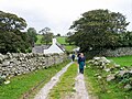
 Approaching Pentrefoelas - geograph.org.uk - 769737.jpg 640 × 480; 101 KB
-
 Ash, late to come into leaf - geograph.org.uk - 5387745.jpg 480 × 640; 110 KB
-
 Autumn trees alongside the A5 - geograph.org.uk - 3749597.jpg 1,024 × 768; 193 KB
-
 B5113 at Maes Gwyn - geograph.org.uk - 4464080.jpg 640 × 481; 92 KB
-

-
 B5113 crossing Pen yr Orsedd - geograph.org.uk - 4464066.jpg 640 × 480; 38 KB
-
 B5113 nears the A5 in Pentrefoelas - geograph.org.uk - 4464086.jpg 640 × 481; 54 KB
-
 B5113 south of Ty Newydd - geograph.org.uk - 4464075.jpg 640 × 480; 40 KB
-
 Barn at Hafod-Garrig - geograph.org.uk - 5378860.jpg 640 × 480; 94 KB
-
 Bethel Welsh Independent Chapel (4).jpg 3,872 × 2,592; 4.34 MB
-
 Bog Cotton - geograph.org.uk - 3551199.jpg 640 × 480; 103 KB
-
 Bridge at Pentrefoelas - geograph.org.uk - 769972.jpg 640 × 480; 88 KB
-
 Bridleway and cleared forestry - geograph.org.uk - 5145018.jpg 640 × 480; 72 KB
-
 Bridleway to Gilar - geograph.org.uk - 5145035.jpg 640 × 480; 75 KB
-
 Bridleway to Gilar - geograph.org.uk - 5145046.jpg 640 × 480; 83 KB
-
 Bryniau Brithion farm - geograph.org.uk - 5387719.jpg 640 × 480; 69 KB
-
 Bryniau Brithion farm buildings - geograph.org.uk - 5387717.jpg 640 × 480; 106 KB
-
 Cae Gwyn Farm - geograph.org.uk - 3167279.jpg 640 × 430; 38 KB
-
 Capel Bethel, Pentrefoelas - geograph.org.uk - 769976.jpg 640 × 480; 67 KB
-
 Cattle grid on a farm road - geograph.org.uk - 5378862.jpg 640 × 480; 77 KB
-
 Cefn-y-Gadfa farm - geograph.org.uk - 5387712.jpg 640 × 480; 102 KB
-
 Cefnen Wen - geograph.org.uk - 5383267.jpg 640 × 480; 61 KB
-
 Cefngarw - geograph.org.uk - 5509262.jpg 1,500 × 1,125; 2.22 MB
-
 Cernioge Mawr - geograph.org.uk - 3167310.jpg 640 × 430; 53 KB
-
 Coed Du, felled woodland - geograph.org.uk - 5387729.jpg 640 × 480; 108 KB
-
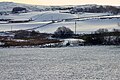
 Country west of Pentrefoelas - geograph.org.uk - 6010478.jpg 2,592 × 1,944; 1.46 MB
-
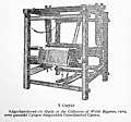
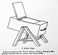
 Cwm Eithin (page 101 crop).jpg 1,479 × 640; 90 KB
-
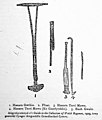
 Cwm Eithin (page 107 crop).jpg 1,344 × 1,246; 221 KB
-
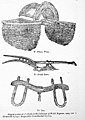
 Cwm Eithin (page 111 crop).jpg 1,565 × 1,456; 309 KB
-
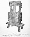
 Cwm Eithin (page 125 crop).jpg 1,622 × 1,630; 236 KB
-
 Cwm Eithin (page 127 crop).jpg 1,344 × 1,579; 170 KB
-
 Cwm Eithin (page 132 crop).jpg 1,489 × 1,097; 92 KB
-
 Cwm Eithin (page 137 crop).jpg 2,050 × 1,633; 305 KB
-
 Cwm Eithin (page 150 crop).jpg 1,468 × 2,072; 414 KB
-
 Cwm Eithin (page 153 crop).jpg 1,592 × 1,961; 362 KB
-
 Cwm Eithin (page 154 crop).jpg 1,510 × 1,426; 169 KB
-
 Cwm Eithin (page 179 crop).jpg 1,420 × 1,348; 130 KB
-
 Cwm Eithin (page 188 crop).jpg 976 × 713; 47 KB
-
 Cwm Eithin (page 2 crop).jpg 2,853 × 2,145; 687 KB
-
 Cwm Eithin (page 205 crop).jpg 2,375 × 1,960; 551 KB
-
 Cwm Eithin (page 227 crop).jpg 2,108 × 1,532; 381 KB
-
 Cwm Eithin (page 23 crop).jpg 1,021 × 677; 59 KB
-
 Cwm Eithin (page 243 crop).jpg 2,537 × 1,464; 303 KB
-
 Cwm Eithin (page 30 crop).jpg 2,037 × 1,588; 365 KB
-
 Cwm Eithin (page 31 crop).jpg 1,593 × 990; 177 KB
-
 Cwm Eithin (page 5 crop).jpg 1,487 × 2,127; 261 KB
-
 Cwm Eithin.djvu 1,844 × 2,579, 261 pages; 30.66 MB
-
 Cwm Eithin.pdf 0 × 0, 261 pages; 78.39 MB
-
 Denbigh Moors - geograph.org.uk - 2476025.jpg 4,000 × 3,000; 5.75 MB
-
 Denbigh Road - geograph.org.uk - 2476030.jpg 4,000 × 3,000; 5.7 MB
-
 Descending to Llyn Alwen - geograph.org.uk - 5383339.jpg 640 × 480; 69 KB
-
 Deserted quarry by Bwlch Gwyn - geograph.org.uk - 4675434.jpg 6,000 × 4,000; 4.85 MB
-
 Elizabeth II post box, Pentrefoelas - geograph.org.uk - 6372318.jpg 3,120 × 4,160; 3.35 MB
-
 Entering Pentrefoelas - geograph.org.uk - 6222731.jpg 1,600 × 1,065; 545 KB
-
 Entrance to Maes Merddyn - geograph.org.uk - 5387442.jpg 640 × 480; 101 KB
-
 Erratic boulders and cows - geograph.org.uk - 5144894.jpg 640 × 480; 72 KB
-

-
 Farm Buildings near to Rhydlydan - geograph.org.uk - 6041989.jpg 800 × 533; 494 KB
-
 Farm road at Bryn-Heilyn. - geograph.org.uk - 5509357.jpg 1,500 × 1,125; 1.82 MB
-
 Farmland near to Pentrefoelas - geograph.org.uk - 6041563.jpg 800 × 533; 608 KB
-
 Farmland, Coed Crug Y Gwynt - geograph.org.uk - 3167252.jpg 640 × 430; 31 KB
-
 Ffrith y Foel, Hiraethog Moor - geograph.org.uk - 5383271.jpg 640 × 480; 51 KB
-
 Field south of the A5 near Rhydlydan - geograph.org.uk - 6041979.jpg 800 × 533; 516 KB
-
 Field wall and Rowan - geograph.org.uk - 5144903.jpg 640 × 480; 94 KB
-
 Fields and Cottages near Rhydlydan - geograph.org.uk - 6041996.jpg 800 × 600; 752 KB
-
 Flush Bracket 11358 on the Foelas Arms, Pentrefoelas - geograph.org.uk - 5552074.jpg 1,200 × 1,600; 640 KB
-
 Foel Las - geograph.org.uk - 5378861.jpg 640 × 480; 131 KB
-
 Foelas Arms Hotel - geograph.org.uk - 3167227.jpg 640 × 402; 71 KB
-
 Foelas Arms Hotel - geograph.org.uk - 5634440.jpg 1,024 × 683; 148 KB
-
 Foelas Arms, Pentrefoelas - geograph.org.uk - 5387749.jpg 640 × 480; 66 KB
-
 Footbridge at Pentrefoelas - geograph.org.uk - 5073925.jpg 640 × 427; 101 KB
-
 Footbridge over the River Merddwr - geograph.org.uk - 2111658.jpg 1,500 × 1,000; 260 KB
-
 Former chapel on the Denbigh Moors - geograph.org.uk - 5715146.jpg 640 × 480; 74 KB
-
 Fron-isaf - geograph.org.uk - 5509363.jpg 1,500 × 1,125; 1.86 MB
-
 Gatehouse at Gilar - geograph.org.uk - 768447.jpg 480 × 640; 92 KB
-
 Gilar - geograph.org.uk - 768450.jpg 640 × 480; 90 KB
-
 Giler Arms, Rhydlydan - geograph.org.uk - 5715159.jpg 640 × 343; 43 KB
-
 Gorse in bloom on the Hiraethog Trail - geograph.org.uk - 5382006.jpg 640 × 480; 112 KB
-
 Graveyard, Pentrefoelas - geograph.org.uk - 612273.jpg 640 × 480; 135 KB
-
 Green Laning - geograph.org.uk - 3854598.jpg 3,264 × 2,448; 2.14 MB
-
 Gwernhywel Isaf - geograph.org.uk - 6076346.jpg 4,000 × 3,000; 2.65 MB
-
 Gwernhywel-isaf Farm - geograph.org.uk - 6041557.jpg 800 × 640; 697 KB
-
 Gwernhywel-isaf viewed from the A5 - geograph.org.uk - 3147841.jpg 1,024 × 680; 222 KB
-
 Gwernhywel-isaf, Pentrefoelas - geograph.org.uk - 6251045.jpg 1,600 × 1,067; 490 KB
-
 Hafod-y-Garrig Farm - geograph.org.uk - 5378858.jpg 640 × 480; 66 KB
-
 Heading for the dam crossing - geograph.org.uk - 4969287.jpg 3,264 × 2,448; 3.7 MB
-
 Hiraethog Moorland - geograph.org.uk - 3103425.jpg 640 × 480; 85 KB
-
 Hiraethog Moorland - geograph.org.uk - 5383333.jpg 640 × 480; 96 KB
-
 Hiraethog trail - geograph.org.uk - 5144913.jpg 480 × 640; 119 KB
-
 Hiraethog Trail - geograph.org.uk - 5378854.jpg 640 × 480; 88 KB
-
 Hiraethog Trail - geograph.org.uk - 5382011.jpg 640 × 480; 81 KB
-
 Holyhead 51 - geograph.org.uk - 4930335.jpg 1,024 × 683; 223 KB
-
 Holyhead 52 - geograph.org.uk - 4713560.jpg 1,024 × 683; 266 KB
-
 Holyhead 53 - geograph.org.uk - 4713573.jpg 1,024 × 683; 163 KB
-
 Holyhead 54 - geograph.org.uk - 4930346.jpg 1,024 × 683; 161 KB
-
 Information board on the Alwen Trail - geograph.org.uk - 3103415.jpg 640 × 480; 86 KB
-

-
 Layby, A5 - geograph.org.uk - 3163991.jpg 640 × 430; 61 KB
-
 Lichen in abundance - geograph.org.uk - 4970158.jpg 4,608 × 3,456; 5.35 MB
-
 Llyn Aled from the A543 - geograph.org.uk - 5715131.jpg 640 × 480; 58 KB
-
 Llyn Alwen from the footbridge - geograph.org.uk - 4970162.jpg 3,264 × 2,448; 3.57 MB
-
 Llyn Alwen from the footbridge - geograph.org.uk - 4970167.jpg 3,264 × 2,448; 3.38 MB
-
 Llyn Alwen looking towards the dam - geograph.org.uk - 4969469.jpg 3,264 × 2,448; 3.73 MB
-
 Lone tree and a footbridge - geograph.org.uk - 4969426.jpg 4,608 × 3,456; 5.9 MB
-
 Looking back towards the lone tree - geograph.org.uk - 4970190.jpg 3,264 × 2,448; 3.72 MB
-
 Looking towards Llyn Aled (lake) - geograph.org.uk - 6223202.jpg 1,600 × 1,065; 685 KB
-
 Looking west on Hiraethog Moor - geograph.org.uk - 5383640.jpg 640 × 480; 47 KB
-
 Lt Col C A Wynne Finch memorial - geograph.org.uk - 5378837.jpg 480 × 640; 109 KB
-
 Maes Merddyn farm - geograph.org.uk - 5387703.jpg 640 × 480; 59 KB
-
 Maes Merddyn walls - geograph.org.uk - 5387444.jpg 640 × 480; 68 KB
-
 Melin Foelas, Pentrefoelas - geograph.org.uk - 924443.jpg 640 × 411; 83 KB
-
 Memorial plaque, Pentrefoelas - geograph.org.uk - 6372584.jpg 4,160 × 3,120; 4.53 MB
-
 Memorial to C A Wynne Finch - geograph.org.uk - 35946.jpg 640 × 480; 190 KB
-
 Mile Stone - Capel Curig 13 - geograph.org.uk - 5142869.jpg 442 × 640; 128 KB
-
 Milestone - geograph.org.uk - 4930334.jpg 683 × 1,024; 265 KB
-
 Milestone - geograph.org.uk - 4930339.jpg 683 × 1,024; 240 KB
-
 Milestone - geograph.org.uk - 5126585.jpg 1,024 × 768; 270 KB
-
 Milestone, Pentrefoelas - geograph.org.uk - 769975.jpg 640 × 480; 137 KB
-
 Minor Road - geograph.org.uk - 5124668.jpg 768 × 1,024; 194 KB
-
 Minor road near Carreg-y-blaidd - geograph.org.uk - 964405.jpg 640 × 480; 105 KB
-
 Minor road north of Rhydlydan - geograph.org.uk - 5715149.jpg 640 × 480; 82 KB
-
 Moel Seisiog with fence - geograph.org.uk - 6807913.jpg 800 × 600; 124 KB
-
 Moorland above Bwlch y Garnedd - geograph.org.uk - 4675431.jpg 6,000 × 4,000; 4.51 MB
-
 Moorland near Bwlch Gwyn - geograph.org.uk - 4675443.jpg 6,000 × 4,000; 6.41 MB
-
 Moorland near Bwlch Gwyn - geograph.org.uk - 4675446.jpg 6,000 × 4,000; 6.44 MB
-
 Moorland track on Pen Bwlch y Garnedd - geograph.org.uk - 4675424.jpg 5,412 × 3,724; 4.15 MB
-
 Moorland with dry stone walls - geograph.org.uk - 5715138.jpg 640 × 480; 61 KB
-
 Moorland with walls - geograph.org.uk - 3551214.jpg 640 × 480; 108 KB
-
 Mossy wall, near Pentrefoelas - geograph.org.uk - 5387724.jpg 640 × 480; 101 KB
-
 Mwdwl-eithin - geograph.org.uk - 3362870.jpg 1,600 × 1,200; 1.14 MB
-
 Mwdwl-eithin from the Alwen Reservoir path - geograph.org.uk - 4317305.jpg 4,608 × 2,592; 3.47 MB
-
 Mynydd Hiraethog information board - geograph.org.uk - 5387453.jpg 640 × 480; 92 KB
-
 Nant-y-Foel - geograph.org.uk - 5378921.jpg 640 × 480; 84 KB
-
 Nant-y-Foel - geograph.org.uk - 5383646.jpg 640 × 480; 93 KB
-
 Nant-y-Foel - geograph.org.uk - 5387715.jpg 640 × 480; 145 KB
-
 Nant-y-Foel, Pentrefoelas - geograph.org.uk - 5378844.jpg 640 × 480; 147 KB
-
 NMW - Aberconwy Inschrift.jpg 2,560 × 1,712; 1.22 MB
-

-
 Old Milestone - geograph.org.uk - 4713556.jpg 683 × 1,024; 235 KB
-
 Old Milestone - geograph.org.uk - 4713570.jpg 683 × 1,024; 238 KB
-
 Old Milestone - geograph.org.uk - 5126583.jpg 768 × 1,024; 370 KB
-

-

-

-

-

-
 Old Milestone in Pentrefoelas - geograph.org.uk - 6037222.jpg 480 × 640; 148 KB
-
 Old Water Pump, Pentrefoelas - geograph.org.uk - 6370742.jpg 780 × 1,040; 143 KB
-
 On the Alwen Trail - geograph.org.uk - 4762430.jpg 640 × 480; 83 KB
-
 Ordnance Survey Cut Mark - geograph.org.uk - 5009280.jpg 640 × 606; 161 KB
-
 Ordnance Survey Cut Mark - geograph.org.uk - 5009284.jpg 563 × 640; 151 KB
-
 Osprey nest platform, Llyn Alwen - geograph.org.uk - 5383625.jpg 480 × 640; 46 KB
-
 Penlan Road - geograph.org.uk - 842328.jpg 639 × 479; 103 KB
-
 Pentrefoelas - geograph.org.uk - 152783.jpg 640 × 480; 98 KB
-
 Pentrefoelas - geograph.org.uk - 3167221.jpg 640 × 356; 57 KB
-
 Pentrefoelas Bridge - geograph.org.uk - 842336.jpg 640 × 480; 138 KB
-
 Pentrefoelas School - geograph.org.uk - 769973.jpg 640 × 433; 48 KB
-
 Pentrefoelas village pump - geograph.org.uk - 5378839.jpg 640 × 480; 102 KB
-
 Pentrefoelas, The Foelas Arms - geograph.org.uk - 55301.jpg 640 × 427; 123 KB
-
 Pentrefoelas, watermill - geograph.org.uk - 55300.jpg 640 × 427; 151 KB
-
 Pentrefoelas.jpg 640 × 480; 70 KB
-
 Picnic area by the River Merddwr - geograph.org.uk - 2111660.jpg 1,500 × 1,000; 340 KB
-
 Pile of boulders - geograph.org.uk - 5145054.jpg 640 × 480; 77 KB
-
 Plas Iolyn with sheep - geograph.org.uk - 5144915.jpg 640 × 480; 52 KB
-
 Pont Pentre'r foelas - geograph.org.uk - 6041581.jpg 800 × 600; 674 KB
-
 Quarried outcrop - geograph.org.uk - 964915.jpg 640 × 480; 97 KB
-
 Rhydlydan chapel - geograph.org.uk - 6010472.jpg 2,592 × 1,944; 1.17 MB
-
 Rhydydlan cottages - geograph.org.uk - 5144878.jpg 640 × 480; 73 KB
-
 Road junction - geograph.org.uk - 964397.jpg 640 × 480; 83 KB
-
 Road junction near Pentrefoelas - geograph.org.uk - 6222729.jpg 1,600 × 1,065; 437 KB
-
 Road leading to Fron Bella - geograph.org.uk - 6222738.jpg 1,600 × 1,065; 512 KB
-
 Road off the A543 leading to Rhydlydan - geograph.org.uk - 6222734.jpg 1,600 × 1,065; 597 KB
-
 Roll of wire netting on the moor - geograph.org.uk - 5383616.jpg 640 × 480; 79 KB
-
 Ruined sheepfold - geograph.org.uk - 5387486.jpg 640 × 480; 79 KB
-
 Sheep grazing on Ffrith-y-Foel - geograph.org.uk - 5387699.jpg 640 × 480; 42 KB


.jpg)


.jpg)
.jpg)
.jpg)
.jpg)
.jpg)
.jpg)
.jpg)
.jpg)
.jpg)
.jpg)
.jpg)
.jpg)
.jpg)
.jpg)
.jpg)
.jpg)
.jpg)
.jpg)
.jpg)
.jpg)


_-_geograph.org.uk_-_6223202.jpg)


