Category:Peperstraat 20, Wijk bij Duurstede
Jump to navigation
Jump to search
| Object location | | View all coordinates using: OpenStreetMap |
|---|
building in Wijk bij Duurstede, Netherlands  | |||||
| Upload media | |||||
| Instance of | |||||
|---|---|---|---|---|---|
| Location | Wijk bij Duurstede, Utrecht, Netherlands | ||||
| Street address |
| ||||
| Located on street |
| ||||
| Heritage designation |
| ||||
 | |||||
|
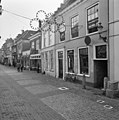
This is a category about rijksmonument number 39718
|
| Address |
|
Media in category "Peperstraat 20, Wijk bij Duurstede"
The following 4 files are in this category, out of 4 total.
-
 Overzicht - Wijk bij Duurstede - 20213446 - RCE.jpg 1,200 × 1,200; 354 KB
-
 Voorgevel - Wijk bij Duurstede - 20213447 - RCE.jpg 1,200 × 1,200; 342 KB
-
 Voorgevel - Wijk bij Duurstede - 20213448 - RCE.jpg 1,192 × 1,200; 298 KB
-
 WbD EF Peperstr nr 20 RM 39718.JPG 771 × 1,197; 197 KB


