Category:Perm Governorate
Jump to navigation
Jump to search
administrative unit of the Russian Empire and the Soviet Union in 1781–1923   | |||||
| Upload media | |||||
| Instance of | |||||
|---|---|---|---|---|---|
| Named after | |||||
| Location |
| ||||
| Capital | |||||
| Inception |
| ||||
| Dissolved, abolished or demolished date |
| ||||
| Population |
| ||||
| Area |
| ||||
| Replaces |
| ||||
| Replaced by | |||||
 | |||||
Subcategories
This category has the following 17 subcategories, out of 17 total.
B
C
G
K
M
- Maps of Perm Governorate (27 F)
P
- Perm Governorate volosts (1 F)
- Permskie eparkhialnyye vedomosti (54 F)
R
Z
Media in category "Perm Governorate"
The following 14 files are in this category, out of 14 total.
-
 1856. Card from set of geographical cards of the Russian Empire 099.jpg 2,731 × 3,976; 3.06 MB
-
 1856. Card from set of geographical cards of the Russian Empire 100.jpg 2,731 × 3,976; 2.9 MB
-
 Bernhard Vasilyevich and Anna Fedorovna Struve.jpg 253 × 400; 14 KB
-
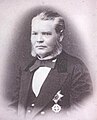 Perm Governor Yenakiyev.jpg 483 × 599; 45 KB
-
 Portrait of Ilya Ivanovich Ogarev - engraving.jpg 301 × 369; 18 KB
-
 Vladimir Plotnikov NyrobChurch.jpg 884 × 624; 478 KB
-

-
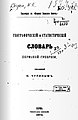 Географический и статистический словарь Пермской губернии.jpg 469 × 719; 61 KB
-
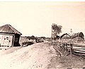 Деревня Верх Усолка Пермский край.jpg 2,549 × 2,079; 388 KB
-
 Знак Волостного старшины Пермской губернии.jpg 672 × 768; 198 KB
-
 Иллюстрированного путеводителя по реке Каме и по реке Вишере с Колвой 01.jpg 2,592 × 1,944; 1.45 MB
-
 Иллюстрированного путеводителя по реке Каме и по реке Вишере с Колвой 02.jpg 2,592 × 1,944; 1.86 MB
-
 Иллюстрированного путеводителя по реке Каме и по реке Вишере с Колвой 03.jpg 2,592 × 1,944; 1.72 MB
-
 Члены 2 Государственной думы от Пермской губернии 1907.jpg 1,500 × 997; 606 KB


